Combining surface reanalysis and remote sensing data for monitoring evapotranspiration
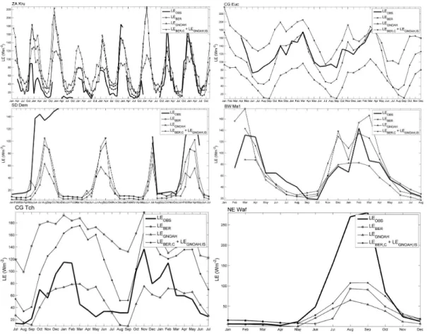
Texto
Imagem

Documentos relacionados
In this study, a remote sensing model of tran- spiration (the primary component of ET), driven by a time series of vegetation indices, was used to substitute transpi- ration from
and Wood, E.: The assimilation of remotely sensed soil brightness temperature im- agery into a land surface model using ensemble Kalman filtering: a case study based on
The objectives of this study are to assessment soil loss by using Geographic Information System and Remote Sensing technology and to determine the effect of land
Spatial distributions of remote sensing based GVF, ISA, albedo, and LAI (a, e, i and m) compared with those based on Noah/UCM lookup tables (b, f, j and n) and simulated maps
Land data assimilation systems (LDAS) are needed to integrate satellite data providing information about land state variables such as the surface soil moisture (SSM) and leaf area
Three different data products from the SMOS mission are assimilated separately into the GEOS-5 land surface model to improve estimates of surface and root-zone soil moisture and
Of the environmental measurements made at the tower; ambient and soil surface temperature (Fig. 5b and c), and wind speed above the canopy and within the canopy (mid-canopy) (Fig.
In this study, the dynamic vegetation model Inland (Integrated Model of Land Surface Processes) driven by two representative concentration pathways (RCPs) scenarios was applied
