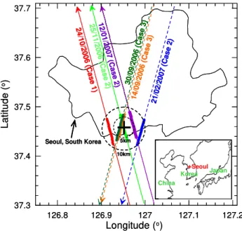
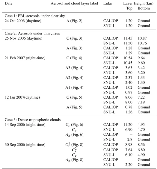
Validation of aerosol and cloud layer structures from the space-borne lidar CALIOP using a ground-based lidar in Seoul, Korea
Texto
Imagem


Documentos relacionados
Aerosol optical depth at 355 nm obtained from the Ra- man inversion is shown as a function of the optical depth from the elastic inversion for 4435 nighttime cloud-free 1 min
Based on 8 years of (January 2008– December 2015) cloud phase information from the GCM-Oriented Cloud-Aerosol Lidar and Infrared Pathfinder Satellite Observation (CALIPSO) Cloud
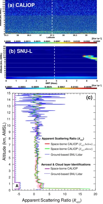
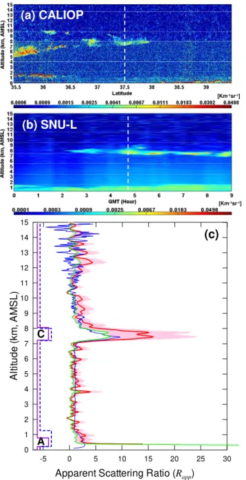
Aerosol optical profile observed by lidar demonstrated that aerosol was mainly constrained below the boundary layer and comprised of spheric aerosol (depolarization ratio < 5
The main objective is to study the extensive (backscatter and extinction coefficients) and intensive (lidar ratio, Ångström exponents) optical properties of free-tropospheric
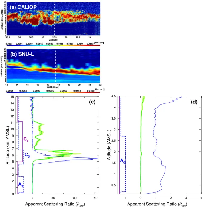
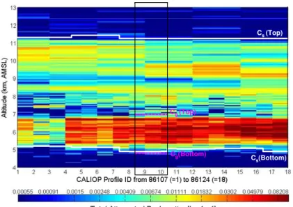
We present initial aerosol validation results of the space-borne lidar CALIOP -onboard the CALIPSO satellite- Level 1 attenuated backscatter coefficient profiles, using co-
For the moderately dense Sa- hara dust layers detected in the CALIOP data used in this study, the mean/median values of the lidar ratios derived from a constrained opaque water
The satellite cloud parameters cloud top height (CTH) and liq- uid water path (LWP) are compared with ground-based CTH obtained from a cloud mask created using lidar and radar data
Data for direct evaluation of the obtained mean vertical profiles were taken from the dataset of Cloud-Aerosol Lidar with Orthogonal Polarization (CALIOP) onboard the NASA
