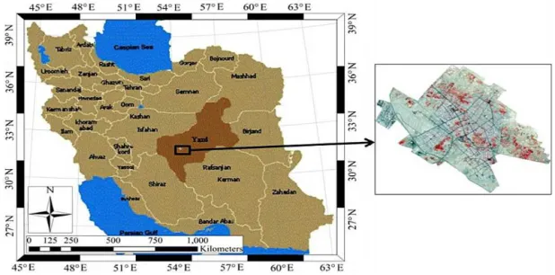
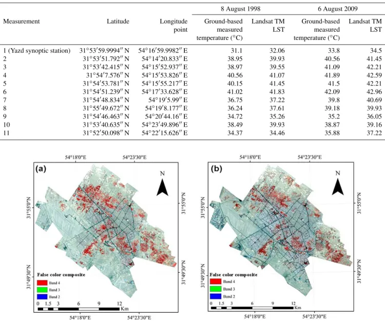
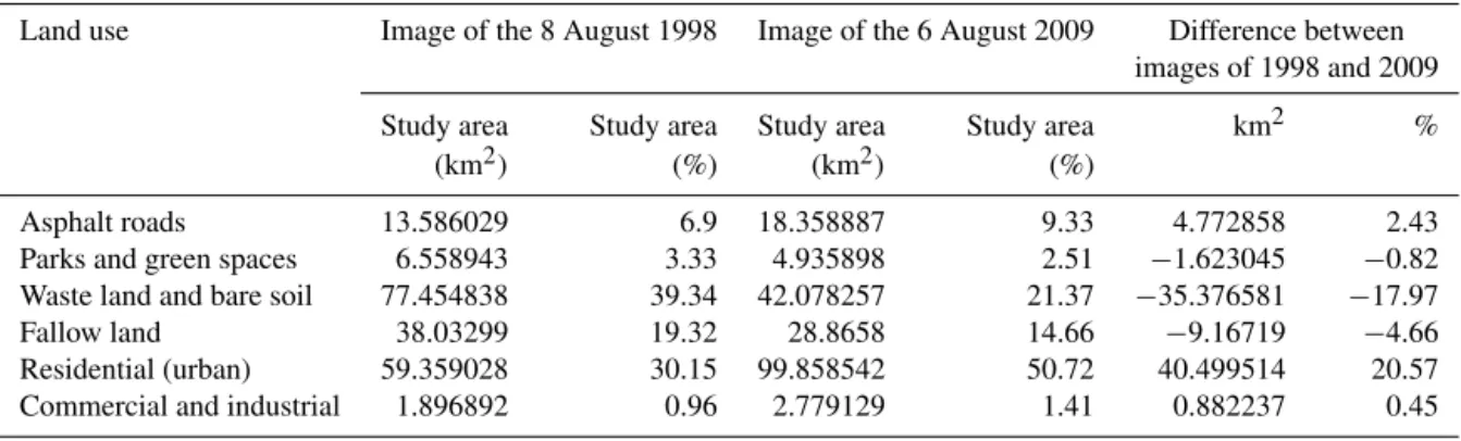
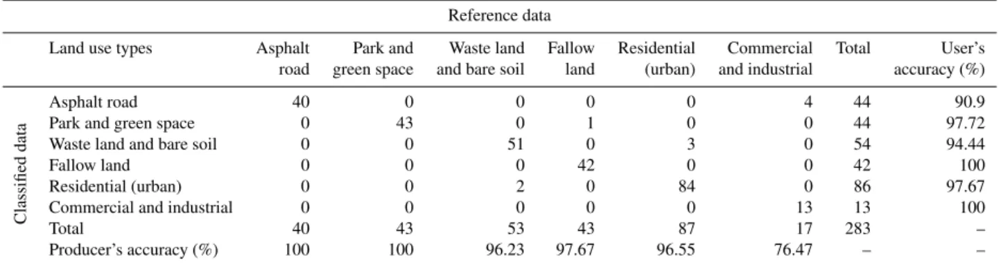
Using Landsat Thematic Mapper (TM) sensor to detect change in land surface temperature in relation to land use change in Yazd, Iran
Texto
Imagem

Documentos relacionados
Emissions of important aerosol and trace gases attributed to LULCC activities for year 2010 and year 2100 for the listed future scenarios (theoretical extreme case is abbreviated
Com o objetivo de descrever um fenômeno específico, a fim de traçar um perfil do que é, porque, como e quando ocorre, na intenção de solucionar problemáticas no cuidado em saúde,
Linking geomorphologic knowledge, RS and GIS techniques for analyzing land cover and land use change: a multitemporal study in the Cointzio watershed, Mexico.. Maps of land cover
The main objective of this study was to assess the impacts of land use and land cover change impact on the stream flow of Gilgel Abbay watershed using Remote
Exploring land use land cover (LULC) change to understand urban warming effect is a necessary work for community and local government. The research can be used
This study is concerned with identifying change in land use and land cover types in East Timor between 1972 and 2011, using satellite images from Landsat MSS, TM and ETM+
- The Ideologicical Structure of the Same-Sex Marriage Debate (and some postmodern arguments for same-sex marriage). Legal Recognition of Same-Sex Partnerships: A Study of
The proposed model of two professionalism models (Evetts, 2010, p.130): organ- isational-based professionalism and occupational-based professionalism in knowledge societies is
