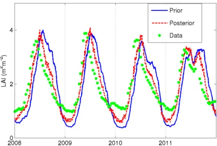
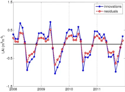
Integrating ASCAT surface soil moisture and GEOV1 leaf area index into the SURFEX modelling platform: a land data assimilation application over France
Texto
Imagem

Documentos relacionados
The study shows that it is possible to estimate the heat flux balance at the sea surface over a large area, using NOAA satellite data and information about
and Wood, E.: The assimilation of remotely sensed soil brightness temperature im- agery into a land surface model using ensemble Kalman filtering: a case study based on
To improve the capability of land-surface process models to simulate soil moisture in semi- arid regions, we adopted the PSO algorithm and data from the SACOL station in the
soil moisture, soil temperature, net radiation and heat fluxes (latent, sensible and ground heat fluxes) at land surface. Temperature and moisture of the surface 2.5 cm soil
M., Guissard, V., Lucau, C., and De- fourny, P.: Optimization of a coupled hydrology – crop growth model through the assimilation of observed soil moisture and leaf area index
Using satellite-based MODIS data (land surface temperature data, EVI, etc.), and ground-based on-site soil moisture data and meteorological data (air tempera- ture, relative
To assess the usefulness of coarse resolution soil moisture data for catchment scale modelling, scatterometer derived soil moisture data was compared to hydrometric measure-
Rees (1992) defines the ecological footprint as, the surface of productive land and aquatic ecosystems, required to produce the resources used and waste

