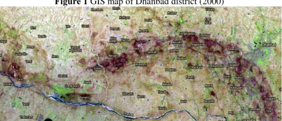
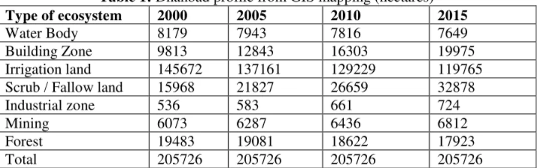
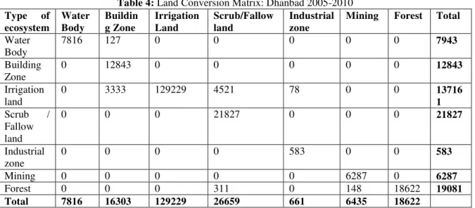
Status Check of the Mining Hub of India: Examining the LandUse Pattern Observed in the Forest –Agricultural Ecosystem of Dhanbad
Texto
Imagem
Documentos relacionados
Neste sentido, com este projecto, pretendemos integrar as novas tecnologias de informação e comunicação no ensino da Matemática, com o objectivo de tornar esta disciplina
Com o objetivo de descrever um fenômeno específico, a fim de traçar um perfil do que é, porque, como e quando ocorre, na intenção de solucionar problemáticas no cuidado em saúde,
A presença de táxons de áreas abertas, juntamente com os espécimes da Tribo Oryzomyini, sugere que na região do sítio Adelar Pilger existia uma paisagem com
Ousasse apontar algumas hipóteses para a solução desse problema público a partir do exposto dos autores usados como base para fundamentação teórica, da análise dos dados
On the question of rhythm, indigenous peoples of this hemisphere are world mas- ters in the realm of cycles.. There certainly exists rhythm that is not cyclical, but what the world
No campo, os efeitos da seca e da privatiza- ção dos recursos recaíram principalmente sobre agricultores familiares, que mobilizaram as comunidades rurais organizadas e as agências
ájusta do-seà pa aà aà ualidadeà doà uidado,àosà uidadosà u aài situiç oà asso ia a -seà aà elho esà esultadosà oà dese ol i e toà og ii oà eà aà li guage à doà
Political participation and ideology is studied by means of the following variables: Whether the respondent has either contacted a politician, worked in a party, signed a
