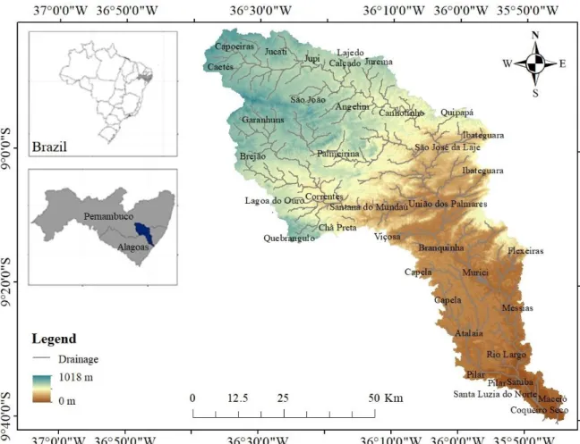
Modeling runoff response to land-use changes using the SWAT model in the Mundaú watershed, Brazil
Texto
Imagem


Documentos relacionados
Na hepatite B, as enzimas hepáticas têm valores menores tanto para quem toma quanto para os que não tomam café comparados ao vírus C, porém os dados foram estatisticamente
> bobi pergunta para Todos: qual é mesmo o objetivo do teste > ken fala para Todos: tem muit´agente aqui > ken fala para Todos: mardem acabou de espulsar agente daqui > lin fala
Peça de mão de alta rotação pneumática com sistema Push Button (botão para remoção de broca), podendo apresentar passagem dupla de ar e acoplamento para engate rápido
The objective of this study was to simulate different scenarios of land use in the Sub - Middle of the São Francisco River Basin using the Soil and Water Assessment (SWAT) model
Tendo em vista o avanço nos estudos de estrutura eletrônica, com a construção de superfícies de energia potencial mais acuradas para moléculas poliatômicas, torna-se necessário
The probability of attending school four our group of interest in this region increased by 6.5 percentage points after the expansion of the Bolsa Família program in 2007 and
Neste trabalho o objetivo central foi a ampliação e adequação do procedimento e programa computacional baseado no programa comercial MSC.PATRAN, para a geração automática de modelos
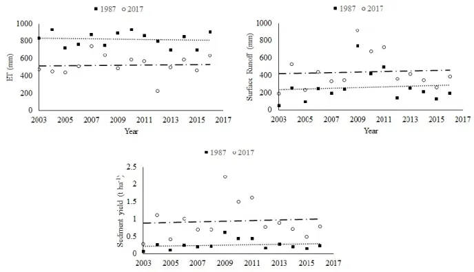
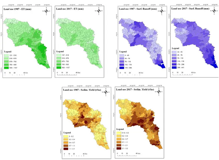
The sediment yield presented a high correlation with the runoff depth in the two spatial scales evaluated: watershed and erosion plot; this indicates a strong
