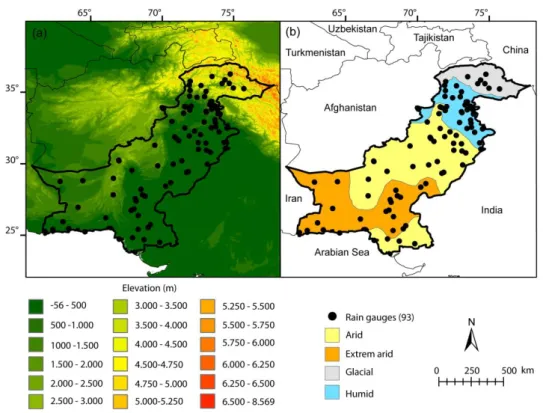
Benefits of the successive GPM based satellite precipitation estimates IMERG–V03, –V04, –V05 and GSMaP–V06, –V07 over diverse geomorphic and meteorological regions of Pakistan
Texto
Imagem


Documentos relacionados
The yearly mean spatial variability of precipitation estimated by the GPM satellite in the years of 2015 and 2016 were concentrated in the Northern part of Southern Amazonas
Regarding GPM satellite, a lower RMSE value was observed in the Piracicaba mesoregion, with a variation of 4 to 38 mm per month, that is, there was a smaller difference between
The definition of who is a fanboy is quite diverse, and it’s not unique to the gaming audience. In fact, they can be found in other creative media productions - movies, comic
The estimates of average monthly recharge for the whole area show an outstanding variability (Fig. There is no constant or directly proportional relation between monthly
- the movement of the mechanism was studied, based on the curves of variable sliders and successive positions (in the
The indices are based on point return period estimates of precipitation totals and peak flows, respectively, spatial averaging of their values, and optimizing the areal extent and
The stochastic space–time error model of Hossain and Anagnostou (2006), originally developed for satellite rainfall error modeling (hereafter named SREM2D), was de- vised in this
A high resolution climatology of precipitation and deep convection over the Mediterranean region from operational satellite microwave data: development and application to the
