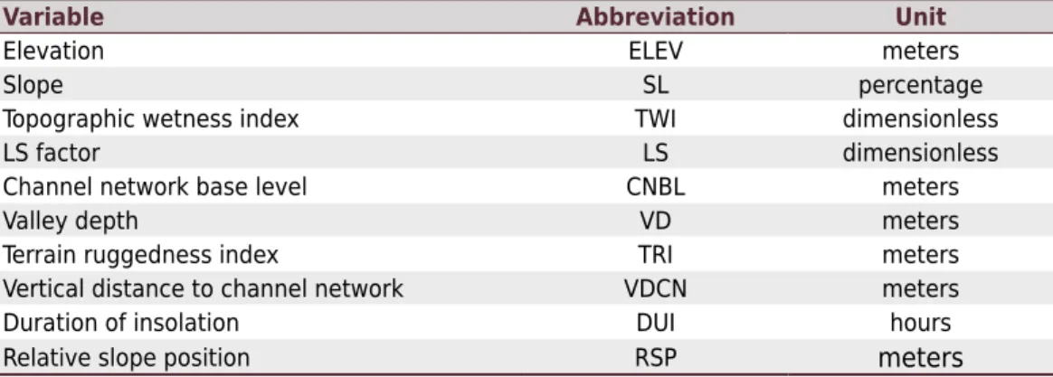
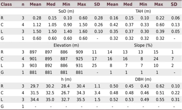
Edaphic and Topographic Factors and their Relationship with Dendrometric Variation of Pinus Taeda L. in a High Altitude Subtropical Climate
Texto
Imagem


Documentos relacionados
Foi testado sob condições de laboratório o efeito de óleos essenciais de alecrim (RosmarInus officinalis L.), camomila (Matricaria chamomilla L.), capim-limão (Cymbopogon citratus
Si tuviéramos que proyectar a partir de lo dicho hasta aquí una ima- gen que sintetice las características ideales del sabio en relación con la problemática del asentimiento
Mycorrhizal variables were related to climatic and edaphic factors, however, the intensity and type of influence of climatic and soil characteristics on AMF
The terrain variables of Landform, Slope, and Topographic Wetness Index were useful in distinguishing some sites for occurrence of the soil components and they can be used as
[r]
The regional climactic factors were the main factors responsible for the coherence patterns in the water temperature and water colour, whereas the landscape position and
The environmental factors which were associated with variation in species composition between the two hillsides were atmospheric temperature, litter depth, soil temperature
Water table depth in the Riacho Fundo watershed varied with net precipitation and with the topographic position of the piezometric wells, which shows that groundwater in the


