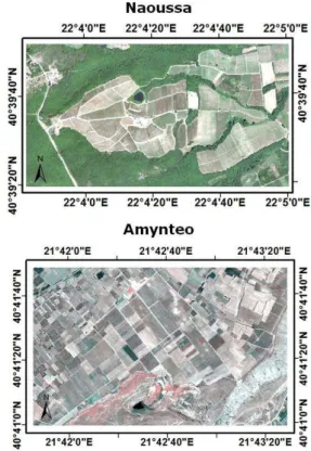
PRECISION VITICULTURE FROM MULTITEMPORAL, MULTISPECTRAL VERY HIGH RESOLUTION SATELLITE DATA
Texto
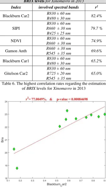
Imagem
Documentos relacionados
Partindo do conceito de governo eletrônico como iniciativas que visam à aplicação das TIC para um melhor modelo de governança, o presente artigo visa contribuir no entendimento de
Automatic detection and classification of damaged buildings, using high resolution satellite imagery and vector data. In: The International Archives of the Photogrammetry,
Quando se tentou avaliar a influência dos erros alimentares cometidos pelas grávidas no respectivo controlo glicémico, apenas se encontrou diferença entre a média do valor
Several authors have already focused on the problem of automatic land cover mapping from multitemporal and multispectral satellite images of medium spatial resolution
A latência do sono e a percentagem da fase N1 e N2, assim como a vigília aumentam com a idade (Ohayon, et al., 2004), o que significa que os idosos têm mais dificuldade em
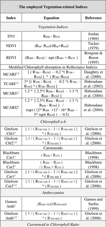
In essence, as described in Table 2.1 and illustrated in Figure 2.9, there is much information to be extracted from the multispectral range of available bands, at each band’s
Three commonly used satellite- derived land cover datasets – i.e., from the US Geological Survey (USGS) and University of Maryland (UMD), which are based on the Advanced Very
Here, for the period mid-1980s to late-2000s/2011 we examine net area fluctuations and shrinking rates using multispectral Landsat satellite data for 321
