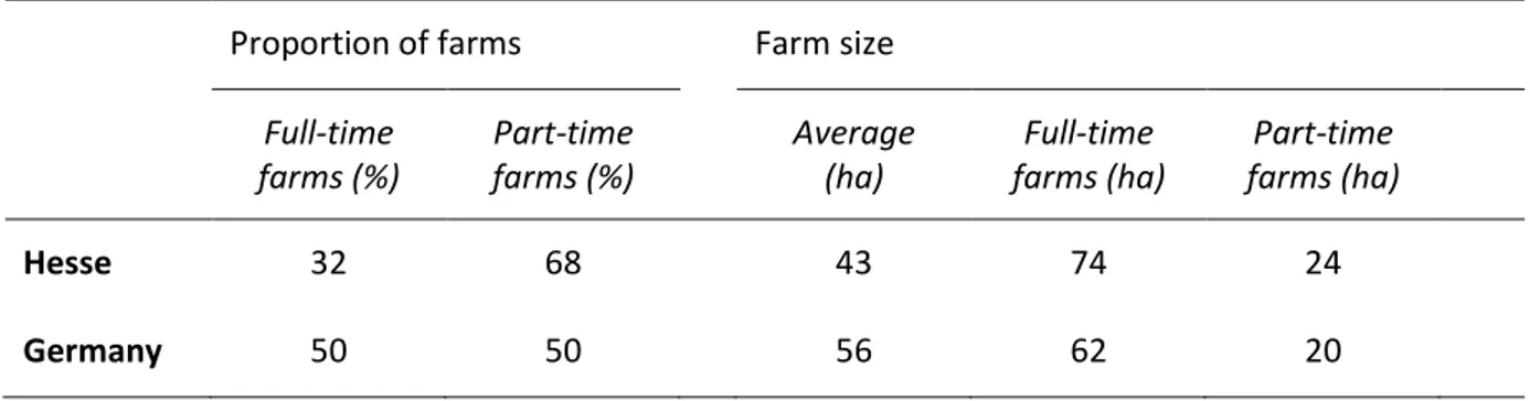
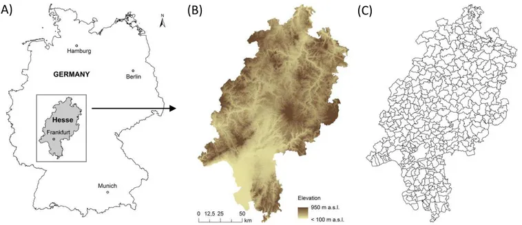
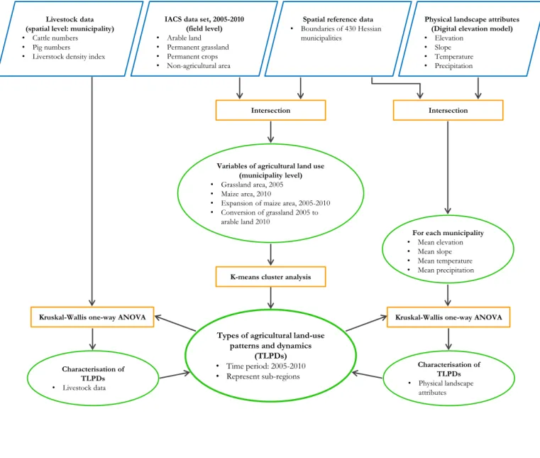
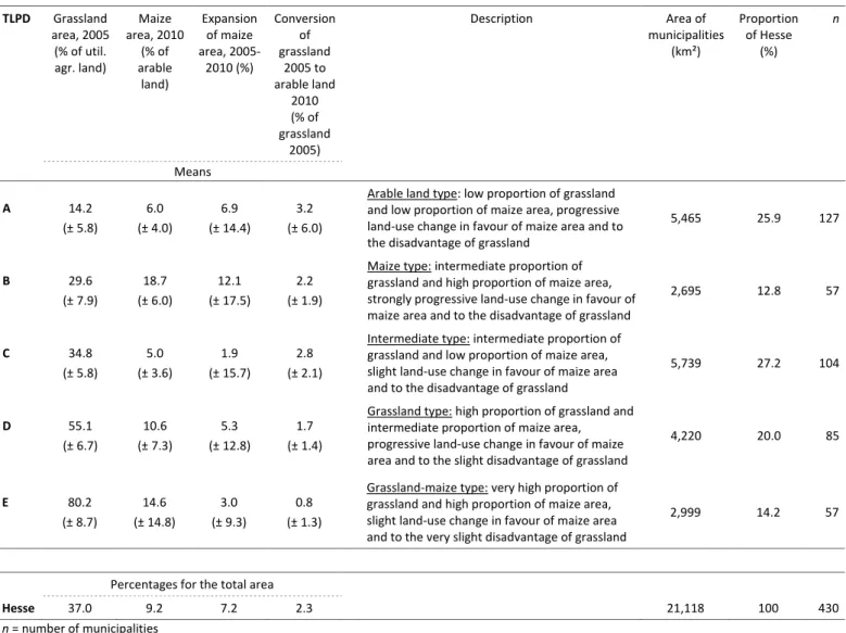
Analysing Data of the Integrated Administration and Control System (IACS) to Detect Patterns of Agricultural Land-Use Change at Municipality Level
Texto
Imagem


Documentos relacionados
Na prossecução dos seus objectivos, quer entre Estados membros, quer no plano internacional, o Instituto Internacional de Língua Portuguesa (IILP) tomará em
Para identificar em qual ano os domicílios brasileiros chegariam à marca de 50% ou mais com a presença da Internet, foi realizada uma projeção populacional
ABSTRACT: The aim of this study was to develop a methodology for mapping land use and land cover in the northern region of Minas Gerais state, where, in addition to agricultural
Para Takeuchi e Nonaka (1997), entender melhor o conhecimento não seria suficiente se não se abordar uma série de conceitos inter-relacionados a ele, como: a experiência, ou seja,
The proposed model of two professionalism models (Evetts, 2010, p.130): organ- isational-based professionalism and occupational-based professionalism in knowledge societies is
In this context, this study presents a proposal for the conceptual modeling of the integrated use of agricultural land suitability methods to develop support
The main objective of this study was to assess the impacts of land use and land cover change impact on the stream flow of Gilgel Abbay watershed using Remote
For the purpose of this study, the quantita- tive assessment of changes in land use and land cover- age between 1979-2004 focused on the land immediately around
