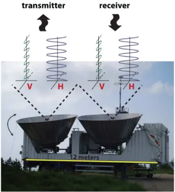
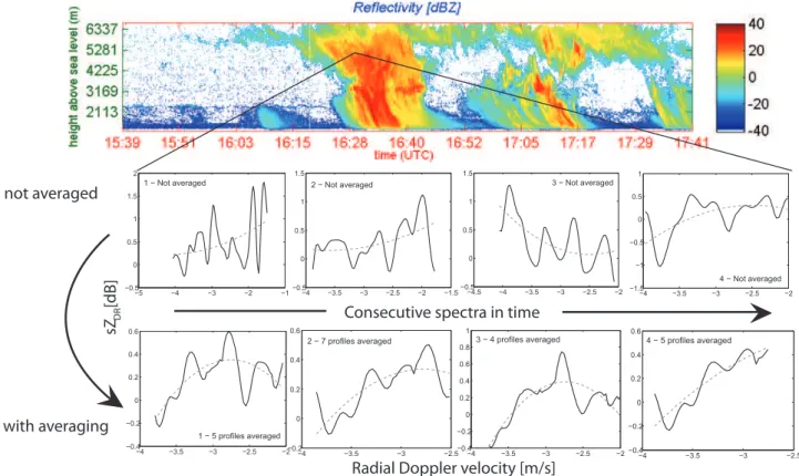
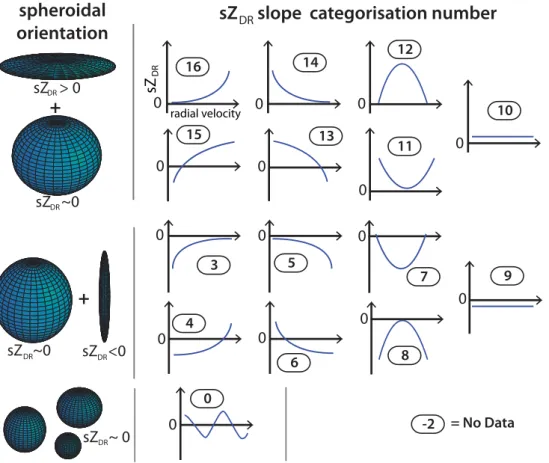
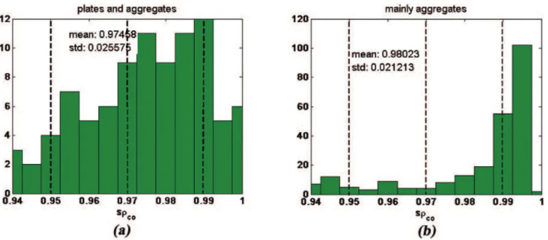
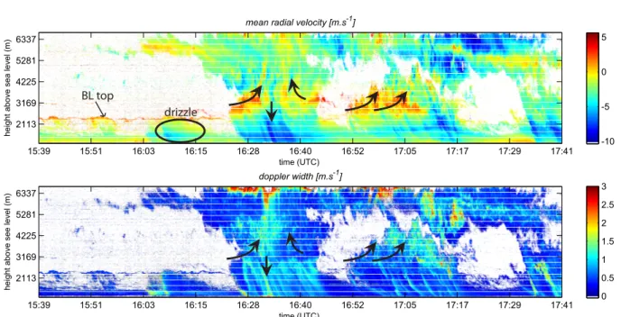
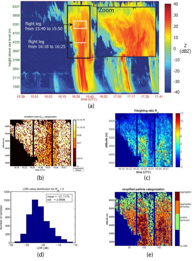
Towards the improvement of cloud microphysical retrievals using simultaneous Doppler and polarimetric radar measurements
Texto
Imagem

Documentos relacionados
We report the simultaneous observation of 1.6– 1.7 mHz pulsations in the ionospheric F-region with the CUTLASS bistatic HF radar and an HF Doppler sounder, on the ground with the
Simultaneous ISR measurements of the electron density and vertical velocity were made by the 224-MHz EISCAT radar so that the latter could be compared with velocities derived from
The analyses in this study are based on a co-location of satellite retrievals of cloud properties, tracer transport model simulations of pollution locations and concentrations,
Also, DSP analyses audio and speech signal processing, video and digital image processing, signal processing, radar (and sonar) signal processing, spectral estimation,
On the relationship between aspect sensitivity, wave activity, and multiple scattering centers of mesosphere summer echoes: a case study using coherent radar
Therefore, based on the airglow intensity variations, radar plots corresponding to these ESF structures and ionosonde observations, it can be inferred that these structures are
The satellite cloud parameters cloud top height (CTH) and liq- uid water path (LWP) are compared with ground-based CTH obtained from a cloud mask created using lidar and radar data
The radar is designed based on the application of eight instantaneous frequency measurement receivers and synchronic checking of amplitude and signal phase in all receivers and
