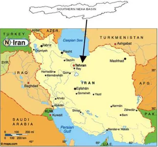
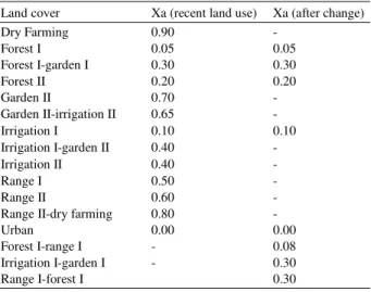
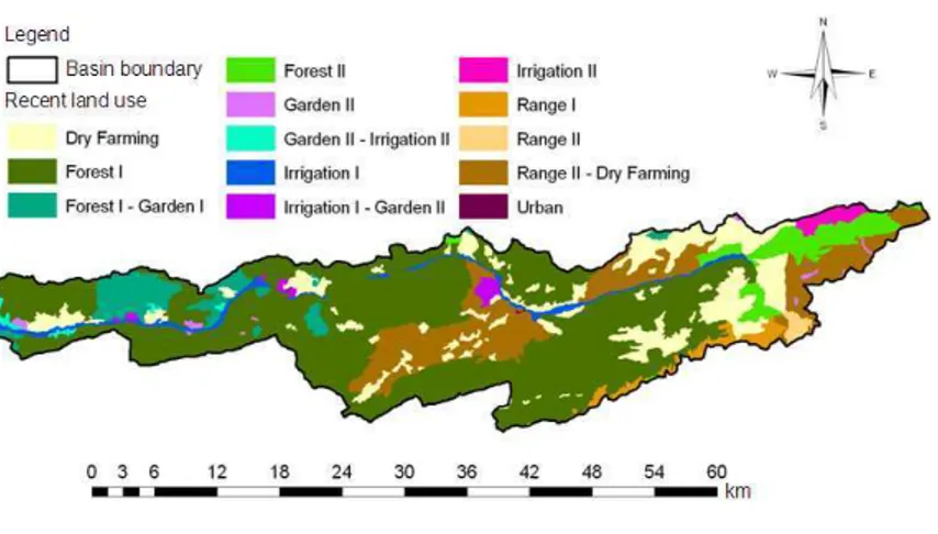
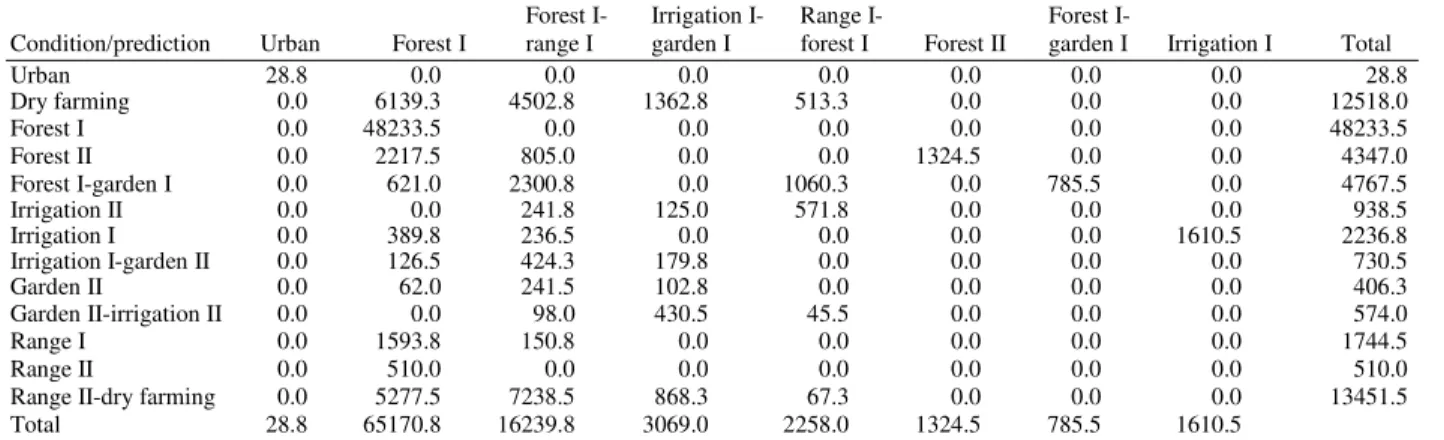
Soil Erosion Prediction Based on Land Use Changes (A Case in Neka Watershed)
Texto
Imagem
Documentos relacionados
(2000) realizaram um estudo transversal para avaliar a possível relação entre a qualidade da restauração coronária, a obturação do canal radicular e a condição apical de
Linking geomorphologic knowledge, RS and GIS techniques for analyzing land cover and land use change: a multitemporal study in the Cointzio watershed, Mexico.. Maps of land cover
The objective of this study was to simulate different scenarios of land use in the Sub - Middle of the São Francisco River Basin using the Soil and Water Assessment (SWAT) model
Therefore, considering the modifications in the land use from 1986 to 2011, the aim of this study ranged to estimate water erosion rates and compare them to the soil loss
ABSTRACT: The aim of this study was to develop a methodology for mapping land use and land cover in the northern region of Minas Gerais state, where, in addition to agricultural
Effect of watershed land use on water quality: a case study in Córrego da Olaria Basin, São Paulo State, Brazil..
Na análise econométrica de modelos de duração, é bastante comum depararmo- nos com a existência de heterogeneidade negligenciada. Este problema deve-se, em grande parte, ao facto
The proposed model of two professionalism models (Evetts, 2010, p.130): organ- isational-based professionalism and occupational-based professionalism in knowledge societies is
