FOREST COVER MONITORING IN THE BARA DISTRICT (NEPAL) WITH REMOTE SENSING AND GEOGRAPHIC INFORMATION SYSTEMS
Texto
Imagem

Documentos relacionados
Land use, land cover, and prevalence of canine visceral leishmaniasis in Teresina, Piauí State, Brazil: an approach using orbital remote sensing.. Uso e cobertura do solo
ABSORB II randomized controlled trial: a clinical evaluation to compare the safety, efficacy, and performance of the Absorb everolimus-eluting bioresorbable vascular scaffold
We applied remote sensing techniques on a TM Landsat 5 image (1:50,000) to map land use and vegetation cover of the Restinga de Jurubatiba National Park and surroundings.. The
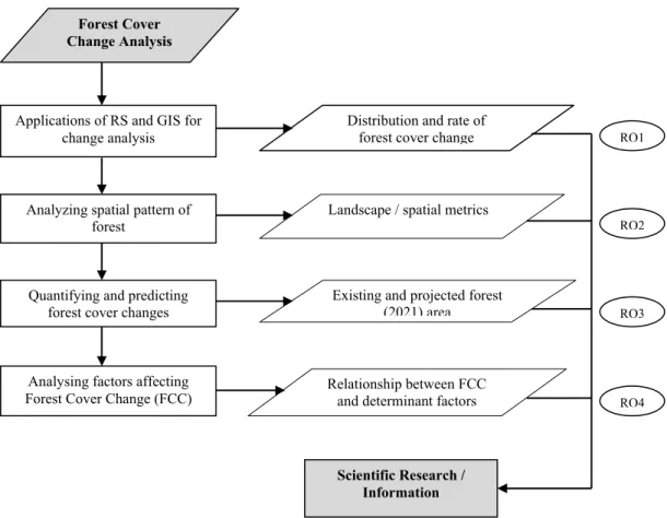
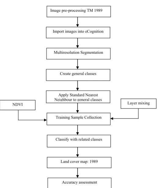
This study clearly indicated that remote sensing in integration with GIS is important tool for classification, mapping, change detection and landscape spatial pattern
This study attempts to analyze land use land cover change and its impact on soil erosion process by applying and adopting commonly used satellite remote
The proposed model of two professionalism models (Evetts, 2010, p.130): organ- isational-based professionalism and occupational-based professionalism in knowledge societies is
The agriculture lands have been located in the southern part of the villages of Khookur, Edayathumangalam, Sathamangalam, Athikudi, Koppavali, Jengamarajapuram,
The International Archives of the Photogrammetry, Remote Sensing and Spatial Information Sciences, Volume XL-1/W5, 2015 International Conference on Sensors & Models in
