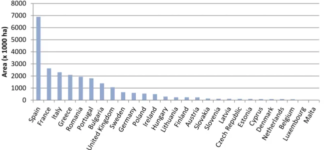
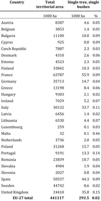
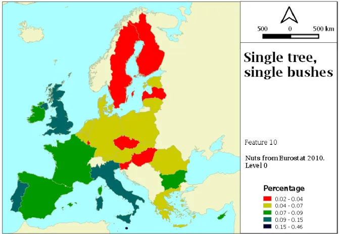
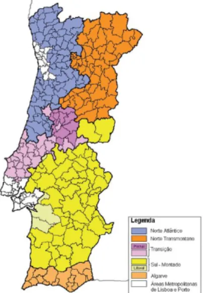
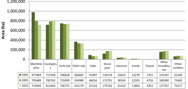
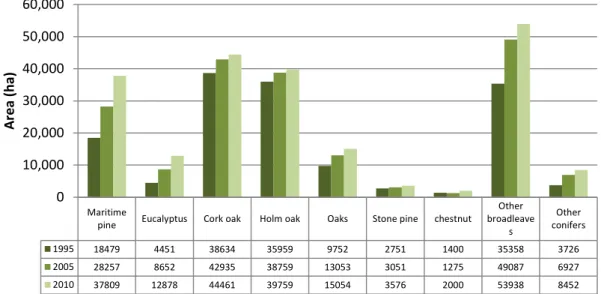
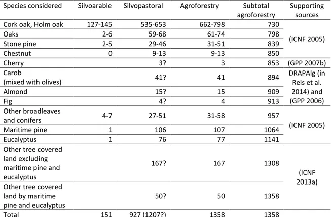
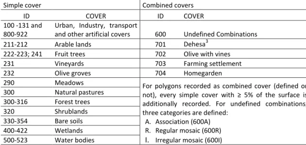
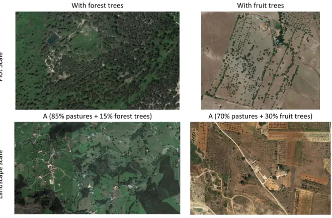
Current extent and trends of agroforestry in the EU27
Texto
Imagem
Documentos relacionados
Os dois tipos de jambu estudados mostraram-se também fonte de compostos fenólicos totais com valores de 360,21 (mg/L) para o jambu convencional e 396,89 (mg/L) para o
Na segunda fase, ocorre o processamento da matriz de similaridades para o inverso das seq¨ uˆencias de entrada S e T , sendo produzidas informa¸co˜es sobre os alinhamentos
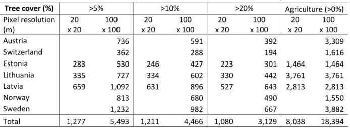
Linking geomorphologic knowledge, RS and GIS techniques for analyzing land cover and land use change: a multitemporal study in the Cointzio watershed, Mexico.. Maps of land cover
O texto busca refletir sobre a emergência daquele que é considerado o sentido moderno do conceito de Revolução, tendo como objetivo a discussão da trajetória que passa do
No corpo do nosso artigo, fizemos notar não apenas que o célebre momento da peripécia em Frei Luís de Sousa (Acto II, cena XV, aliás ecoando em réplicas trocadas entre
ABSTRACT: The aim of this study was to develop a methodology for mapping land use and land cover in the northern region of Minas Gerais state, where, in addition to agricultural
The proposed model of two professionalism models (Evetts, 2010, p.130): organ- isational-based professionalism and occupational-based professionalism in knowledge societies is
