Deriving high spatial-resolution coastal topography from sub-meter satellite stereo imagery
Texto
Imagem

Documentos relacionados
Automatic detection and classification of damaged buildings, using high resolution satellite imagery and vector data. In: The International Archives of the Photogrammetry,
Classification and extraction of spatial features in urban areas using high- resolution multi-spectral imagery, IEEE Geoscience and Remote Sensing Letters ,
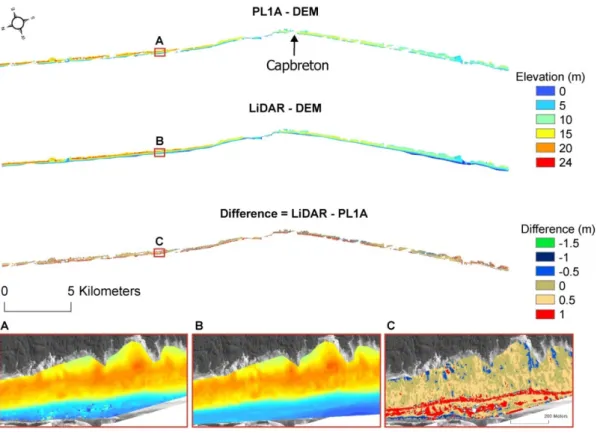
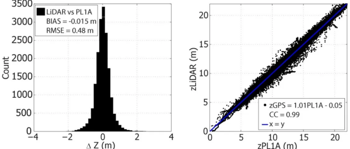
The presented assessment of the mapping potential of Pléiades stereo and tri-stereo data revealed that the 2D geo-location accuracy of the initial sensor model is within the range
The present study investigates the possibil- ity of a relationship between the coastal topography with steep slopes and sea-salt snow chemistry, using high reso- lution data from
This paper presents methodology and evaluation of Digital Surface Models (DSM) generated from satellite stereo imagery using Semi Global Matching (SGM) applied in image space
Comparing the results of hyperspectral imagery classification with the optimized classification system of hybrid images show that using DSM beside hyperspectral imagery
A new class of regression-cum- ratio estimators has been proposed for two-phase sampling using information on two auxiliary variables derived from high resolution satellite data..
In this study, two kinds of homo-type stereo pairs and 4 kinds of hetero-type stereo pairs were used to make RPC stereo models using in-track stereo pairs of GeoEye-1
