A Robust False Matching Points Detection Method for Remote Sensing Image Registration
Texto
Imagem

Documentos relacionados
We propose a strategy for road extraction, vehicle detection and incident detection from remote sensing imagery using techniques based on neural networks,
The result shows that using TR-NDBI and the nighttime light remote sensing image are a feasible and effective method for extracting low- density residents’
Applications to derive maritime value added products like oil spill and ship detection based on remote sensing SAR image data are being developed and integrated at the
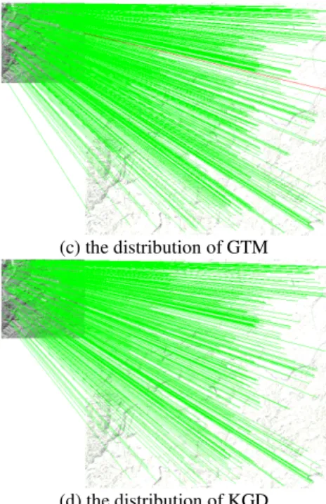
In the third phase, the match result by optimizing the feature points and strictly limiting match threshold is used to calculate geometric transformation model parameters between
Zhang et.al., [4] have proposed a method to recognize a bridge over water in remote sensing image by using binary coding specific to combination feature extraction
Integrated approach (Figure 1) of remote sensing and geographic information system such as image classification, change detection techniques, spatial metrics and land use
The goals of this thesis are, using remote sensing techniques, to (1) develop a robust method for extracting shoreline locations; (2) analyze a unique 16 and 26-year record of daily
The criterion of success rate for the real data is lower than that of simulation data as the accuracy of ground truth is 1 pixel, therefore when the systematic error
