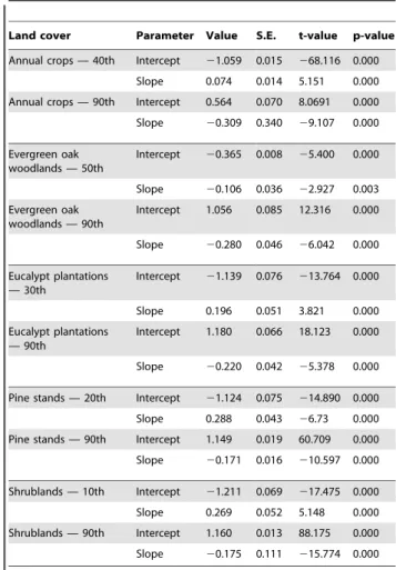
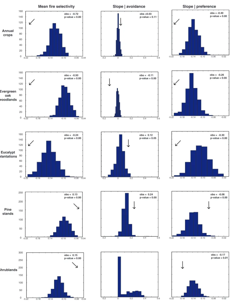
Wildfire selectivity for land cover type: does size matter ?
Texto
Imagem


Documentos relacionados
Os dois tipos de jambu estudados mostraram-se também fonte de compostos fenólicos totais com valores de 360,21 (mg/L) para o jambu convencional e 396,89 (mg/L) para o
Acrescenta: “racionalidade e irracionalidade não devem ser identificadas com o sucesso ou fracasso da ação, prospectivamente” (1936: 895). Posteriormente, em Manifest and
Title: Kinetic and energetic parameters of carob wastes fermentation by Saccharomyces cerevisiae: Crabtree effect, ethanol toxicity and invertase repression.. Article Type:
Conclusion summary of EI Risk Assessment assuming the contribution of Active Substance and Excipients given by option 2A and all contribution given by all components of the
The proposed model of two professionalism models (Evetts, 2010, p.130): organ- isational-based professionalism and occupational-based professionalism in knowledge societies is
A investigação do comportamento de consumo aponta questionamentos mais amplos que o comportamento de compra por considerar o que acontece antes e depois da
ABSTRACT: The aim of this study was to develop a methodology for mapping land use and land cover in the northern region of Minas Gerais state, where, in addition to agricultural
The albedo estimates calculated from the Landsat image show a significant potential to help in the identification and delimitation of anthropic and natural features in the
