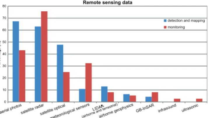
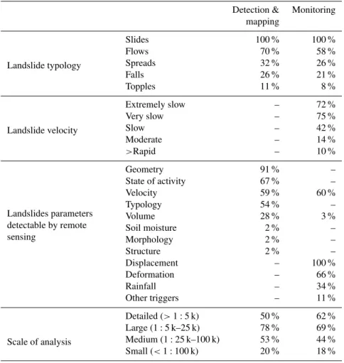
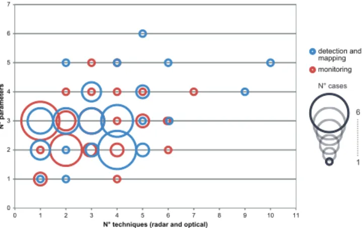
Technical Note: Use of remote sensing for landslide studies in Europe
Texto
Imagem


Documentos relacionados
In the light of the technological transformations that have been occurring in the field of Remote Sensing, the objective of this study was to evaluate the feasibility and the
The purpose of the present study was to make use of satellite remote sensing techniques to obtain an insight into the dispersal patterns of turbidity plumes and
The proposed model of two professionalism models (Evetts, 2010, p.130): organ- isational-based professionalism and occupational-based professionalism in knowledge societies is
The study assessed the association between environmental characteristics obtained by remote sensing and prevalence of canine visceral leishmaniasis (CVL) in the neighborhood
Para identificar em qual ano os domicílios brasileiros chegariam à marca de 50% ou mais com a presença da Internet, foi realizada uma projeção populacional
Remote sensing, as a timely and none destructive tool, could be an alternative to traditional plant testing
Genericamente, concluímos que o nexo interno/externo potencia a transformação vertical política, entre a coordenação interna e a cooperação externa, tendo a União Europeia
In this dissertation, our purpose is to build different ensemble methods to compare and to analyse the results of accuracy obtained (on their classification of satellite images
