Bol. Ciênc. Geod. vol.21 número2
Texto
Imagem


Documentos relacionados
For the solution of the fitting problem, the linear or linearized relationship, written between the given data points and unknown parameters (one equation per data
Real Time Kinematic (RTK) Global Navigation Satellite Systems (GNSS) technique - specifically, the Global Positioning System (GPS) - came on the market by early 1990s
Before Cholesky decomposition, sorting the diagonal elements in ambiguity covariance matrix (ascending or descending) can reduce condition number of matrix and
This article is a continuation of the thesis to increase the reliability of the determined coordinates of corners of a building in the RTN GNSS mode using the algorithm
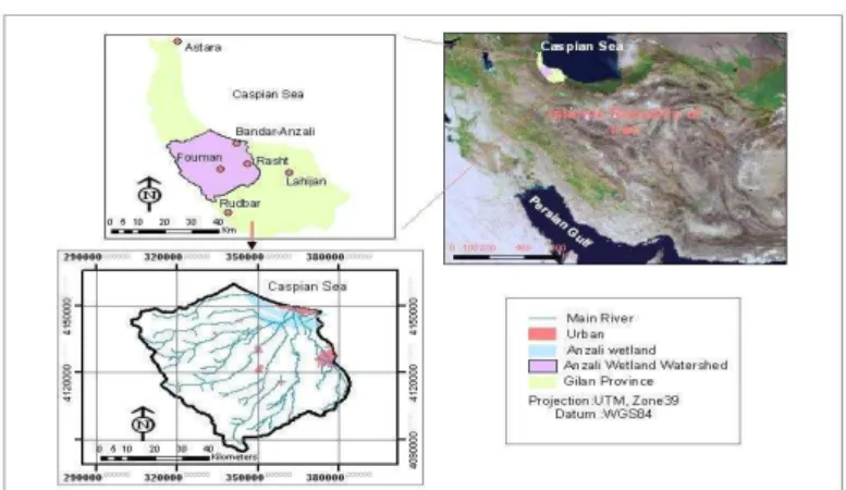
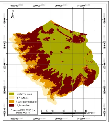
Having a wilderness landscape, this zone has the required potential for the ecotourism activities including mountaineering, hillside climbing, visiting natural
Liu and Shi (2006, 2009), Shi and Liu(2007) defined a computational fuzzy topology to compute the interior, boundary, and exterior parts of spatial objects, and based
Various surfaces fitting using the plane coordinates of the reference points and analysis with different buffers were used to determine the geoid undulation Taiwan.. The
Stereo-graphic, Equi-distant, Orthogonal and Equi-solid-angle projections presented similar results even considering that Bower-Samyang fisheye lens was built based
