The contribution of historical aerial and satellite photos to
archaeological and geo-archaeological research: case studies in Italy
and Turkey
G. Scardozzi
CNR-IBAM, Italian National Research Council, Institute for Archaeological and Monumental Heritage, strada per Monteroni, c/o Campus Universitario, 73100 Lecce, Italy
Received: 25 January 2010 – Revised: 18 April 2010 – Accepted: 20 April 2010 – Published: 17 May 2010
Abstract. The paper evidences the importance of old aerial and satellite photos of ancient topography studies, with ex-amples concerning archaeological and geo-archaeological research conducted in Italy and Turkey, during a coopera-tion between the Ancient Topography, Archaeology and Re-mote Sensing Laboratory (AnTAReS Lab) of the Institute for Archaeological and Monumental Heritage of the Italian National Research Council (IBAM-CNR) and the Ancient Topography and Photogrammetry Laboratory (LabTAF) of Salento University.
The historical aerial photos, i.e. those before the big trans-formations of the 1950’s and 1960’s, and the space photos taken in the 1960’s and 1970’s, particularly useful for the Near East, represent a fundamental tool for the study of the territory. In many cases, in fact, they document landscapes that have been modified by urbanization, building of large infrastructures, transformations in the land use and diffusion of mechanized agricultural methods. Only through the de-tailed analysis of these aerial and space photos it is possible to recover a fundamental documentation concerning the exis-tence, the location and the layout of archaeological evidence and paleo-environmental elements otherwise lost; so, their use during research is very important for the reconstruction of the ancient topography of urban and territorial contexts.
Correspondence to:G. Scardozzi (g.scardozzi@ibam.cnr.it)
1 Introduction
The historical aerial photos, i.e. those before the big transfor-mations concerning Italy during 1950’s and 1960’s (for Italy see Piccarreta and Ceraudo, 2000; Guaitoli, 2003; Scardozzi 2008a), and the space photos taken in the 1960’s and 1970’s, particularly useful for the Near East (for examples see Gali-atsatos, 2004; Beck et al., 2005, 2006, 2007; Ur, 2005 and 2007; Wilkinson et al., 2005; Goossens et al., 2006; Scar-dozzi, 2008b), represent a fundamental tool for the study of the territory during ancient topography research. In many cases, in fact, they document landscapes which have been greatly modified by urbanization, building of large infras-tructures, transformations in the land use and diffusion of agricultural mechanization; these transformations have of-ten radically changed historical landscapes, modifying the morphology of territories or destroying and covering up a lot of ancient evidence. Only through the detailed analysis of old aerial and satellite photos, possibly in integration with ancient cartography, it is often possible to recover, at least partially, a fundamental documentation concerning the exis-tence, the location and the layout of archaeological evidence and paleo-environmental elements otherwise lost.
112 G. Scardozzi: Contribution of historical aerial and satellite photos to research satellite photos for the ancient topography studies. The
ex-amples that I will give in this paper are to show in more de-tail the importance of the aerial photos acquired before and during the Second World War for research on some ancient sites of Southern and Central Italy. These photos come from the “Fondo S.A.R.A. – Ala Littoria S.A.”, which is a collec-tion of numerous aerophotogrammetric flights realized in the 1930’s by S.A.R.A. (Societ`a Autonoma Rilevamenti Aero-fotogrammetrici) in order to update the cadastral maps of Viterbo Province; also, there are aerial photos realized by the Istituto Geografico Militare (I.G.M.) and the Royal Air Force (R.A.F.) in 1943–1945.
These images, sometimes scarcely used in archaeological research, constitute a very important documentation about urban contexts and territories that later have been changed or partially destroyed; in them it is therefore possible to de-tect and examine ancient structures and archaeological traces of buried features now no longer visible.
Sometimes paleo-environmental elements that allow the reconstruction of ancient landscapes are also visible in these photos. In these cases the ground check of traces and anoma-lies visible in the images are very important. Two case stud-ies regard the area of the archaic and Roman harbor of Torre S. Giovanni (south-western Salento, Apulia) and the area of the Yumuktepe, a prehistoric settlement in Mersin (south-eastern Turkey). In the first case a very rich multitemporal documentation (between 1943 and 2006) allows us to recon-struct an ancient lagoon (now reclaimed) behind the coastline and the transformation of the last one. In the second case, the analysis and processing of multitemporal space photos taken by reconnaissance United States satellites between 1967 and 1980 allow us to reconstruct the ancient landscape around the Yumuktepe and the valley of the Kizil Dere, that is situated near the settlement; these images also allow the reconstruc-tion of the ancient coastline of the alluvial Adana plain, east of Mersin.
2 Historical aerial photos for a better understanding of the ancient topography of the Viterbo Province
In Italy the search of historic aerial photos, often scarcely used in archaeological research, can take place, in the main public archives such as those in the Istituto Geografico Mil-itare (Geographic Military Institute) in Florence and in the Aerofototeca Nazionale of the Istituto Centrale per il Cat-alogo e la Documentazione (National Aerial Photographic Archive of the Central Institute for Cataloguing and Docu-mentation) in Rome. There is also the possibility of gath-ering these types of images in minor archives or in those not specialized in the collection of aerial images, such as the State Archive of Viterbo, which conserves a consider-able number of aerial photos from the second half of the 1930’s, the “Fondo S.A.R.A. – Ala Littoria S.A.”, that were re-cently discovered (Caprasecca, 2006a, b; Scardozzi, 2008a).
The latter are images taken about between 1935 and 1939 by the S.A.R.A. (Sezione Autonoma Rilevamenti Aerofo-togrammetrici) of Rome. They were commissioned by the Minister of Finance, General Directorate of Land Register and Technical Services, and used airplanes of the Ala Litto-ria Societ`a Aerea, in order to upgrade the maps of the Pon-tifical Land Register of the Viterbo Province and remained in use after the unification of Italy. In the 1930’s S.A.R.A., which was part of O.M.I. (Ottica Meccanica Italiana), ob-tained many commissions both in Italy and abroad, among which was one to carry out the surveys for the creation of the new land register maps of the Province of Viterbo, of Terni as well as for parts of Rome and Sondrio (Piccarreta and Ceraudo, 2000; Boemi, 2003). These areas were sur-veyed both in plan and in altimetry with the aerophotogram-metric method, here applied for the first time to land register mapping. The commission given to S.A.R.A. was part of the works aimed at the creation of the New Land Register (or-dered by the laws 1 March 1886, no. 3682, and 21 January 1897, no. 23). The works started in 1934 after the new uni-fied text of laws on the New Land Register (Testo Unico delle leggi sul Nuovo Catasto) was approved with Royal Decree 8 October 1931, no. 1572.
The “Fondo S.A.R.A. – Ala Littoria S.A.” is formed by glass slides 13·18 cm, roughly on a scale of 1:10 000– 1:11 000, shot with a Nistri photo-camera that created stereo-scopic strips from a sequence of inclined pairs of frames that cover entirely the same area. They were taken one frontwards and one backwards with a 6◦ inclination; therefore these are stereoscopic images that generally have almost symmet-ric viewpoint angles. For each Municipality of the Viterbo Province there are printed enlargements on a scale of about 1:4500, about 27.8·37.8 cm, with further enlargements on a scale with a greater denominator for urban centres. They are often paired with the “Drafts of the limits of private prop-erties” (“Abbozzi di delimitazione delle propriet`a private”), which are extracts of the former Pontifical Land Register up-dated with aerial photos, often containing notes on archaeo-logical remains, taken during a direct survey.
The aerial photos of the “Fondo S.A.R.A.– Ala Littoria S.A.” allow us to have a view of large parts of the Viterbo Province before any transformations (natural, but mostly an-thropic) of the second post-war period and allow us to gather a considerable amount of extremely important data for the study of ancient topography, town planning and generally of the territory of this area. They offer, in fact, a very wide cover and great detail, while before the I.G.M flight of 1954, the only vertical images previously available were the photos taken by the reconnaissance flights of the Royal Air Force between the years 1943 and 1944, which covered only par-tially the territory.
Fig. 1.The remains of two small ancient settlements in the territory between Vitorchiano and Bomarzo (Viterbo Province) in an aerial photo of the “Fondo S.A.R.A. – Ala Littoria S.A.” of the second half of 1930’s and in a pan-sharpened Ikonos-2 image (colour composite RGB 3-2-1) of 29 May 2005: the old image show clearly the moats and the defensive walls of the settlement of Camorella (1), now covered by vegetation, and of the settlement of Pranzovico (2), now destroyed by modern structures.
(Scardozzi, 2008a; Gasperoni and Scardozzi, 2010). This research included the study of ancient centres and road sys-tems of Etruscan, Roman and Medieval periods located in the municipalities of Viterbo and Fabrica di Roma (for ex-ample, the ancient sites of Norchia, Castel d’Asso, Musarna, Ferento and Falerii Novi) and for the study and historical re-construction of territories such as those of Vitorchiano, Bo-marzo, Soriano nel Cimino, Vignanello and Corchiano, in the eastern part of the Viterbo Province. These images al-lowed us to recover abundant data that would have other-wise been lost, thus forming an exceptional documentation, of low elevation, areas transformed by agricultural activities or by the expansion of modern urban centres. Furthermore, many photos were taken in winter months, so that the exten-sive forest areas that characterize the investigated territory appear with a less rich vegetation compared to today. This allows for an easier understanding of visible ancient remains, the reading of their planimetric articulation and their spatial characteristics (Fig. 1).
3 Multitemporal aerial and satellite photos for the study of the Torre San Giovanni coastal territory (Lecce province)
The historic aerial images not only allow us to recover im-portant data on archaeological evidence and ancient con-texts that would otherwise be lost, but often permit us to reconstruct historic landscapes that have been subsequently transformed. In fact, sometimes in these photos paleo-environmental elements are so visible that we are able to reconstruct ancient landscapes. In these cases the ground check of visible traces and anomalies in the images is very important.
In the study of the area of the Archaic, Roman and Me-dieval harbor of Torre S. Giovanni (south-western Salento, Lecce Province) a rich multitemporal aerial and space photo
documentation (between 1943 and 2006) allows us to recon-struct an ancient lagoon (now reclaimed) behind the coast-line and the transformation of the latter. The analysis of this stretch of the Salento coastline was carried out in the scope of a territorial research project is the result of an agree-ment between the Municipality of Ugento, the Departagree-ment of Cultural Heritage of the University of Salento and the Su-perintendence for Archaeological Heritage of Puglia. The research project included the excavation (directed by Bietti Sestieri, Chair of European Protohistory of the Salento Uni-versity) of the so-called Specchia Artanisi, a funerary com-plex located about 2.5 km south-west of Ugento (Lecce) and formed by three large tumuli (diameters between 15 and 25 m) consisting of accumulation of arranged rocks, that cover four large crate tombs with lithic slabs dating from the Early and Middle Bronze Age. The stratigraphic exca-vations, carried out in June–July 2008 and in September– October 2009, were integrated with a systematic archaeo-logical survey of the surrounding territory (carried out by LabTAF and IBAM-CNR), between the modern towns of Ugento and Torre San Giovanni. This allowed us to locate at least one of the settlements to which the burials belonged and to reconstruct the condition of the ancient topography (Scardozzi, 2009).
114 G. Scardozzi: Contribution of historical aerial and satellite photos to research
Fig. 2.A detail of the “Provincia di Terra d’Otranto” (1613) drawn by Mario Cartaro (National Library of Naples): the shadow indicate deep bay to the south of the promontory of Torre San Giovanni (Lecce Province), protruding into the sea more than today.
in the toponymy (Padule Bianco, I Paduli, Paduli degli Spon-derati – “Padule” in local language is “Palude”, “marsh”), reclaimed between 1932 and 1952 (Lezzi, 2000).
This lagoon seems to have been schematically documented before it was completely interred by the cartography of XVI and XVII centuries, which shows that the promontory of Torre San Giovanni was once more isolated and extended in a south-west direction than it is today (Fig. 2).
The aerial images taken by the I.G.M. in 1943 (Fig. 3), 1947 and 1955 allow for the reconstruction of the ancient ap-pearance of this area, of the geomorphology of the coastline and of the overlooking sea-shoals, showing evident traces of residual humidity and ancient dune stretches. They
Fig. 3.Mosaic of I.G.M. aerial photos of 1943 (strip 47, photos 210–212) with the area between Torre San Giovanni and Torre Mozza; along the coast have already been made basinsSuddenna,BiancaandUlmo.
parallel to the sandy shoreline, standing about 200 m from it (D’Alessandro et al., 1998). In historic times this natural canal and the now non-existing lagoon were occupied by the harbour near Torre San Giovanni, that formed the Messapian, Roman and Medieval port of Ugento. The archaeological remains document that there was a presence in the harbour area at least from the Archaic age up to High-Medieval times (Urso, 1941; Zecca, 1963; D’Andria, 1978; D’Andria, 1979; Zecca, 1980; D’Andria, 1983; Desy, 1983; D’Andria, 1988; D’Andria, 1991; Desy and De Paepe, 1990; Lamboley, 1996; Semeraro, 1997; Pizzurro, 2002; Auriemma, 2004).
The current appearance of this port area is very differ-ent from the ancidiffer-ent one, since the original natural pier is now broken in seven parts due to eustatism, while the op-posite sandy shore is constantly being modified by the ef-fect of marine currents, that widen the shoreline in some areas, while reducing it in others. In the northern part the shore line is now about 30 m wider since the recent con-struction of two piers. Instead, in the southernmost area, in the direction of Lido Marini, an intense phase of over-washing took place resulting in a reduction of the coast of up to about 100 m (Mastronuzzi et al., 1987). The examination of the photos from the 1940’s and 1950’s and the compari-son with the later aerial images available (A.M. – Aeronau-tica Militare1968, Istituto Geografico Militare 1972, Societ`a Rossi 1979, AeroTop 1988, C.G.R. – Compagnia Generale Riprese Aeree 1997 and 2006), highlight the transformations in the area of Torre San Giovanni and Lido Marini. The docu-mentation offered by the aerial images was also integrated by some high resolution satellite images, particularly by space photos that were taken on 12 September 1961, 12
Decem-ber 1968 and 24 July 1970, respectively by United States spy satellites Corona KH-3 (mission 9022; ground resolu-tion about 7.5 m), Corona KH-4A (mission 1049; geometric resolution about 2.75 m) and Corona KH-4B (mission 1111; geometric resolution of about 1.80 m). Some of the few pho-tos that are available for Italy, belonged to strips that include Greece and the Balkan area, as well as a QuickBird-2 im-age, with a ground resolution of 0.6 m, acquired on 13 May 2004. The aerial and satellite images document how in the last decades there has been a strong expansions of the ur-ban areas, significant modification in the use of the terrain (with an extension of olive groves to the detriment of the ar-eas previously occupied by arable fields, scrub and garrigue) and a deep alteration of the coastline (Fig. 4): in particu-lar, the construction of the small tourist pier at Torre San Giovanni has modified the currents, thus varying the nor-mal regime of transportation and sedimentation along the sandy coast. Further south, the stretch of coast near the “Rot-tacapozza Sud” basin was affected by an extremely strong erosion phenomenon, with the disappearance of the original dune line and a strong reduction of the coastline (Dadamo et al., 2008a, b).
116 G. Scardozzi: Contribution of historical aerial and satellite photos to research
Fig. 4.The coast between Torre San Giovanni and Torre Mozza in a Corona KH-4B space photo of 1970 and in a C.G.R. aerial photos of 2006 (sezione 536100).
presence of this settlement, located in a dominant position for the control of the coast line and of the lagoon sited im-mediately south, is today documented by potsherds scattered on the surface of fields, as strongly altered and affected by agriculture (planting of olive trees) and obliterated by shifted earth. In any case, it cannot be excluded that in the area east of the Specchia Artanisi other small settlements existed that could have used the same funerary area, but surface research have not shown the presence of other protohistoric sites.
The historic aerial images also document the Specchia be-fore the recent agricultural interventions that have partially altered its borders (mostly the western and eastern ones), and the morphology of the area immediately north of the monu-ment before the transformations of recent years when a natu-ral canal that interrupts the rock step and slopes from north-east to south-west was filled with debris.
4 Historical space photos for the reconstruction of the ancient topography around the Yumuktepe (Mersin)
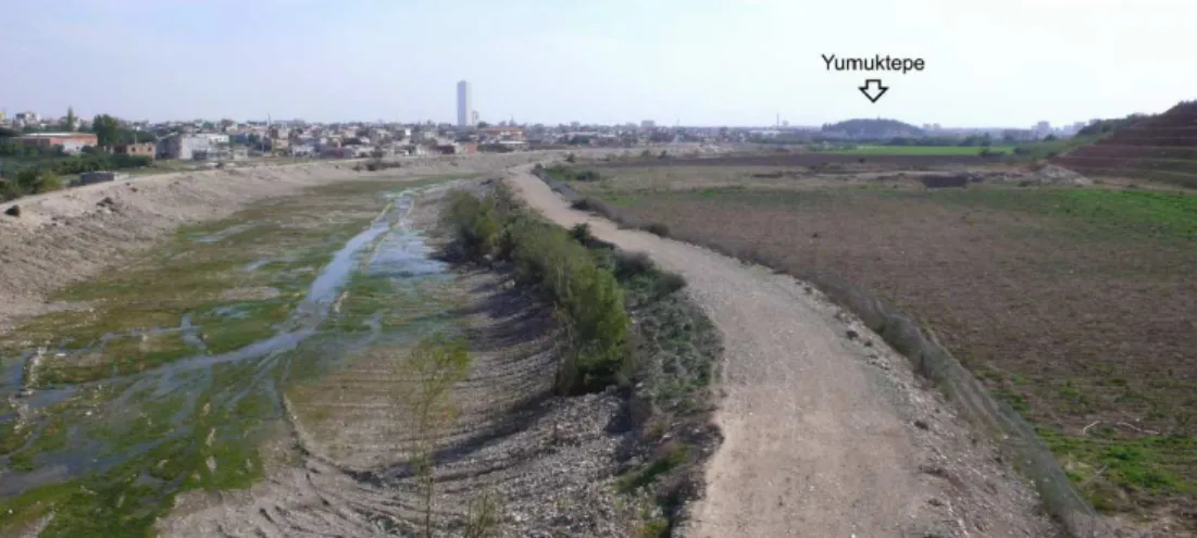
Fig. 5.A view of the Kizil Dere Valley north-west of the Yumuktepe (2008).
the Near East). In this case, the analysis and processing of multitemporal space photos taken by United States recon-naissance satellites between 1967 and 1980 allow us to re-construct the ancient landscape around the Yumuktepe, atell
sited at the eastern margin of the Adana plain and settled from the Neolithic age (7000 BC) up to the Byzantine period (but with the absence of any Roman or Roman-related set-tlement), located at the western periphery of Mersin (Caneva and Sevin, 2004), and of the valley of the Kizil Dere River, that flows west of the mound, closely bordering and badly eroding its edge. These images also allow us to understand and document the formation process of the alluvial Adana plain and to reconstruct the ancient coastline.
In the course of the research, lacking an adequate car-tographic and aerial-phocar-tographic documentation, historic satellite images were thus recovered which would show the investigated territory before the transformations of recent years, that included a considerable expansion of Mersin and of the other urban centres in the Adana plain, and the de-velopment of several industrial buildings. The images were recovered in different detail scales, according to the speci-ficity of the research: in particular, one Gambit KH-7 image taken on 8 February 1967 (mission 4036; geometric resolu-tion 0.6 m), one image of the Corona KH-4A satellite taken on 8 August 1967 (mission 1043; geometric resolution about 2.75 m), three images from the Corona KH-4B satellite taken on 14 May 1968, 31 July 1969 and 10 March 1970 (missions 1103, 1107 and 1109; geometric resolution about 1.80 m), and two images of the Hexagon KH-9 satellite taken on 17 June 1975 and 18 July 1980 (missions 1210 and 1216; geo-metric resolution 6–9 m) were collected. Together with these images that document the evolution of the territory in the 1960’s and 1970’s, another was recovered from QuickBird-2, taken in 29 December 2007, in order to have a compari-son with the current situation. Instead, historical aerial pho-tographs prior to 1967 are not available.
Regarding the study aimed at the reconstruction of the an-cient morphology of the area in which the Yumuktepe is lo-cated and at in the point where the Taurus foothills come closest to the Mediterranean coast (south-eastern Cilicia), the examination of the remote sensing data was accompanied by ground checking of the visible traces and evidence in the im-ages along the course of the Kizil Dere River (Fig. 5), for a stretch of about 3 km upriver of thetell. The surveys reached the area of Karaisal, where the river sharply turns south-east. The geologic studies showed that it was formed by a rising of the territory immediately east of the water course, which occurred in a quite recent geologic age (Caneva and Marco-longo, 2004).
The main aim of the research was to reconstruct the an-cient river course, that today runs west of the Yumuktepe. For this investigation, satellite images from the end of the 1960’s resulted particularly helpful, having provided a very detailed image of thetellsurrounding territory before the ur-ban expansion of Mersin reached it (Fig. 6). In fact, today it is almost completely surrounded by urban areas, as is the river course between the hill and the sea (about 2.3 km). Fur-thermore, the Kizil Dere River bed was lined with artificial banks in the 1970’s. Consequently the historic images doc-ument the situation that preceded these interventions on the river (Fig. 7), showing that when overflowing occurred it had a tendency to move in an east-west direction inside a quite wide alluvial plain, formed by the sediment left behind by the water course and defined by two slopes 2–3 m high.
118 G. Scardozzi: Contribution of historical aerial and satellite photos to research
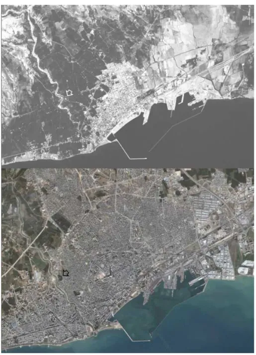
Fig. 6.Mersin in a Corona KH-4B space photo of 1968 and in a QuickBird-2 pan-sharpened image (colour composite RGB 3-2-1) of 2007: the shadows indicate the Yumuktepe.
investigations thus allowed us to reconstruct the morphology of the area in prehistoric and protohistoric times, evidenc-ing several paleo-beds of the Kizil Dere both west of Yu-muktepe, where it flows today, and east, where, according to a hypothesis formulated a few years ago on the basis of a geological study (Caneva and Marcolongo, 2004), it is likely that in the past the river flowed. In this area, today urbanized, the ancient alluvial plain was partially filled in. Considering also the data from the archaeological excava-tions of the Tepe, where, for example, one of the gates of the Chalcolithic Citadel (5000–4200 BC) was uncovered on
120 G. Scardozzi: Contribution of historical aerial and satellite photos to research
Fig. 8.Corona KH-4B image of 1970 georeferenced on a topographic map of the Yumuktepe area: paleo-river beds of the Kizil Dere and the ancient coast line are showed.
images, was very important. These photos documented the paleo-beds of the Berdan, Seyhan and Ceyhan rivers which formed the Adana plain with their sediments, causing its enlargement also in historic times, and forming one of the biggest delta in Turkey, in the southern sector of the plain. It is sufficient to keep in mind the situation of the Roman town of Tarsus, along the Berdan river course, that was reached by ship by Anthony and Cleopatra and that today is located 14 km from the coastline. The DEM facilitated the
Fig. 9.The territory of Mersin (1) andTarsus(2) in a Gambit KH-7 photo of 1967, with a large trace of residual humidity (3) and the dunes (4) between the second city and the sea; the delta of the Berdan and Seyhan rivers (5) and the site of the ancient city ofSoloi(6) are also visible.
122 G. Scardozzi: Contribution of historical aerial and satellite photos to research instead, clearly document the tells that are now destroyed
or transformed and the dune lines of the coast’s widening between Mersin and the centre, with the significant place-name of Karatas (“black stone” in Turkish). It is located on a coastal relief that determined the sharp turn eastwards of the last stretch of the river Ceyhan. Such lines are at the origin of the coastal lakes that characterize the area, today partially transformed, compared to a few years ago, by the prolifera-tion of industrial plans and of the use of machinery in agri-culture. In conclusion, the traces of residual humidity visible in the satellite images of 1960’s document several lagoons nowadays filled in, and quite far from the coast (Figs. 9–10), especially in the area of Tarsus. This proves how the ground has substantially advanced to the detriment of the sea. The analysis of archaeological remains in the Adana plain (where in the southern part an occupation from the Bronze age is documented) combined with remote sensing observation has dated this phenomenon particularly to the protohistoric and historic times and after the earliest Yumuktepe settlement which was established on recent marine sediments.
Acknowledgements. I thank Anna Maria Bietti Sestieri and Isabella Caneva for letting me take part in the research concerning the Specchia Artanisi and the Yumuktepe. I also thank the Director of the State Archive of Viterbo, Dr. Augusto Goletti, and his staff for their courteous and helpful assistance in enabling me to consult the aerial photos of the “Fondo S.A.R.A. – Ala Littoria S.A.”. Finally I thank Giovanna Occhilupo for information regarding the his-torical maps of Salento preserved in the National Library of Naples.
Edited by: L. Eppelbaum, N. Masini, and F. Soldovieri Reviewed by: two anonymous referees
References
Auriemma, R.: Salentum a salo. Forma Maris Antiqui, Congedo Editore, Galatina, 2004.
Beck, A. R., Philip, G., Abdulkarim, M., and Donoghue, D. N. M.: Evaluation of Corona and Ikonos high resolution satellite imagery for archaeological prospection in western Syria, Antiq-uity, 81, 161–175, 2007.
Beck, A. R., Philip, G., Donoghue, D. N. M., and Galiatsatos, N.: Geo-locating Corona imagery for archaeological surveys and cultural resource management: a case study in Syria, in: volo nel passato: aerofotografia e cartografia archeologica, edited by: Musson, C. Palmer, R., and Campana, S., All’Insegna del Giglio, Firenze, 295–299, 2005.
Beck, A. R., Philip, G., and Wilkinson, K. N.: Satellite imagery as a resource in the prospection for archaeological sites in central Syria, Geoarchaeology, 21, 7, 735–750, 2006.
Boemi, M. F.: Le raccolte aerofotografiche, in: Lo sguardo di Icaro. Le collezioni dell’Aerofototeca Nazionale per la conoscenza del territorio, edited by: Guaitoli, M., Campisano Editore, Roma, 29–42, 2003.
Caneva, I. and Marcolongo, B.: The history of the mound, in: Mersin-Yumuktepe a Reappraisal, editeb by: Caneva, I., Sevin, V., Congedo Editore, Galatina, 23–31, 2004.
Caneva, I. and Sevin, V. (Eds.): Mersin-Yumuktepe a Reappraisal, Congedo Editore, Galatina, 2004.
Caprasecca, A.: A historic flight and the study of archaeologi-cal landscape in Maremma (Central Italy), in: From Space to Place. Proceedings of the 2nd International Conference on Re-mote Sensing in Archaeology, (Rome, 4–7 December 2006), edited by: Campana, S. and Forte, M., BAR International Series 1568, Oxford, 43–46, 2006a.
Caprasecca, A.: Un volo aereo storico per lo studio del paesag-gio antico in Maremma, Sci. Tech. Cult. Herit., 15, 1–2, 41–48, 2006b.
Dadamo, M., Zaccarelli, N., Zecca, S., and Zurlini, G.: Traietto-rie evolutive della fascia costiera: il caso del litorale di Ugento (Prov. Lecce), in Atti del II Simposio Internazionale “Il mon-itoraggio costiero mediterraneo: problematiche e tecniche di misura” (Napoli, 4–6- giugno 2008), 67–74, 2008a.
Dadamo, M., Petrosillo, I., Zaccarelli, N., and Zurlini, G.: Approc-cio integrato per la comprensione della dinamica storica dei Pae-saggi culturali della Provincia di Lecce, in Atti del XVIII Con-gresso della Societ`a Italiana di Ecologia (Parma 2008), 2008b. D’Alessandro, A., Loiacono, F., Ricchetti, G.: Note illustrative alla
carta geomorfica del Salento meridionale (F. 525 “Gallipoli”, 526 “Nard`o”, 527 “Otranto”, 536 “Ugento” e 537 “Capo S. Maria di Leuca”), in Atti Convegno sulle “Conoscenze Geologiche del Territorio Salentino”, Quaderni di Ricerche del Centro Studi Geotecnici e di Ingegneria, 11, 207–222, 1987.
D’Andria, F.: Ugento. Torre S. Giovanni, Studi Etruschi, XLVI, 564–565, 1978.
D’Andria, F.: La documentazione archeologica medioevale nella Puglia meridionale, in Le aree omogenee della civilt`a rupestre nell’ambito dell’Impero Bizantino: la Serbia, Congedo Editore, Galatina, 223–228, 1979.
D’Andria, F.: Lo Zeus stilita di Ugento e il capitello di Vaste. Nota, Taras, III, 1-2, 155–162, 1983.
D’Andria, F.: Messapi e Peuceti, in Pugliese Carratelli G. (a cura di), Italia omnium terrarum alumna, Milano, 653–715, 1988. D’Andria, F.: Insediamenti e territorio: l’et`a storica, in I
Mess-api. Atti del Convegno di Studi sulla Magna Grecia, 30, 1990, Taranto, 393–478, 1991.
Desy, Ph.: R´eflexions sur l’´economie et le commerce du Sal-lentin hell´enistique `a propos d’amphores in´edites de Gallipoli et d’Ugento, Antiquit´e Classique, LII, 175–194, 1983.
Desy, Ph. and De Paepe, P.: Torre S. Giovanni (Ugento) les am-phores commerciales hell´enistiques et r´epublicaines, Studi di Antichit`a, 6, 187–234, 1990.
Gasperoni, T. and Scardozzi, G.: Bomarzo, Mugnano, Bassano in Teverina. IGM F. 137, I SO “Attigliano” – II NO “Soriano nel Cimino”. Carta Archeologica d’Italia, Contributi, Viterbo, in press, 2010.
Galiatsatos, N.: Assessment of the Corona series of satellite im-agery for landscape archaeology. A case study from the Orontes valley, Syria, Thesis for the degree of Doctor of Philosophy, Uni-versity of Durham, 2004.
Goossens, R., De Wulf, A., Bourgeois, J., Gheyle, W., and Willems, T.: Satellite imagery and archaeology: the example of Corona in the Altai Mountains, J. Archaeol. Sci., 33, 6, 745–755, 2006. Guaitoli, M. (Ed.): Lo sguardo di Icaro. Le collezioni
2000.
Pizzurro A.: Ozan. Ugento dalla Preistoria all’Et`a Romana, Lecce, Italy, 2002.
Scardozzi, G.: Fotografie aeree storiche e ricerche di topografia antica nell’Etruria meridionale interna, Archeologia Aerea. Ricerche di Aerotopografia Archeologica, III, 21–59, 2008a. Scardozzi, G.: Old high resolution satellite images for landscape
ar-chaeology: case studies from Turkey and Iraq, in Remote Sens-ing for Environmental MonitorSens-ing, GIS Applications, and Ge-ology, Proceedings of SPIE Europe Remote Sensing, Confer-ence 7110 “Remote Sensing and Archaeology”, Cardiff, 15– 18 September 2008, 7110/03, 1–14, 2008b.
Case Studies using Corona Satellite Photography, ArchAtlas, edition on-line, 2007.
Urso, P.: Ugento attraverso la storia, Taranto, 1941.
Wilkinson, T. J., Wilkinson, E.B ., Ur, J. A., and Altaweel, M. R.: Landscape and settlement in the Neo-Assyrian Empire, Bulletin of the American Schools of Oriental Research, 340, 23–56, 2005. Zecca, S.: Portus Uxentinus vel Salentinus, Ed. Mariano, Galatina,