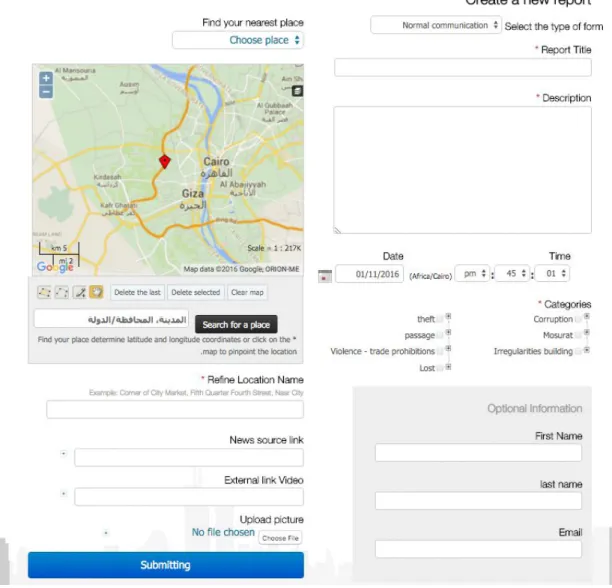
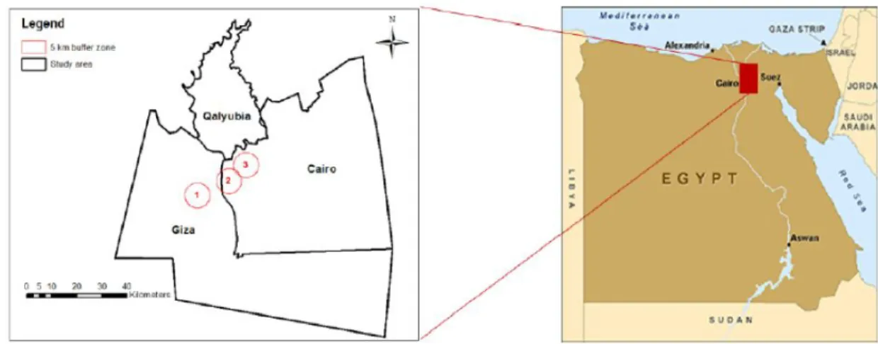
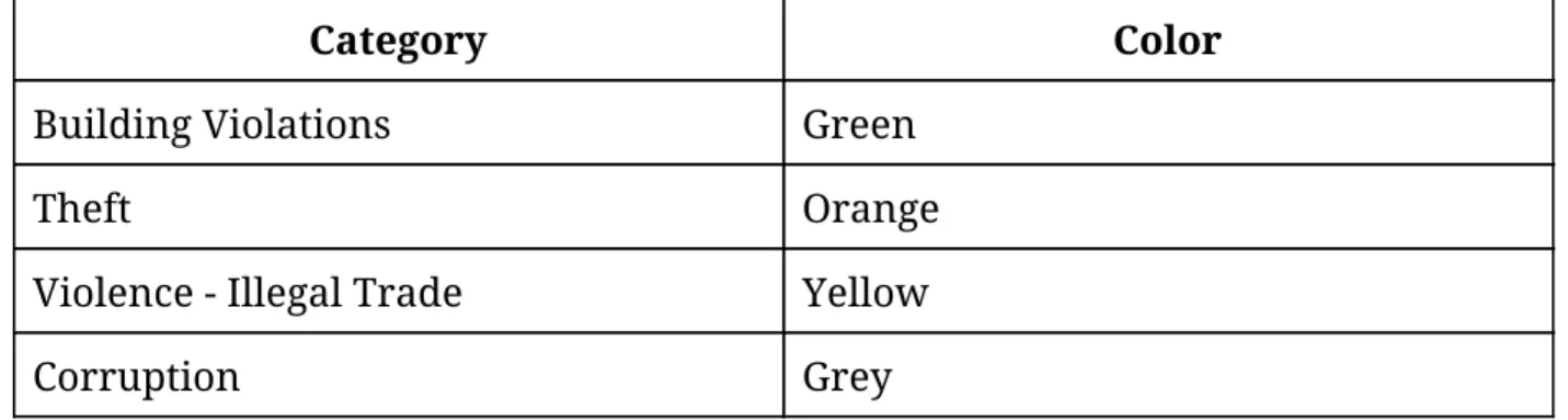
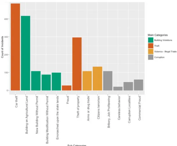
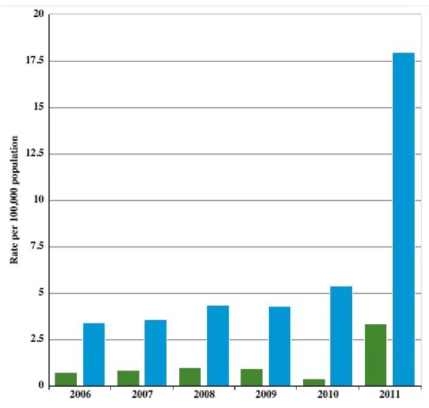
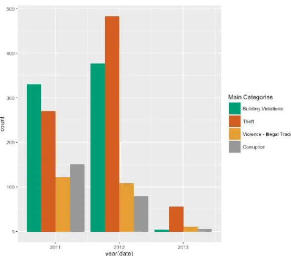
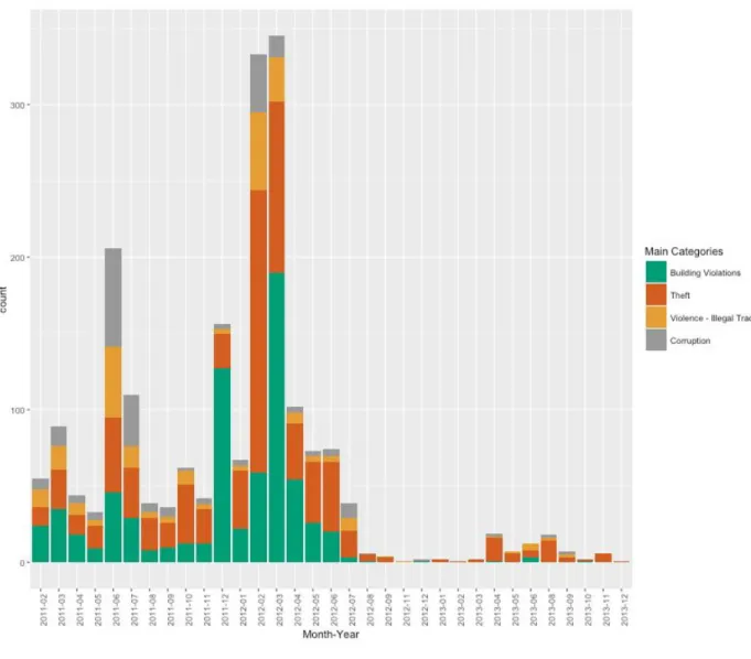
Investigating Crime Patterns in Egypt using Crowdsourced Data between 2011-2013
Texto
Imagem


Documentos relacionados
Neste trabalho o objetivo central foi a ampliação e adequação do procedimento e programa computacional baseado no programa comercial MSC.PATRAN, para a geração automática de modelos
Nesse sentido, pesquisas relacionadas com ensino e aprendizagem de Línguas (LEFFA, 2011; TERMERO, 2009; ALMEIDA FILHO, 1993), relevância do idioma Inglês no Comércio
A functional system was developed constituted by an application for smartphones that enables the monitoring of the geographic position, heart rate and physical activity being
Utilizando os preços da arroba do boi gordo para o Estado de Goiás e os preços da arroba do boi gordo no mercado futuro da BM&F, foi calculada a razão de hedge
O experimento foi realizado com uma amostra de 43 alunos dos cursos de licenciatura em Engenharia Informática da Universidade Fernando Pessoa, como já referido,
Micaela Janan (2001, pp.33-34), valendo-se de um instrumental lacaniano a fim de desvendar “the obscure logic that governs Propertius’poetry”, informa que os poemas de Galo – a
To examine the temporal patterns in the occurrence of a tropical ichthyofauna, fisheries-independent samples were collected between September 2003 and July 2004 from
O estudo histológico foi realizado por dois patologistas com experiência em Uropatologia e pautado na identificação da perda de informação – quando não incluídas as
