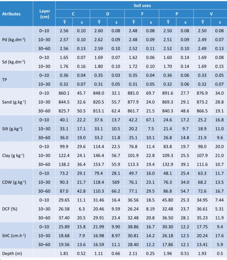
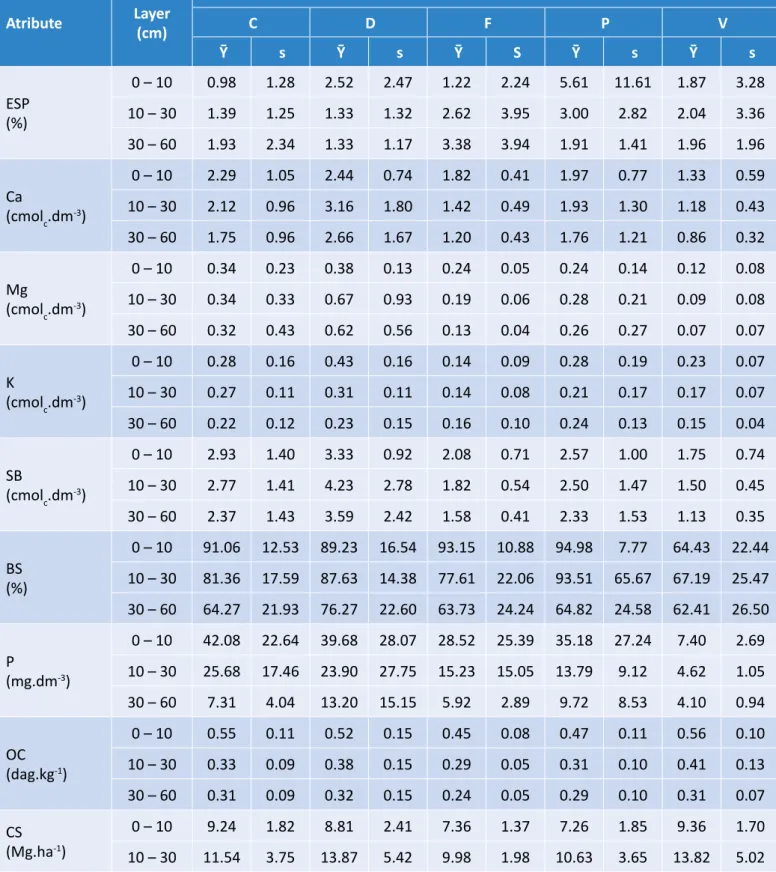
CHANGES IN SOIL PROPERTIES IN FUNCTION OF DIFFERENT SOIL USES IN THE IRRIGATED PERIMETER OF ICO-MANDANTES IN THE SEMIARID REGION OF PERNAMBUCO, BRAZIL
Texto
Imagem


Documentos relacionados
Assim, para este projeto são necessários estudos de topologias utilizadas em redes, sensores, protocolos de comunicação wireless, arquitetura de microcontroladores,
Agradeço aos tradutores e intérpretes de Língua Brasileira de Sinais (LIBRAS) e Língua Portuguesa, Geyson Lima de Carvalho e Tafnes Mota de Lima Oliveira,
O Bolsa Escola continua, no entanto, não inserindo totalmente o seu público, tanto por problemas de organização que enfrenta como pela dupla estigmatização a qual esses indivíduos
The irregular pisoids from Perlova cave have rough outer surface, no nuclei, subtle and irregular lamination and no corrosional surfaces in their internal structure (Figure
Enquadra-se no campo de estudo na área da ergonomia, com interface homem-ambiente ou Ergonomia do ambiente construído com ênfase na utilização de APO Análise Pós Ocupação e
O primeiro aspecto é que as diferenças sexuais não podem ser vistas apenas como biologicamente determinadas na acepção meramente genital, antes, são social e
Neste trabalho o objetivo central foi a ampliação e adequação do procedimento e programa computacional baseado no programa comercial MSC.PATRAN, para a geração automática de modelos
Ousasse apontar algumas hipóteses para a solução desse problema público a partir do exposto dos autores usados como base para fundamentação teórica, da análise dos dados
