RADIATION SCIENCES
08-01 (2020) 01-17ISSN: 2319-0612 Accepted: 2019-10-21
BJRS
Distribution of Pb isotopic signatures in a
hydrographic sub-basin of the Poços de Caldas Plateau,
Minas Gerais, Brazil
Dutra
aP. H., Carvalho Filho
aC. A., Feliciano
aV. M. D.
a Serviço do Meio Ambiente/ Comissão Nacional de Energia Nuclear (CNEN)/ Centro de Desenvolvimento da
Tecnologia Nuclear (CDTN)/ CEP 31270-901/ Avenida Presidente Antônio Carlos, 6.627/ Campus da UFMG/ Belo Horizonte - MG, Brasil
pedroh_dutra@hotmail.com
ABSTRACT
The Taquari River Basin, located in the Alkaline Complex of Poços de Caldas, in the south of Minas Gerais, Brazil, is situated in an old volcanic caldera. In the study area there are fields and pastures; agriculture with cultivation of vegetables; rose plantations; and native forest, in addition to the Mineral Treatment Unit of Caldas (UTM-Caldas), which is part of the Industrial Complex of Poços de Caldas (CIPC), a uranium mining and processing facility. The main objective of this work was to investigate the isotopic Pb signatures of river sediments, rocks, mining tailings and fertilizer samples collected in the region surrounding UTM-Caldas in order to identify environments with influences from geogenic and / or anthropogenic sources. The results showed that there is an anthropic contribution (fertilizers and mining tailings) in some sectors of the Taquari river basin, generating possible concerns about the amount of elements that can be transferred to the water bodies. In addition, there is a significant geogenic contribution of naturally enriched areas, which have distinct situations that also generate an increase in the concentration of chemical elements in water bodies.
1. INTRODUCTION
The rapid increase in technology that began at the end of the 19th century, coupled with the growth in world population, led to the use of a great deal of fertilizer on commercial crops in order to take better advantage of the soil and resulted in high productivity [1].
Phosphate minerals are the main raw material for making phosphate fertilizer and are widely used in natura as a source of phosphorus. In the production process for more soluble forms of phosphorus, most of the metals remain in the fertilizer [2]. It is known that these phosphates naturally contain levels of various metals, including lead. This can be a reason for concern regarding environmental contamination [3] due to the fact that they have no known function in plant metabolism and growth. Lead (Pb) levels in phosphate fertilizer can vary from 7 mg kg-1 to 225 mg
kg-1 [4]. Some studies have found that levels of uranium (U) and thorium (Th) and their decay
products can be highly significant, depending on the origin of the phosphate mineral [5].
The same growth has taken place in mining worldwide that has taken place in agriculture. Mining became more prominent beginning in the First Industrial Revolution (at the turn of the 20th century), when mass production intensified mining to meet the increasing demand of industrial activities. The worldwide growth in population has been accelerating and with it there is greater demand not just for food but also for manufactured goods. To supply the demand for these goods, metals and minerals (which are non-renewable resources) are being consumed at an accelerated rate. This increases as developed nations become more industrialized.
Mining results in the displacement and extraction of large amounts of material. The quantity of waste generated by the activity depends on the mining technique used, the concentration of the mineral substances in the ore, and the location of the deposit and how far it is below the surface. There are two main types of solid waste: extraction waste and tailings. Extraction waste is the material that is dug up in the process of preparing the mine for mineral extraction. it doesn't have any monetary value and is deposited in piles. Tailings are the waste of mineral processing that ore undergoes [6]. Another significant problem that results from mining is acid mine drainage (DAM) The acid solutions generated by DAM can solubilize chemical elements that are present as it leaches through rock and soil, coming to contaminate groundwater or surface water such as rivers, streams, and lakes [7].
The Poços de Caldas Plateau (PPC) is located in the south of the Brazilian state of Minas Gerais. There are world-renowned radioactive anomalies on the plateau. One of these anomalies is called Morro do Ferro (Iron Hill). This anomaly is known to have one of the highest levels of naturally-occurring background radiation in the world [8]. In the mining history of the PPC, one of the known anomalies, located in the Campo do Cercado region, was classified as a possible uranium deposit. It went on to become the first commercial-scale uranium mine in Brazil [9].
Studies that were carried out beginning in the mid-60s introduced new ways to apply methods involving Pb isotope ratio analysis in research dealing with Pb isotopic signatures in environmental studies [10,11]. This research seeks to correlate the concentration of detected metals with their original source, be that natural or anthropogenic, in order to identify environments that have been altered by human activity or those that have their original characteristics (geogenic). Note that the isotopic signature of Pb can't be affected by physical or chemical processes [12]; it's signature in the environment being studied tends to be identical to its point of origin, so the isotopic signatures of Pb from human sources are different from those that are natural in origin.
The isotopic signatures of Pb in the environment can vary significantly as a result of the regional geological characteristics. For this reason, the signature in a specific place must be determined in order to identify possible human contributions to the environment [13].
The Poços de Caldas Plateau has naturally occurring uranium (U), thorium (Th) and lead (Pb). Lead is an element that is derived from the radioactive decay of the elements U (238U and 235U) and
Th (232Th) in the form of its stable isotopes 206Pb (238U), 207Pb (235U) and 208Pb (232Th), in addition
to the presence of lead in its natural isotope, 204Pb. For this reason, the four stable isotopes of lead
are found in the environmental system being studied. These isotopes behave as natural tracers that are capable of characterizing and monitoring geogenic and/or anthropogenic sources of U, Th, and Pb in the different subsystems that are present in the study region. Taking all of this into account, the main objective of this study is to characterize Pb signatures in samples of sediment, fertilizer, and mining waste, as well as to identify environments that have experienced geogenic and/or anthropogenic influences.
2. S
TUDYA
REAThe study area includes the Poços de Caldas Alkaline Complex (CAPC), more specifically, the Poços de Caldas Plateau, which is in the town of Caldas in the state of Minas Gerais in Brazil. It has an area of 102 km2, enclosed by the Mineral Treatment Unit (UTM-Caldas), which belongs to the
Nuclear Industries of Brazil (INB).
The Poços de Caldas Alkaline Complex (CAPC) includes plutonic, hypabyssal and volcanic alkaline rocks, which contain phonolites and nepheline syenites, accompanied by pyroclastic and sedimentary rocks. This complex has a semi-circular geological structure classified as a volcano caldera. It has an average dimension of 33 km in diameter and a surface area of around 800 km2
[14].
The Mineral Treatment Unit (UTM-Caldas), located in the old uranium mine called the Osamu Utsumi Mine, began its mining activities in the early 80s and was definitively shut down in 1995. During 13 years of operation 44.8 × 10⁶ m3 of mining waste and around 2.39×10⁶ m3 of tailings
were generated [9].
The most relevant UTM-Caldas installations for the context of this study are the tailings DAM (BR) and the waste-pile # 4 (BF4). The location of these installations is shown in Figure 1. The ore was extracted from an open pit of around 200,000 m2 (20 ha) with a volume of around 2 Mm³. After then the ore was sent for physical and chemical processing where the uranium was produced in the form of ammonium diuranate (yellowcake). The solid and liquid effluents from chemical processing were deposited in the tailings DAM (BR).
The effluents leaving the BR pour into the A2-25 settling pond, and then are released to the Soberbo Creek. The mining waste, made up of the products of stripping, waste rock, and low grade ore, were deposited in the waste piles such as waste-pile # 4 (BF4). Most of the acidic water (pH 3– 4) that has percolated through WRP#4 is collected in the A1-75 effluent retention pond (Figure 1), situated on the banks of the Consulta Stream.
In the study area, along with UTM-Caldas, there are large areas of fields and pastures; agriculture related to produce; rose plantations; large areas of native vegetation; and a predominance of forestry cultivation. The types of land use mentioned, especially forestry, use significant amounts of fertilizer and agricultural correctives. In these cases, the effect of fertilizer
use has led to an increase of from 30 to 50% in crop yields for eucalyptus. Phosphorus is one of the main nutrients responsible for this response.
The UTM-Caldas is located at the division of waters that separate the hydrographic basins of Antas Creek and the Verde River. The study area delimited is found in the sub-basins of the Taquari River, Consulta Stream and Soberbo Creek, as can be seen in Figure 2. All of these sub-basins are part of the Verde River Basin [9].
Consulta Stream is an affluent of the left bank of Soberbo Creek, that in turn empties into the right bank of the Taquari River, a tributary of the Verde River. The Verde River is an affluent of the Pardo River. The BF4 and its discharge point (A1-75) are located in in the Consulta stream sub-basin, while the BR and the A2-25 settling pond are found in the Soberbo Creek sub-basin. Note that Consulta Creek was redirected at the time that the Osamu Utsumi mine was opened, when BF4 was implemented [9].
Figure 2: Map of the local hydrography
3. MATERIALS
AND
METHODS
3.1. Sample preparation and collection
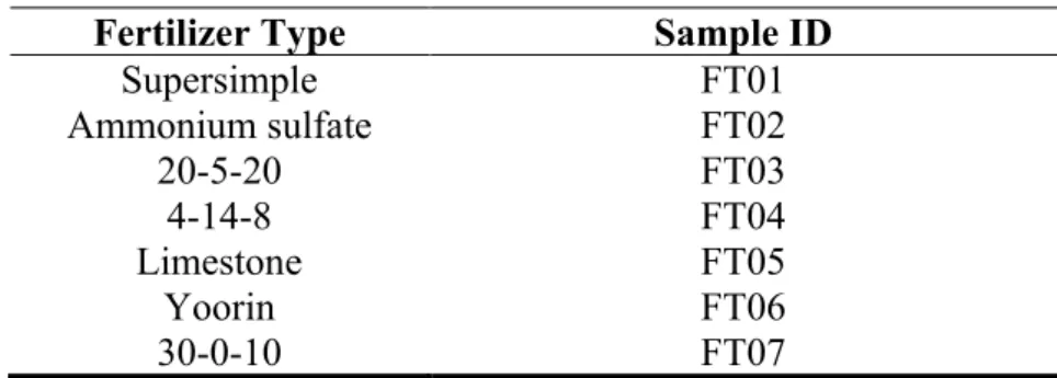
Samples were collected in order to evaluate the distribution and isotopic signatures of Pb in sediment from the bottom of the sub-basin while carrying out this study. There were seven different fertilizer samples that are common in the study area (Table 1); three rock samples for local geogenic characterization of the material (Table 2); ten samples made up of mining waste (Table 3); and thirty four sediment samples (Table 4). The soil occupation and usage data and proximity to native vegetation was taken into account. Figure 3 shows the location of the sediment sampling stations.
The point SD1-2 is found near the sources of Consulta Stream, SD2-9 is found near the sources of Soberbo Creek and SD3-5 found near the sources of the Taquari River. These stations have passive environmental sources which are caused by potato farms, eucalyptus plantations, and rose fields along the waterways. Sample points were added amidst the waterways: SD1-74 and SD1-76 on Consulta Stream, SD2-77 and SD2-71 on Soberbo Creek and SD3-3, SD3-8 and SD3-1 on the Taquari River. The selection of these points was focused on empowering and representing the comparison with the results of the springs and question those found at the mouth of the rivers studied. Points SD1-1 on Consulta Stream, SD4-2 on Soberbo Creek and, DS4-3 and SD4-400 on Taquari River, are sampling stations that are close to the mouth of the rivers. These stations are used as control points to check the contamination level that reaches from one river to another.
Table 1: Identification of fertilizer samples. Fertilizer Type Sample ID
Supersimple FT01 Ammonium sulfate FT02 20-5-20 FT03 4-14-8 FT04 Limestone FT05 Yoorin FT06 30-0-10 FT07
Table 2: Identification of rock sample collection points Sample Station Location Sample ID
PC-100 Tinguaíto TG
PC-106 Caldasito CT
RP01 Tinguaíto RO
Table 3: Sample points for mining waste. Sample
Station Location Sample ID
A1-75 effluent retention pond (BF4) RM01 - RM09 – RM11
A2-25 Settling pond (BR) RM02 - RM10 - RM12
PC-101 Composite sample from BF4 RM03
PC-102 Composite sample from BF4 RM04
PC-103 Composite sample from Chemical Processing Waste –
west beach (BR) RM05
PC-104 Composite sample from Chemical Processing Waste –
north beach (BR) RM06
Table 4: Description of sediment sample points.
Sample Station Location Sample ID
SD1-2 Upstream from Consulta stream ("lake" and eucalyptus
farm) SD01 - SD20 - SD30
SD1-74 Upstream from the deviation of Consulta Stream SD02
SD1-76 Downstream from A1-75 SD03 - SD21 - SD31
SD1-1 Near the mouth of Consulta Stream SD04 - SD22 - SD32
SD2-9 Rose farm SD05 - SD23 - SD33
SD2-77 Upstream from the BR? SD06
SD2-71 Farm downstream from the BR SD07 - SD24 – SD34
SD4-2 Near the mouth of Soberbo Creek SD08 - SD25 - SD35
SD3-5 Pouso Alegre Farm – Potatoes SD09 - SD26 - SD36
SD3-8 Left bank affluent of the Taquari River SD10
SD3-1 Near the Morro do Taquari Hill U-Zr anomaly SD11 - SD27 - SD37
SD3-3 Right bank affluent of the Taquari River SD12
SD4-3 Downstream from the intersection of Soberbo Creek
and Taquari River SD13 - SD28 - SD38
Figure 3: Location of the sampling stations and soil use and occupation map.
Source: Author.
All of thesamples were stored in clean plastic recipients. They were closed and protected from light to impede alteration of the samples. Once in the lab, sediment and mining waste samples were stored in clean stainless steel trays to be dried in a forced-air heater for 24 hours. Next, the sediment was dried in a heater with an average temperature of 90°C. After this, the samples were broken down and sieved using a 63 μm (230 mesh) stainless steel screen. After this procedure had taken place, the samples were sent to be pulverized with a mortar and pestle to reduce the grain size.
The fertilizer and rock samples only went through the pulverization process with a mortar and pestle. After this grain-size reduction procedure, all of the samples were sent for analysis.
3.2. Determination of Pb isotopic ratios
The thermal ionization mass spectrometry (TIMS) technique was used to determine the isotopic ratios of Pb. TIMS is a precise and exact analytical technique using thermal ionization that is
capable of measuring the isotopic ratios of elements in samples obtained. The main application of TIMS is to measure isotopic ratios of elements used in geochronology tracer studies [14].
This technique has been amply used in recent years in environmental analysis because it is very easy to detect isotopes. The advantage over other techniques for isotope ratio detection are: it shows chemical and physical stability; it is able to carry out very precise measurements; it can evaporate and ionize samples at different temperatures; it had almost a 100% ion transmission rate for the collector; it is more consistent for samples with low mass. The extensive chemical pre-treatment and optimization of the vaporization and ionization of the sample lead to the lengthening of the analytical procedure, but on the other hand, it allows Pb isotopes to be determined with a relative standard deviation (RSD) of 0.001% to 0.01% [15].
Determination of Pb isotopic ratios were carried out in two labs. Some of the samples were sent to the Isotopic Geology Laboratory (LGI - UFRGS) of the Federal University of Rio Grande do Sul. A Thermo-Finnigan Triton thermal ionization mass spectrometry (TIMS) was used to measure Pb isotopic ratios. Other samples were sent to the Center for Geochronological Research (CPGeo-USP), located at the Universidade de São Paulo. The analyses were carried out in a Finnigan MAT 262 thermal ionization mass spectrometer (TIMS).
The isotopic analyses were carried out with the mass spectrometer system in the static mode. Pb was deposited on simple rhenium (Re) filaments, placed in silica gel and H3PO4. The Pb was
corrected by the fractionation effect by 0.1% based on 38 analyzes with the standard reference material NBS SRM 981 [18]. The total value for the blank was Pb < 100 pg. Typical analytical errors for the 206Pb/204Pb ratio were equal to or less than 0.1%, and the average of the analyses was
in general 5 blocks of 10 analyses (n = 50).
4. RESULTS
AND
DISCUSSION
The study regarding the isotopic composition obtained in the matrixes analyzed previously mentioned was based on the interpretation of the diagrams of the lead isotopes involved (208Pb/204Pb
4.1. Diagram of 208Pb/204Pb vs 206Pb/204Pb
The results for sediment were expressed in the form of 208Pb/204Pb and 206Pb/204Pb isotopic
ratios indicted values with a variation from 37,899 to 38,845 and 17,655 to 18,477, respectively. The Pb isotopic ratios obtained for the matrixes analyzed, shown on Figure 4, have some standard behavior that can be interpreted as indicators of Pb sources.
Figure 4: Diagram of 208Pb/204Pb vs 206Pb/204Pb.
The analysis of the 208Pb/204Pb vs 206Pb/204Pb diagram allows the influence of the elements 232Th
(that decays to 208Pb), 238U (that decays to 206Pb) and Pb to be implied, and thus it encapsulates all
of the isotopes analyzed. In general, it can be stated that:
● The sediment is made up of a uniform group, most of which have little dispersion, with the exception of samples SD21 (SD1-76 station), SD30 (SD1-2 station), SD23 (SD2-9 station) and SD 11 (SD3-1 station);
● Sediment sample SD30 (SD1-2 station) may have been influenced by the application of fertilizer in the region in the forestry cultivation period. This can be claimed because fertilizer FT06 has an isotopic signature very close to what is found in the sediment sample. Another determining factor is that the results for sample SD30 differ from the results of samples SD20 and SD01, both of which were collected at the same sampling station (SD1-2) and there is conformity with the main group of sediment samples;
● The group of sediments including SD21 (SD1-76 station), SD23 (SD2-9 station) and SD33 (SD2-9 station), SD24 and SD34 (SD2-71) have an isotopic signature near the local geogenic signature and thus they should be considered the most radiogenic samples;
● The majority of the waste and fertilizer samples have the same isotopic signature for
208Pb/204Pb shown by most of the sediment samples analyzed.
4.2. Diagram of 206Pb/207Pb vs 208Pb/207Pb
The results for sediment expressed in 206Pb/207Pb vs 208Pb/207Pb isotopic ratios have values that
vary from 1,165 to 1,187 and 2,479 to 2.501, respectively.
The isotopic results obtained for the matrixes analyzed, when laid out in the 206Pb/207Pb vs 208Pb/207Pb diagram shown in Figure 5, are analogous to those in the 208Pb/204Pb vs 206Pb/204Pb
diagram in Figure 4. The use of this diagram of the three isotopes also reveals standards of behavior that can be interpreted as indicators of Pb sources with different isotopic signatures [11].
Figure 5: Diagram of 206Pb/207Pb vs 208Pb/207Pb.
Analysis of the 206Pb/207Pb vs 208Pb/207Pb diagram (Figure 5) reveals that:
● the sediment is in a uniform group with little dispersion for most of the members of the group except samples SD21 (SD1-76), SD30 (SD1-2), SD23 (SD2-9) and SD 11 (SD3-1); ● sediment sample SD30 (SD1-2) may have been influenced by the fertilizer in the region
during forestry cultivation. This can be stated because fertilizer FT06 has isotopic signature near that found in the sediment sample. Another determining factor is that sample SD30 is different from samples SD20 and SD01, both of which were collected at the same sampling point and conform to the majority of the sediment samples;
● the group of sediment samples that includes SD21 (SD1-76), SD23 and SD33 (SD2-9), SD24 and SD34 (SD2-71) has a similar isotopic signature to the local geogenic isotopic signature; that is, they are the most radiogenic samples;
● the majority of the waste and fertilizer samples have the same isotopic signature for
208Pb/204Pb as the group of the majority of sediment samples analyzed.
5. CONCLUSION
The isotopic signatures found in the region had the following variations: 208Pb/204Pb from
37,899 to 38,845; 206Pb/204Pb from 17,655 to 18.477; 206Pb/207Pb from 1,165 to 1,187; 208Pb/207Pb
from 2,479 to 2,501.
As much as the geogenic sources influenced one or the other sampling point, the process of exploring a radioactive anomaly in the region had an effect in the area of Consulta Stream, coupled with the release of the huge demand in the cultivation of forestry in the area. It isn’t possible to draw a line between the two sources.
The study showed the sensitivity of Pb isotopes in the identification of anthropogenic and geogenic components in sediment its potential for monitoring this type of contamination in aquatic systems that are submitted to anthropic action. The results obtained show that:
● Consulta Stream is impacted by the high rate of fertilizer use in the area near its source and in the forestry regions upstream of the old uranium mine. Meanwhile, downstream from the old mine, elements that come from contamination sources have been found.
● Soberbo Creek is impacted by the use of fertilizer in the area near its source because of the rose farm. Multiple sources have been detected downstream from the old uranium mine, though it isn’t possible to say what the main contaminant is at this point. Each contaminant should be associated with its elemental composition in order to state whether it is present or not.
● Taquari River is impacted by the high rate of fertilizer use in the area near its source and because of forestry areas. Along the course of the river, it enters a geogenic region notable for the proximity to the Taquari Anomaly, which contains caldasite. From this point there is a mixture of compounds and until the mouth, there are increases from Soberbo creek, and
the main source that’s responsible for the impact can’t be evaluated, since the results reveal elements that are specific to each material.
ACKNOWLEDGMENT
This work was financially supported by the Minas Gerais Research Support Foundation (FAPEMIG). The authors would like to thank the Nuclear Industries of Brazil (INB) for their technical and operational cooperation. They would also like to thank the Nuclear Technology Development Center for providing the laboratories for analysis.
REFERENCES
[1] LAPIDO-LOUREIRO, F. E. de V.; NASCIMENTO, M. Importância e Função dos Fertilizantes numa Agricultura Sustentável e Competitiva. In: LAPIDO- LOUREIRO, F. E. de V.; MELAMED, R.; FIGUEIREDO NETO, J. Fertilizantes: agroindústria e sustentabilidade.
Rio de Janeiro: CETEM/MCT, 645p., 2009.
[2] YOUSAF, M.; LI, J.; LU, J.; REN, T.; CONG, R.; FAHAD, S.; LI, X. Effects of fertilization on crop production and nutrient-supplying capacity under rice-oilseed rape rotation system.
Scientific Reports, vol. 7, 2017.
[3] AGBENIN, J. O. The distribution and dynamics of chromium and nickel in cultivated and uncultivated semi-arid soils from Nigeria. Sci. Total Environ., v. 300, n. 1-3, p. 189-199, 2002.
[4] GONÇALVES, V. C. Cadmium, Lead and Nickel: Phosphate fertilizer contents, and fractionation and sorption in soil of Rio Grande do Sul. (In Portuguese). Ph.D. - Universidade Federal do Rio Grande do Sul, Porto Alegre, 2009.
[5] JACOMINO, V.M.F.; OLIVEIRA, K.A.P.; TADDEI, M.H.T.; SIQUEIRA, M.C.; CARNEIRO, M. E.; NASCIMENTO, M. R.L.; SILVA, D. F.; MELLO, J.W.V. Radionuclides and heavy metal contents in phosphogypsum samples in comparison to cerrado soils. Rev. Bras. Ciênc. Solo, 33: 1481-1488.
[6] INSTITUTO BRASILEIRO DE MINERAÇÃO (IBRAM). Gestão e Manejo de Rejeitos de Mineração. Available at: <http://www.ibram.org.br/sites/1300/1382/00006222.pdf>. Last
accessed: 10 Jul., 2019.
[7] CARVALHO FILHO, C. A. Quality Assessment of Surface Waters in Vicinity of the Caldas Uranium Mining and Industrial Facilities, Minas Gerais (Brazil). (In Portuguese). Ph.D.
Thesis. Nuclear Technology Development Center, Belo Horizonte, 2014.
[8] EISEMBUD, M. & T Gesell, T. Environmental Radioactivity from Natural, Industrial and Military Sources. 4rd ed. Cambridge: Academic Press, 1997.
[9] DUTRA, P.H. Distribution of isotopic Pb signature distribution in a hydrographic sub-basin of The Planalto de Poços de Caldas, MG. (In Portuguese). Ph.D. Thesis. Nuclear
Technology Development Center, Belo Horizonte, 2019.
[10] NRIAGU, J. O. A Global Assessment of Natural Sources of Atmospheric Trace Metal.
Nature, v. 338, p.47-49, 1989.
[11] VECCHIA, A. M. D. Isotopic Investigations of Pb in Groundwater and Sediment -
Lagoa Real Uraniferous Province (Bahia). (In Portuguese). Ph.D. Thesis. Nuclear
Technology Development Center, Belo Horizonte, 2015.
[12] BOLLHÖFER, A.; CHISHOLM, W.; ROSMAN, K. J. R. Sampling Aerosols for Lead Isotopes on a Global Scale. Analytica Chimica Acta, v. 390, p. 227-235, 1999.
[13] SANTOS, S. N.; LAFON, J. M.; CORRÊA, J. A. M.; BABINSKI, M.; DIAS, F. F.; TADDEI, M. H. T. Distribuição e Assinatura Isotópica de Pb em Sedimentos de Fundo da Foz do Rio Guamá e da Baía do Guajará (Belém – Pará). Quím. Nova, v. 35, n. 2, p. 249-256, 2012.
[14]
MOTOKI, A., VARGAS, T., CHIANELLO, E., CORRÊA, F.J.G., OLIVEIRA, J.L.S.,Klotz M. Nível de denudação atual do Complexo Alcalino de Poços de Caldas, MG-SP. In: CONGR. BRAS. GEOL., 35. Anais..., v. 6, p. 2633-2648, 1988.
[15] THIRLWALL, M. F. Inter-laboratory and Other Errors in Pb Isotope Analysis Investigated using a 207Pb/204Pb Double Spike. Chem Geol, nº163, p. 299–322, 2000.
[16] UNIVERSIDADE DE SÃO PAULO. Centro de Pesquisas Cronológicas. Instituto de Geociências. Available at: < http://www.igc.usp.br/index.php?id=cpgeo >. Last accessed: 18
[17] UNIVERSIDADE FEDERAL DO RIO GRANDE DO SUL (UFRGS). Laboratório de Geologia Isotópica. Instituto de Geociências. Available at: <https://lgi.ufrgs.br/>. Last
accessed: 07 Aug. 2019.
[18] National Institute of Standards and Technology – NISTI. SRM 981 - Common Lead Isotopic Standard. Available at: <https://www-s.nist.gov/srmors/certificates/981.pdf>. Last