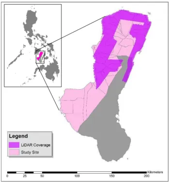
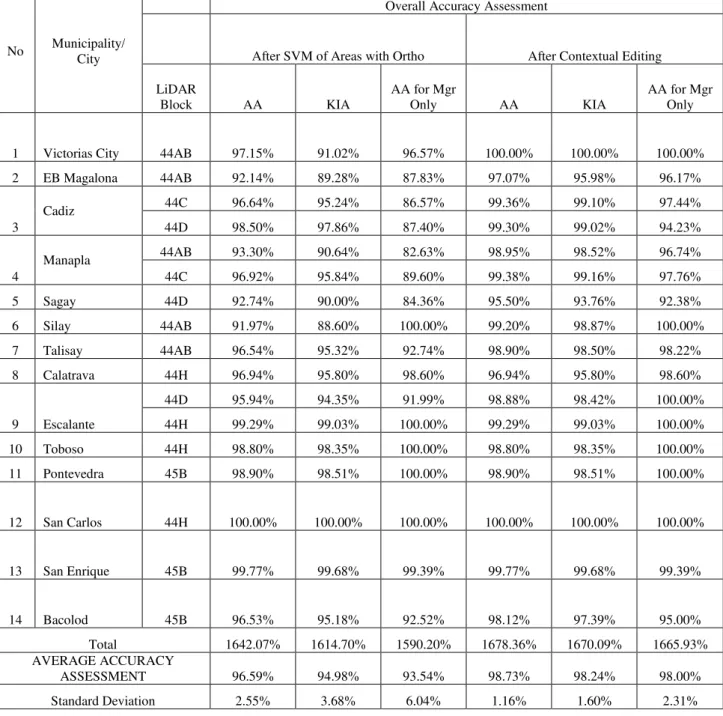
MANGROVE FOREST COVER EXTRACTION OF THE COASTAL AREAS OF NEGROS OCCIDENTAL, WESTERN VISAYAS, PHILIPPINES USING LIDAR DATA
Texto
Imagem

Documentos relacionados
Porém, ao entendermos a fotografia como símbolo, ou seja, como forma não apenas de apontar a realidade, mas também de conferir a ela novos significados e interpretações, vemos que
The São Francisco River has a progressive transition of ecosystems from downstream to upstream, with mangrove along the sand coastal plain “restinga,” Atlantic rain forest,
While developing the zoning plan for the Biosphere Reserve of the Atlantic Coastal Forest – RBMA, state and federal conservation areas already established within the cocoa region
Average share percentage of soil fauna community groups in forest plantations, used for recovery of areas degraded by gravel extraction, in areas with addition
Não se observaram diferenças estatisticamente significativas na percentagem de inibição induzida pelas MSCs na frequência de células NK a produzir TNFα ou IFNγ, bem como,
a) Preservation of mangrove forest as a strategy of future action plan to mitigate climate hazard near the shore line in coastal region. b) More detailed assessment
Other impacts have occurred in areas surrounding Serra dos Carajás, mainly caused by removal of forest cover, including settlement areas of GETAT and land corresponding to
