263
César Machado Moreira
Centro de Estudos Arnaldo Araújo/ Universidade Lusíada de Famalicão/ Porto / Portugal
Abstract
During the 20th century, the production of electricity by hydroelectric methods brought about dramatic modifications in the Portuguese landscape. This paper looks at the work produced by architect Januário Godinho between 1945 and 1964 for the Cávado Hydroelectric Company (HICA), and his design on different levels for the hydroelectric complex on the Cávado River, located in the inland region of Trás-os-Montes in the north of Portugal.
HICA and the architecture of Januário Godinho addresses the relationship between technological development and structural conception, and the use of design on a large-scale landscape to overcome the limits of 'modern architecture'. The disproportionate nexus of scale between the operation itself, the obsession of the Portuguese political body and the ethnographic interests of the intellectuals created a clash that may bring about a new understanding of the facts when looked at in relation to the debate on contemporary planning.
Located at a great distance from major cities, very difficult to get to and with very few, if any, resources available, the structures built by HICA necessitated the creation of a series of small, brand-new urban settlements. New settings were designed, which fell somewhere between the two apparently opposed worlds of the village and the hydroelectric power station. Places with economic, social and cultural dimensions such as houses, schools, churches and other social areas coexisted with workplaces, dams, hydroelectric power stations and control centres. The mixed nature of these activities, which were superimposed on the previously existing low-income agricultural structure, created original landscapes as well as an alternative approach to understanding Portuguese post-war architecture.
The methods used to produce this landscape of infrastructure were plain: political will supported by technical knowledge, resulting in the creation of a layout in which a cultural approach would inform the design. But if we are asking two apparently neutral questions, a third very simple one also emerges. What did the landscape of Cávado look like before the construction process began? How did the technicians and architects bring about its transformation? If we take a look at the architectural production that emerged there, the answer does not seem clear. The question, then, is: what were the models used in the production of this landscape? Can they be found in the midst of the post-war architectural debate?
264
“It is not enough to copy and combine elements brought from here and there, fitting the description of whoever you like, in order to try to create architecture.”1
Introduction
In 1944, law number 2002 on the electrification of the country, conceived by Ferreira Dias (1900-1966), established the framework for the production, transport and distribution of electricity in Portugal. In July 1945 the government announced its policy on large hydroelectric projects, and created the entities needed - the Zêzere Hydroelectric Company (Hidroeléctrica do Zêzere - HEZ) and the Cávado Hydroelectric Company (Hidroeléctrica do Cávado - HICA) - to embark on the ambitious programme of electrification of the country.
This operation, given Portugal's past experience with hydroelectricity, represented a substantial leap in both quantitative and qualitative terms relative to size and complexity of the projects, requiring a depth of knowledge and availability of means hitherto unseen in a Portuguese context. (LUCENA, 2004) Although having scant prior experience in this field, the companies advanced immediately on the construction of large dams on Portugal's major rivers. This process, which was not uneventful, came to be a part of the history of modern architecture in Portugal.
HICA was created for the purpose of bringing to fruition the hydroelectric development of the Cávado-Rabagão basin system2
1 LINO, Raul, A nossa casa, Apontamentos sobre o bom gôsto na construção das casas simples
[our house, notes on good taste in the construction of basic houses], Atlântida, 2ºedição, p.75
, considered to be the second
2 The Cávado is one of four rivers whose course lies entirely in Portugal, with its source in the
Larouco mountain at an altitude of 1527 metres, and running in a north-easterly/south-easterly direction for 129 Km before finally emptying into the Atlantic Ocean at Esposende. Its hydrographic basin covers an area of 1589 Km2 and is bordered by the mountains of Larouco, Gerês, Barrosos and Cabreira.
265 largest hydrographic basin for the potential production of energy in Portugal.3
The high rainfall registered in the mountainous part of the course of the Cávado allowed for the construction, on this river and its tributaries, of one of the largest groups of dams in the country, with HICA planning and building five dams at: Venda Nova (1951), Salamonde (1953), Caniçada (1955), Paradela (1958) and Alto Rabagão (1964).
Its dams and power stations, spread throughout the valleys of the Cávado river and its tributaries, were located in the Province of Entre-Douro-e-Minho in the North-West of Portugal, in the geographical region of the North Atlantic (RIBEIRO, 1991, p.145). This region is characterized by the rugged peaks and flat summits of the Peneda, Soajo, Amarela and Gerês mountain ranges, its fracture valleys and young slopes being home to the sources of the rivers Minho, Lima, Cávado, Homem and Ave (BRITO, 1994, P.49).
The locations chosen for the construction of these dams, far from the principal urban centres, were not, however, completely uninhabited. Despite difficulties of climate and topography, the region was marked throughout by a strong human presence, a fact confirmed by several studies carried out at the time.
The essentially mountainous location, and the way of life that characterized the economic reality and social life of the resident communities (OLIVEIRA, GALHANO, 1992, p.130), led to an economic system based on two main activities: cattle-grazing and agriculture. During the first half of the 20th century those activities, which determined the type of settlements that existed in the interior of the country, were the subject of a number of studies. Working with materials that were distinct from each other, the groups of geographers, ethnologists, engineers and architects each pursued a similar objective: a study of the culture of inland Portugal, its people and its traditional buildings. With similar methods of compiling the data that was to be used to describe and interpret the material collected, these different groups were able to construct landscapes that could be described, inhabited, analysed and given form.
Between 1938 and 1939, geographer Orlando Ribeiro (1911-1997) published his Survey of Regional Geography (Inquérito de Geografia Regional 1938) and
3 The hydrographic basin of the Douro river is the largest, but dependence on Spain caused
construction at this site to be delayed, with the state first opting to proceed with developments on the rivers Cávado and Zêzere.
266
Survey of Rural Habitats (Inquérito do Habitat Rural 1939). Between 1942 and 1947 it was the turn of the agricultural scientists to publish their Survey on Rural Housing (Inquérito à Habitação Rural)4. Between the 1940s and 1960s several articles were published in specialist journals on the work of anthropologist Ernesto Veiga de Oliveira (1910-1990) who worked with ethnographer Fernando Galhano (1904-1995)5
Reading these documents confirms “...the renewed interest in local traditions that lay behind the enthusiasm with which [the studies] were carried out...” (COSTA, 1980, p.23) and permits understanding of the practices used by the different teams in the collection and recording of information. These 4 examples represent different ways of looking at the land, the interest in rural settlement, the attention paid to poverty, and to the modern features and productive role of popular architecture, translating into the different viewpoints that inform those distinct ways of seeing the landscape.
and, in 1961, it was the turn of the architects, with their publication of a Survey on Portuguese Regional Architecture (Inquérito à Arquitectura Regional Portuguesa).
These studies allow us to see that up to the 1950s when the dams began to be constructed, the landscape had remained virtually unaltered (RIBEIRO, 1995, p.294) with the resident populations and their rural lifestyles being the main protagonists in the long and subtle process of the construction of those landscapes (DOMINGUES, 2001, p, 59).
For the construction of the dams and all the associated infrastructure, HICA had to find skilled personnel wherever it could, bringing them to the construction sites and, later, to the power stations. This need for personnel resulted in the
4 Two volumes were published. At the end of the 1940s, the publication of the third volume of the
Survey on Rural Housing carried out by the agricultural scientists was stopped by the Estado Novo, due to its overly negative view of the conditions of rural housing. This third volume was published in 2013 by the Universidade técnica de Lisboa, Inquérito à habitação rural, Lisboa, UTL, 2013
5 During this period, many studies carried out by anthropologists were published sporadically in
different specialist magazines. It is only in more recent times that these have been compiled for publication. Such is the case with the work carried out by Ernesto Veiga de Oliveira and Fernando Galhano, “Construções Primitivas em Portugal" [primitive constructions in Portugal], Lisboa, Dom Quixote, 1988 and “Arquitectura Tradicional Portuguesa” [traditional Portuguese architecture], Lisboa, Dom Quixote, 1992. Two important studies on the North of Portugal, directed by Jorge Dias (1907-1973), were published in those years, “Vilarinho das Furnas, Uma aldeia comunitária" [Vilarinho das Furnas, a community village], 1948 and Rio de Onor, Comunitarismo agro-pastoril [Rio de Onor, agro-pastoral communitarianism], 1953.
267 movement, sometimes over long distances, of large numbers of workers of all levels who had to take sudden leave of their homelands, leaving behind their families, friends and interests. “These workers found themselves, all of a sudden, in the middle of unknown terrain, where everything was new to them: the work itself, a waterway that was uninhabited, the habits and traditions of a region, even the language itself...”6 Adaptation to a new reality was made worse by the diverse nature of the personnel involved, from upper-management staff, with their university and higher-level studies who were employed to work in the power stations, to the most humble of unskilled workers, who had only the most basic levels of education and were very often illiterate, who lived and worked on the construction sites. The former consisted of a smaller group of personnel with permanent positions, in locations where the quantity of unskilled labour was small. On the construction sites however the number of workers was much larger, and they were mostly working on fixed-term contracts for a variety of different employers. In this group, levels of unskilled or low-level skills were high. The placement of these workers in far-away locations which did not have suitable living conditions meant that different types of accommodation had to be built. During the time that construction work was under way, the workers lived in pre-fabricated huts next to the construction sites. For the employees at the power stations, the company, in line with the social model in use at the time by many large industries, called on professionals – architects – to design the settlements that would act as living quarters and small urban centres.7
When it came to the planning and design of the buildings for the settlements of Venda Nova, Salamonde and Caniçada, HICA worked with outside architect Januário Godinho. The final settlement, in Pisões, Alto Rabagão, was designed by the company's staff architects, with the majority of projects being attributed Located next to the power stations, these centres reconfigured a larger industrial landscape in which their presence is seen as being equally relevant and as important as the power stations and the dams.
6 Minutes from the debate held by Hica in 1957 “Problemas sociais inerentes a uma grande
empresa hidroeléctrica” [social problems inherent to a large hydroelectric company] ATVN. p.(2.6) 6
7 See also on this subject: Deolinda Folgado, O lugar da industria no território, in A arquitectura da
industria [the architecture of industry], 1925-1965, Registo Docomomo Ibérico, Barcelona, Actar, 2006, pp.80-90
268
to João Castelo Branco.8
To house the personnel who would be in charge of running the Vila Nova power station, HICA built, next to the power station, a small group of houses, a Pousada - hostel and some supporting buildings.
The Pousada of Pisões, the only building of the group designed by Januário Godinho, was the last building that this architect designed for HICA.
The settlement was placed on a hillside on the left side of the Cávado river, around 800m from the power station building, facing the future reservoir of the Salamonde dam, the second to be created by HICA. In January, Januário Godinho presented “... detailed plans for the houses to be built in the settlement attached to the power station, with the Board having definitively chosen the types of houses for managers and workers... “9
In Salamonde, with the experience gained from work on Venda Nova, HICA was already aware of the need for creating accommodation at the site of the next dam for technicians and workers to live in while construction work was taking place on the dam and related projects. By planning for these to be definitive structures, HICA could later use them to house the employees who would be running the power station.
Once the locations of the dam and power station were finalized, HICA engineers decided on the siting of the dwellings, choosing the south bank of the Cávado river, upstream from the dam on a south-west facing hillside, which would be reached by the new access road built for the dam. In contrast to what had happened relative to the settlement of Venda Nova, which had involved a lot of indecision and a variety of locations discussed for the building work, in Salamonde, “...the need to locate the installations close to the work and to provide the appropriate exposure, dictated the choice of location and the boundaries of the area to be occupied.”10
The proposal highlighted three main objectives: the location of the buildings at higher elevations, non-interference with the sparse vegetation that existed, and the choice of views to the south and west rather than towards the future
8 In Paradela however, there was no need to build a settlement, given that the water of the dam
at that level went to the power station at Venda Nova where it then entered the turbine.
9 Minutes no. 182, of 19 January 1949, AHME, ARCAHICA. p.2
10 Project brief, installations for the dam at Salamonde, signed by the chief engineer of the civil
269 reservoir which would mean that the houses would have to be turned to face north.
In the plans that Godinho drew up, the houses - 10 in total - were split into two groups adapted to the slope of the terrain. The detached buildings rise out of the terrain in order to make best use of the landscape, their main façades facing south/west, to take in views of the valley. Lower down, the other façades nestle into the hillside or rest on granite walls, a solution identical to the one found for the houses in the settlement of the Venda Nova power station. The main road, which goes around the settlement, terminates at the hostel building, and from it radiate a number of short paths providing access to the houses. Clearly separate from the main road, the houses have a special positioning in relation to the new topography and exposure to the sun.
The process of building the Caniçada dam turned out to be very similar to that of Salamonde. The type of dam that was chosen, the subterranean nature of the power station and the proximity between the different sections were all points that were adopted in the same way for Caniçada.
The engineers decided that the site should be very close to the dam and that it should occupy as small an area as possible11
Following similar lines to the work already carried out, the general building plans envisioned for the same site not only the definitive buildings, but also those that were temporary and could be taken down.
, indicating as a suitable location the land next to the EN 308 road, downstream from the reservoir, on the south-facing hillside.
The proximity of the buildings destined for accommodation to the towns of Gerês and Amares meant that in this case fewer houses were planned when compared to previous levels of the hydroelectric system, and that there would also be no need for a Pousada.12
11 The high value of the land next to the dam at Caniçada made for difficult negotiations with the
locals who lived in the villages that would be affected by the construction of that section of the hydroelectric system. The expropriation of land needed for the section at Caniçada was, due to the size and the quality of the land to be purchased, a problem that would force HICA to spend a much greater sum of money for the same purpose than had been previously spent at the other sites.
As these nearby locations were served by schools and chapels, these were not included in the plans made by HICA for the settlement
270
at Caniçada, which was thereby reduced to a small collection of houses that was spread along the main road.
Figure 1. Terraced houses belonging to the 1st phase constructed at the Vila Nova settlement, 1951 – Photography Alvão, Archive da EDP, Porto
The types of house chosen for permanent housing in the settlement were versions of type B and C houses designed 2 years previously for the settlement at Vila Nova. The solutions found for their interior areas are practically identical to those of the houses at Vila Nova, with differences being visible only in the relationships that the houses established with the landscape.
In line with the times, the houses were positioned in accordance with a social hierarchy defined by HICA, with the first group of houses, located in the quietest area and having the best road access, aimed at those of a managerial level. The materials and the language used were the same as those used in the workers housing settlements at Salamonde and Vila Nova: tiled, gabled roofs, plastered walls, visible granite basements, and window frames and blinds in wood.
Construction work on the 5th level of the hydroelectric system was the largest project that HICA carried out. At one point during construction, the site at Alto Rabagão had over 4,000 people at work, who together with their families led to a total resident population of over 12,000.13
13 Report, Balance Sheet and Opinion of the Supervisory Board. HICA S.A.R.L. Financial year
nineteen, 1964. AHME. p.15
271 In 1958, the first general plans were made for the installations that were to become part of the large construction site, which took the name of the nearest location, Pisões. With the experience obtained on previous levels of the hydroelectric system, and the large number of workers expected for the construction site, the installations were divided into two types.
Some were temporary, for use during construction, and others, more permanent, would be used during construction and would then make up the definitive settlement for the workers who would be operating the hydroelectric power station.
The general plans for the two groups of buildings were finished between May and July 1958. The temporary buildings were decided on first, to be located on a hillside on the right-hand-side of the river next to the dam and the power station, close to Km 117 of national road E.N.103, between Braga and Chaves, near Pisões.14
As well as planning for different types of dwelling and dormitories, a host of provisional supporting services were also included, such as schools, a hospital, a social centre, a cinema, a chapel and a shopping area.
Permanent buildings were decided on during a second stage, to be located on the same hillside, in an area that was higher and flatter.
15
The plans for the settlement at Pisões followed a similar pattern to the previous ones. Located on a hillside sloping downwards N-S towards the reservoir and the dam, it included a series of detached and terraced houses as well as a group of facilities, in an area of over 8 hectares.
As had already happened previously on construction sites at previous levels, several of those installations, which were prefabricated, were transferred from the site at Paradela once construction work at that location had come to an end.
At the end of 1958, as well as the settlement built for the future permanent staff of the power station, containing 40 detached houses, there were also 349
14 The parish of Vila da Ponte in the municipality of Montalegre.
15 The general plans for accommodation and installations of 09/05/1958 stated: 1 Dormitory for
higher-level personnel, 1 Dormitory for managers, 1 B1 House, 3 B Houses, 1 Bc House, 10 C Houses, 3 Cc Houses, 1 I House, 6 E Houses, 6 Ec Houses, 4 Rows of 4 D Houses, 8 Rows of of 2 L houses, 1 Row of 2 Lc houses, 1 L’ house, 1 School with two adjoining rooms, 1 Porch – Garage, 1 Dormitory for auxiliary staff, 2 Dormitories for specialist staff, 2 Shower blocks, 75 Rows of 4 houses for workers, 1 Public washing tank, 1 School with 2 rooms and a canteen, 1 Dormitory for 40 workers, 1 Dormitory for 80 workers, 1 Kitchen with oven – refectory, 1 General kitchen – refectory, 1 Cooperative, 1 Covered porch area, for commerce, 1 National Guard post, 1 Social Centre for workers, 1 Hospital, 1 General Office, 1 Laboratory, 1 Warehouse.
272
houses and 29 dormitories being built, with a total capacity to deal with around 1400 workers and salaried staff.16 They also built a chapel, schools, recreation centres, refectories, canteens, a market, shower blocks and a permanent medical centre.
The construction of dams and infrastructure for the transportation of energy, firmly founded within a modern culture, determined the large-scale transformation of place in a process of appropriation of the existing landscape. The terrain taken over by HICA led to the transformation of nature by the collective (COSGROVE'S, 1984), establishing places in which the vision was guided by the new representations of space, as well as by new practice and local usage.
The settlements created by HICA were notable for their social programmes, developed in accordance with hierarchical levels. When the design of the settlements was being developed, no thought at all was given to the relationship between the new inhabitants and the existing populations. Those villages next to the dams which had not been submerged by the reservoirs rarely received any sort of benefit as a result of their proximity to these constructions. Ancestral habits, skills and lifestyles had nothing whatsoever to do with the modern settlements that HICA built for its workers.
A dichotomy that was also reflected in the architecture itself. In all the settlements, the groups of houses were laid out so as to adapt themselves to the terrain, with optimum conditions relative to sun exposure and direction which the houses faced being taken into consideration. An integration into the landscape that was often the result of the movement of large quantities of earth in order to transform the very steep hillsides into terraces against which the houses could lean.
The types of houses built, closely linked to the type of settlement, were not very varied, being designed to meet the specific needs of their inhabitants. Each settlement consisted of two or three types of house, with one or two floors, with variations mostly in relation to number of bedrooms and in the relationship
16 Report, Balance Sheet and Opinion of the Supervisory Board. HICA S.A.R.L. Financial year
273 between the social areas of the house: individual for houses aimed at managers, and shared for the remaining employees. The centre of the settlements were generally devoted to supporting infrastructure: The 'Centre for happiness at work', the chapel, the market and the Pousada.
In all the settlements “...there was a series of buildings that demonstrated a relationship of analogous form and function...” (ARGAN, 2008 [1963]: 269) The houses designed by Januário Godinho followed rules that defined a model which, with few alterations, was used for all the different inhabitants and different settlements. The types of houses chosen for Vila Nova were, with only minor alterations, used in Salamonde and in Caniçada. In Pisões, despite the fact that plans were drawn up by a different architect, the adoption of those same solutions can be clearly seen.
Receptive to the idea of uniformity in the built environment, Januário Godinho worked with the materials he had, taking as a foundation the relationship between financial constraints and natural possibilities.
The buildings that were constructed do not bear any resemblance to the rudimentary buildings that existed in the surrounding villages. Stonework, in granite or schist depending on the locations, and thatched roofs, common in that area, are very distant from the systems of construction used in the new settlements, which were motivated by economics and the need for dwellings that could be easily reproduced. Concrete posts and beams, voided concrete slabs, walls in brick or granite - when it was necessary to raise the basements of the buildings - and tiled roofs resting on wooden structures. The technology and construction processes used to build the power stations and dams were used purposefully, though on a more subtle level, in the building of the settlements.
274
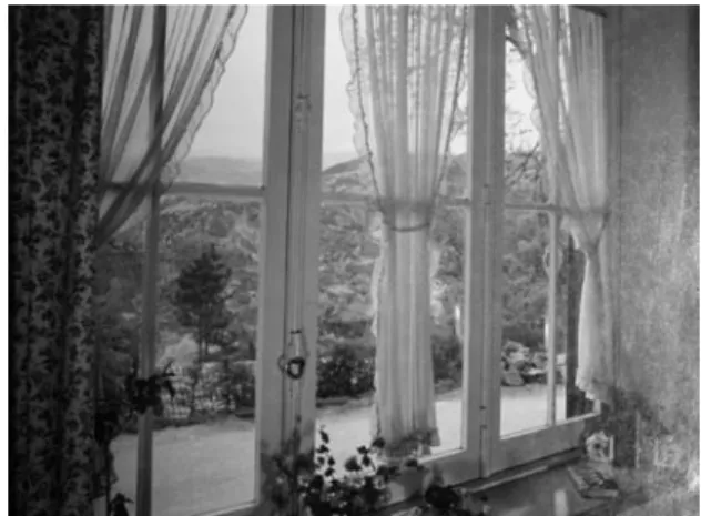
Figure 2. Interior of a house in the settlement of Vila Nova, April 1952 – Photography Alvão, Archive da EDP, Porto.
The architecture of the HICA settlements is not “...merely a question relative to the use of the materials most available locally, or of copying any simple form of construction used, for want of anything better, by our ancestors of the last one or two centuries. Its regional forms are those that are best suited to real-life conditions and which reveal themselves to be the most successful at allowing people to feel at home and in their own environment: not limiting itself to merely using the resources of the soil, it reflects, more than anything, cultural conditions...” (MUNFORD, 1941: p.23)
The settlements of Venda Nova, Salamonde and Caniçada, designed by Godinho display “...his feeling for place and access to a healthy belief in the value of experience which is seen in the choice of materials, the inflections and outlines of the spaces, in the relationships of spaces to landscape” (PORTAS, 1987:136). Where before there was wasteland, hills and mountains, came houses, facilities and roads, all to accommodate the new communities who had come from so far to be there. It was in this context that Januário Godinho worked. His architecture did not seek to mimic pre-existing construction, instead, everything was new. There was no intention of placing the new settlements within the framework of the other villages, their locations were chosen for reasons of function and operability, and this also had to apply to the different dwellings and facilities which made up the settlements. The quality of the architecture that Januário Godinho provided for HICA can be found in the way in which he etched
275 the images of an architecture, which he wrote into the existing landscape and which is not rural and was never intended to be so, onto the collective imagination.
Acknowledgements
This work was carried out at CEAA | Centro de Estudos Arnaldo Araújo at ESAP, and was financed by the Portuguese government via the FCT – the Portuguese national funding agency for science, research and technology, as part of the PEst-OE/EAT/UI4041/2014 strategic project.
References
ARGAN, Giuliu Carlo, Sobre a tipologia em arquitectura in Uma nova agenda para a arquitectura, org. Kate Nisbett, Cosac naify, 2008 [On the tipology of arcjitecture, publicado em Architectural Design n.33, Dez.1963, pp.564-565.]
BRITO, Raquel Soeiro de, Dir. “Portugal perfil geográfico”, Editorial Estampa, Lisboa, 1994, P.49
BISSON, Marie-France, Vernaculaire Moderne? Vers une comprehension de la notion d’architecture vernaculaire et de ses liens avec la modernité archtectural. Montreal, Université du Québec à Montreal, 2007
COSGROVE'S, Denis E., Social Formation and Symbolic landscape, New Jersey, Barnes and Noble Books, 1984
COSTA, Alexandre Alves, Dissertação para o concurso de habilitação para obtenção do título de professor agregado (1980), Porto, Edições do curso de Arquitectura da ESBAP, 1982, p.23
DOMINGUES, Álvaro, A Paisagem Revisitada, Revista Finisterra, Vol.XXXVI, Nº72, Centro de Estudos Etnográficos, Lisboa, 2001, p.59
FERREIRA, Luís Lucena, "A produção de electricidade na segunda metade do século XX e a engenharia nacional”, in Engenharia em Portugal no Século XX, Coord. J. M. Brandão de Brito, Manuel Heitor e Maria Fernanda Rollo, Publicações Dom Quixote, Lisboa, 2004 JACINTO, Rui Candeias, As barragens em Portugal: de finais de oitocentos ao limiar do século XX in Momentos de inovação e engenharia em Portugal no século XX, Lisboa, Centro de estudos em inovação, tecnologia e políticas de desenvolvimento do Instituo Superior Técnico - Dom Quixote, 2004
KAGAN, Jerome, The Three Cultures: Natural Sciences, Social Sciences, and the Humanities in the 21st Century, Cambridge University Press, New York, 2009
LEAL, João, Etnografias Portuguesas (1870 – 1970): Cultura Popular e Identidade Nacional, Publicações Dom Quixote, Lisboa, 2000
MUNFORD, Lewis, The South in Architecture, New York, Harcout, Brace & Company, 1941, p.32
OLIVEIRA, Ernesto Veiga de, e GALHANO, Fernando, Arquitectura tradicional portuguesa, Publicações D. Quixote, Lisboa, 2003, 5ºedição (1ºedição 1992)
276
PORTAS, Nuno, Januário Godinho – 1910, in Catalogo da exposição, Arquitectura, Pintura, Escultura, Desenho, integrada nas comemorações do 75º aniversário da UP, Porto, Universidade do Porto, 1987
RIBEIRO, Orlando, Portugal, o Mediterrâneo e o Atlântico, Lisboa, Livraria Sá da Costa, 6ºedição, Lisboa,1991 (1ºedição 1947)
RIBEIRO, Orlando, Opúsculos Geográficos – VI volume – Estudos Regionais, Fundação Calouste Gulbenkian, Lisboa, 1995
TOSTÕES, Ana, Em direccção a uma estética industrial: Zeitwill ou vontade de modernidade in DOCOMOMO, A arquitectura da indústria – 1925 – 1965, Barcelona, Actar, 2000
César Machado Moreira. Since 2010, studying on the PhD programme in Architecture at the Faculty of Architecture, University of Porto on an FCT research grant: SFRH/BD/72332/2010. Masters from the Universidade Lusíada de Famalicão - 2009. Masters at the Escuela Superior Técnica d’Arquitectura de Barcelona - 2000. Graduated in 1998 from the Universidade Lusíada do Porto. Lecturer at the Universidade Lusíada since 2001. Senior Researcher at the Centro de Estudos Arnaldo Araújo (CEAA). Has worked as an architect since 2002, with work published and shown at several national and international exhibitions.