1
ACKNOWLEDGEMENTS
To begin with, I have been studying for long time to reach and become a Landscape Architect. It has been a hard and pleasure way which has made me mature as a person and as a professional. I have met inspiring people during the way that taught me a lot and made this project possible; I would like to thank them:
Special thanks to all teachers which for many years, have given me their knowledge and patience. I am so grateful that they have aroused my interests and always supported me.
Special thanks go to Maria Kylin, my master project supervisor who has been a support and a guide from the beginning with patience and determination.
My deep gratitude to Professor Conceição Castro with who I spend many hours in her wonderful and pleasant lessons of vegetation, and that without her help, I don´t know how I could deal with the administrative troubles during my education abroad.
I also want to thank Inga-Lill Olsson from the Swedish University of Agricultural Science (SLU), the person how has helped me most during my studies in Sweden, who has been the kindest person from the beginning of my studies all the way through my project.
I would like to thank my friends from Otero de Herreros whom they have followed and listened of many conversations about my projects.
Many thanks to Alexandre Palinhas, my dear colleague and friend, for countless discussion, both supportive and helping; to Naran, for sharing my daily life and spending many stimulating discussions; to Osquitar and Fernan, old friends that they give me wise counsel. They deserve my appreciation and they inspire me; to Otto, Diego and Luis Canelo for always being a moral support and inspiration.
I would like to extend my genuine thanks to Arvidssons family who not only shared so generously everything with me, but also opened their arms to their family.
Finally, my deepest gratitude goes to my mother, father, sister and brother Nieves, Santiago, Eva and Mariano who brought me up to become who I am, with the highest support and infinite love. And, finally, my beloved Gry, the most precious of supporters.
2
RESUMO
Planeamento de Corredores Verdes e Land Art em Sjöbo, Suécia
Este projecto representa um processo teórico e prático de planeamento que integra uma rede de corredores verdes e possível localização para a instalação de obras de Land Art. O projecto obedece a uma escala Municipal. O principal objetivo é realizar um plano baseado na síntese das características do território e do caráter do lugar, tratando os dados através de um sistema de informação geográfica.
O caso de estudo localiza-se no município de Sjöbo, Suécia. A Câmara Municipal está interessada no crescimento do turismo da região, tendo em vista o desenvolvimento do município. Este projecto procura ser parte de um turismo ecológico e sustentável aplicando a combinação perfeita de Corredores Verdes e Land Art.
3
ABSTRACT
Greenways Planning and Land Art in Sjöbo, Sweden
This project presents a theoretical and a practical process of planning integration of a greenway network and a possible location for land art works of a municipality level in Sweden. The main aim is to reach a plan which is made following the characteristic of the territory, the character of the places and sites as prerequisites analysed by a geographic information system.
The case study is done in Sjöbo Municipality. The Municipality is trying to improve the touristic attraction, indeed, help to achieve a better development. This project is a perfect combination to be part of an ecological and sustainable tourism development.
4
CONTENS
ACKNOWLEDGEMENTS ... 1 RESUMO ... 2 ABSTRACT ... 3 INTRODUCTION ... 6 1. INTRODUCTION ... 6 Background ... 6Main aim and objectives ... 8
Issues and questions ... 9
Limitations (constraints in the process) ... 9
Reach to a proposal ... 9 2. METHODOLOGY ... 10 THEORETICAL PART ... 10 PRACTICAL PART ... 11 Working process ... 13 Techniques ... 14
Examples of inspiration and guidance ... 14
Reflections ... 15
BACKGROUND ... 16
3.THEORETICAL AND CONCEPTUAL COMPLEMENTS ... 16
4.GREENWAYSINLANDSCAPEPLANNING ... 19
Introduction ... 19
What is a greenway? ... 19
Why we should create greenways? ... 21
Brief history of the greenways ... 23
Theory of “Continuum Naturale” from Francisco Caldeira Cabral ... 24
Values of greenways ... 25
Types of greenways ... 26
Greenway`s functions ... 27
Creating a comprehensive greenway network ... 30
Balancing between recreation and conservation: Impacts and planning strategies ... 31
Examples guidance ... 34
5.LANDARTINLANDSCAPEPLANNING ... 35
Introduction ... 35
The beginning of a new dialogue with the nature ... 35
Aesthetic value ... 36
5
Relation Land Art- Site ... 38
Identity of the local linkage: Place ... 38
Land Art in the process of planning ... 39
Example projects ... 41
Reflections ... 45
6.GUIDELINES ... 46
PROPOSAL/ CASE STUDY... 47
7.APPROACHOFAPOPOSAL ... 47
8.SJÖBO ... 48
Regional location ... 48
Territorial location ... 49
Socio-economic context ... 49
Historical and cultural context ... 50
Characterization of the landscape in Sjöbo ... 50
Guidelines ... 54
10.HOTSPOTS ... 55
Selection process ... 55
Reflection ... 58
11.GREENWAYNETWORK ... 59
Why integrate greenway planning in Sjöbo? ... 59
Making a greenway network ... 60
Process of selection: assumptions, requisites and alternatives ... 60
Process of selection: Balance of the alternatives... 65
12.LANDART ... 68
Characteristics of the Land Art project: ideas and assumptions ... 69
Selection of the areas: requisites ... 70
Process of selection ... 70 Reflections ... 73 13.DISCUSSION ... 74 14.CONCLUSION ... 76 15.REFERENCES ... 78 Books ... 78 Papers ... 79
Websides and Internet Documents: ... 81
Others resources ... 81
6
INTRODUCTION
1.INTRODUCTION
The integration of a greenways network and a plan for Land Art in a territory requires following a methodology adapted of its environment. The biotic and not biotic resources, management policies and the use of the land establish a series of prerequisites at time to changes and modify the uses of the landscape. Despite the fact that there are other social and economic features that mark well-defined objectives, there is also an aesthetical character of the landscape and an ethical character in planners which steers a creative and moral awareness applied in landscape planning.
Thereby this project has been developed in order to get a clear understanding how to plan a method which gets a good proposal of the two spoken topics for a determined territory.
Background
Big threats have undergone the sustainability of territories and landscape. Effects on the landscape such as the fragmentation, homogenization, the densification of the cities and the abandonment of the countryside, have involved serious consequences to the terms of sustainability for the territories. The European landscapes have been affected with impacts like the lost of the traditional patterns and the lost of biodiversity.
New changes must succeed in the political and the current social culture to avoid serious negative consequences for the environment due by the aggressive use of the landscape. To supply the massive consumerism it has been done radical structuring for the use of the land. Thus, for example, big extensions of fields have been planted with same species to get the best profitability of the production. That have created homogeneity of the forest and agricultural fields and it has a very strong impacts for the biodiversity and the natural environment. There are several negative situations that can be noted: uncontrolled fire-forest loss of biodiversity in plants and animals, plagues and diseases, change in traditional sustainable uses of the land and alterations of its patterns are some of the several problems that are being experienced. This was just some of the changes because in the same way the urban densification is causing a high pressure on the territory against the biological, cultural and historical values. (Hellmund & Smith, 1993).
Not everything with human activity could be seen as something wrong. Treatments, laws and strategies are the new instruments using, from the global until the local scale, to help in the management of the resources in a sustainable direction. At the global scale, since the Conference of the United Nations about Environment and Development that it was celebrated in 1992 in Rio de Janeiro, 27 principles was indicated. These principles establish several requisites to reconcile the demands of the human
7 development with the environmental protection. After that, it has been done instruments of environmental legislation to regulate the human’s environmental activities. Further it has appeared methods and processes towards a sustainable development to foment the biodiversity and help in the protection of the natural heritage. As an example, it has been appealed to demarcate areas to the conservation. And in the same way, appeared strategies which help to the genetic interchange of populations. In that way, the corridors have become the elements which connected the isolated areas.
Meanwhile, it increased the awareness and the concern of human health. Then, the importance of the green areas in the urban structure became important as well as proximity of the nature. The search for a healthier environment out of the air pollution, the high levels of noise and the pressure of the density of population, has required taken the nature as a way to escape (Bechtel, R & Churchman, A. 2002). Sports in the nature and outdoor activities began to attract people in an exponential grade due to the physical, psychological and social rewards that are achieved. The nature is a source of emotions and feelings for the leisure which transmits pleasure appreciation and encourages experiences. Those experiences have been corroborated physiologically that it causes good mood. (Bechtel, R & Churchman, A. 2002)
The emotional quality of the countryside, forests and beautiful landscapes expresses perceptual and spiritual sensations that everybody can perceive, and its interpretation is defined as the poetry of the landscape (Sanchez de Muniain, 1949). But poetry is also the sensations of the cultural landscape which after years of work, changes and marks on the land are involved in the essence of the places. Likewise, talking about the aesthetical emotions, it provides attraction by the beauty that can be found onto the intrinsic features in the nature. It was and it is idealized by humans, and it was referenced by Tomas D´Aquino, who defined the beauty as something which is a pleasure for the view. The aesthetic of nature comes from Immanuel Kant as aesthetic experience. He argued that nature is more than Art and explain that it is involved in the idea of the beautiful and sublime as aesthetical experiences of nature. At the same time, in relation with the beauty character scenic of the nature, emerge the idea of the picturesque applied in famous pictures and English garden of the eighteen century. And everything has its influence on the current days in which the environmental aesthetic has an important relevance of the everyday life where the human aesthetic appreciation of environments goes together with the environmental and moral responsibilities to maintain ecological health (Carlson, 2010)
All this leads to new practical perspectives that they are able to correct and prevent of the current and future environmental problems without lost the view of the social development. Those perspectives must to be developed in plans and programs to regulate the intervention in the environment and to purpose of ensure a sustainable progress of the human activities. Greenways have become an instrument in landscape planning because it is able to achieve solutions by its multifunctional and
8 ambivalence between recreation and conservation. Thus, it is a framework to study and practice on the territory and that is the motive of this project.
Approaching the aesthetic environment toward human influence in the landscape, work with nature and on nature is a reason for use greenways as an aesthetical element of the nature. In the same direction but with other aims, land art, recognised as artistic experience, is developing in the contemporary cultural atmosphere. The close relationship that this kind of Art establishes with the nature, marks and emphasizes the epistemological consideration that the actual society has taking towards the nature. Far away of esoteric thoughts, in this project Land Art is understood as sculptures located in the landscape that have a great cultural value, that they are a part of the actual society, that they have an economical consideration and that they are part of the future cultural heritage. Thereby the aesthetic expression of the Art in extreme relation with nature will be source of emotional sensations with the aim to transmit feelings to the visitors.
Taking into account what has been discussed in the preceding lines, the municipality of Sjöbo is taken as a practical exercise. To do this project it has been developed a methodology for providing a plan that can respond to the requirements of the society which it could be received as a practical consideration to the Öreferie program. Program that is focused in bring new opportunities for a local tourism in Skåne and in Själland.
Main aim and objectives
The main aim is to reach a methodical process able to integrate land art and greenways plans as part of landscape planning procedure from a holistic point of view. That is reach using a geographic information system as a work tool.
To reach the main aim, two objectives have to be achieved. The first one is to develop a greenway network in the territory. To achieve that, it will be to analyse the physical environment and different factors which depends the integration of the network, establishing a list of requisites and use them to obtain the best alternative.
The second objective it will be suggest suitable locations to installed land art work. It arises as an idea to promote a natural outside art gallery in a large scale which foments attraction and mainspring for the regional and local tourism. For that, it will be study what characters the area has to hold to be selected as an implantation site.
The integration of these two objectives, in the base study case, leads to a implantation proposal which is also a object of this project.
9
Issues and questions
They were many questions that arise in the beginning of this project; others came during the process of searching; and many others appeared after the study case. The main question is: How can greenways and land art works be integrated into a process of landscape planning?
The issues and questions that have been formulated at time to start looking into the bibliography, arise from the greenway subject: What is a greenway? Which are the characteristics that a greenway has to have? Which criteria could be used to select a greenway? How can it create a network? How to choose the best optional network for a territory? And for the Land Art subject: Why can it be decided for a land art master plan? What are the possible problems that can be found in the process of making a plan, during the planning and after planning? What are the prerequisite that can constitute a good emplacement for land art works? How can the planer choose and finds the potential areas where to introduce artworks?
Limitations (constraints in the process)
Perhaps the most difficult have been to get a global view for the main problem that can come with the execution of this project. The use of the land, the individualism of the artists around the concept of their artworks and the difficulties of found a site where all the stakeholders are in agreement, they were a complex problem to resolve. In this case, other similar project and the consulting to planners, artist and stakeholders has been study to get an idea on how a consensual solution could be made.
In a practical way, it has been a lack of knowledge about Swedish culture, Swedish language and laws in force in Sweden, which, at the beginning of this project has caused some small inconveniences.
In a technical way, the disposition of the digital information required for a deeper and more detail study of the territory in the study case hasn´t been what It was expecting, but finally it was enough to get a satisfactory proposal and to reach the main aim.
Reach to a proposal
In the searching to achieve a proposal, the case study presented is a real situation in a municipality territory. Therefore the use of the consulted literature in the process of making the proposal is crucial and very useful to reach a good result. The result is a map in which selected possible areas to introduce land art works and the greenways network. To achieve that final map is followed a methodology in three steps has been followed and described in the next chapter.
10
2.METHODOLOGY
The methodology of the manufacture of this project is based on two fundamental parts, a theoretical study of the bibliography and a proposal or study case. To acquire the objectives a deep knowledge has been achieved in the two subjects: Land Art and greenways. It would lead to gain ideas, to obtain answers and even to create new questions.
THEORETICAL PART
The first part of the process within the project is the literature review. The theoretical part begins with studying articles and books in relation to Land Art and greenways. These two large concepts has been reduced or summarized in its components, in the way to get an easy and focused knowledge. The history of the concept, their types, characteristics and generalities, indeed, the basic knowledge of them, has been compressed with the objective to go on to the main aim of the project.
The literature about greenways has served to elaborate the method to follow in the study case. Planning with ecological and sustainable issues is part of the strategies of planning with greenways, so to focus the project was very useful the considerations about the environment and land use, thus as reflects about different study cases.
Otherwise, the topic about Land Art is very wide due all the different interpretations that there are around the concept. The thematic representation and conceptual views of the Land Art founded in the literature was useful just only to follow the subject on two directions: to a description and meanings of the land art works; and second, headed to a philosophic way.
Trying to find a theoretical base in relation with land art, which can give an easy understanding to the project, has been used the concepts nature, place, site and space. Both of them are briefly discussed from the author’s point of view because they are used during the writing of the planning project.
Very few cases about Land Art with relation about landscape planning were founded in Europe. It was study tree different projects already done which already have a great importance for the locality as for the international meaning.
The projects were studied because present similar characteristics which could help to achieve a procedure as a part of the landscape planning. It will be discussed and compared to conclude with practice knowledge in the process of making a new land art plan.
11 PRACTICAL PART
This part develops a study case in which was related with the theoretic and depicting a way how to introduce land art and greenways in landscape planning. Thereby, the objective of this study case is to get a proposal useful to be integrating in the Master Plan of the Municipality. A greenways network and selected areas where to put land artworks are located in a map as conditions. That conditions determinate which kind of intervention could be done and how should be done. To reach it, it has followed two working methodologies: the analytic and the synthetic method. The analytic is applied to know the components of the landscape to get an easier understanding. The synthetic is used to engage relations between components of the landscape to get a global view of the system.
The synthetic:
The synthetic method gathers information about the context and characteristics of the territory from several sources. It deals with the selection and crossing information to reach a holistic point of view of the territory. A geographic information system (GIS) is used as fundamental tool in landscape planning. That presents digital and cartographical data with the possibility of work with then in different layer over the territory.
This information is useful and essential in the process and selection of the alternative greenway network and the location of the land art areas. GIS reads the maps alter given criteria, then GIS processes the information and synthesizes the data, and it is able to get a previous network in the map. Likewise with the land art areas selected.
The analytical:
The analytical parametrical method consists in the interpretation in part of a data system. Maps, schemes and pictures are divided in themes or topics. The study of the thematic maps gives a simple understanding of the components of the landscape. It is essential to study the problems and opportunities of each part to get coherent proposals. Thus methods are used to select the thematic maps to use with GIS. The combination of the thematic maps and its formulation done by criteria is part of the scheme work.
12 The project reaches a proposal following three steps (Figure 1):
The first one is to locate hotspot, points which present several services and touristic elements to support and be attractive for tourists. The selection is done with GIS following a requisites set of selection.
The second step is to connect the hotspots with greenways. It decides to take three alternatives according with three thematic features. Each theme has different requisites of selection. To be able to make a decision it has been done a balance of the alternatives. The balance is done with a crossing data matrix between the features and four factors of implantation of the network. That crossing is done with a positive and negative subjective valuation depending how is affected. The valuation is made by holistic interpretation of the digital cartography and physical characteristics of the landscape, as well as an overview of the social and cultural features in the territory in study. To reach a value is counting the positive values in the matrix in base of the four factors for each alternative. Then the selected alternative will be which more positive values get.
The third step is to find the possible areas to place land art works. The process is done like in the point before. It is done by GIS using a set of requisites and in base of the greenway network alternative selected.
13
Working process
I.Study into literature, articles and others sources:
1.Reading articles and books about the main subjects: Land Art and Greenways; 2.Making a brief, and comments;
3.Contrasting similar sources;
4.Deal with the knowledge in the next parts of the process.
II.Characterization and evaluation of the territory: to reach a global knowledge about Sjöbo Municipality. (Pragmatic analysis):
1.Analysis of maps from the large scale to the detail; 2.Analysis of the conditions;
3.Localization of the interesting points. Definition of possible touristic routes.
III.Locating the hotspots
1.Definition of Hotspot;
2.Setting the touristic elements for types of tourism by GIS; 3.Select the requisites of selection;
4.Selection of the Hotspots.
IV.Greenways planning
1.Definition of the greenways; Greenways theory;
2.Scheme and structure of the data analysis procedure by GIS. Basic information to process by GIS;
3.Selection of greenways in base to three alternatives; 4.Analysis and balance of the different alternatives; 5.Selection of the best alternative.
V.Searching for the best areas to introduce Land Art works. 1.Definitions and concepts about Land Art;
2.Prerequisites to find possible areas to introduce land art works; 3.Searching the areas by GIS;
14
Techniques
The techniques used in the process of realization of the project are that landscape architects must manage to achieve a global and a detail approach of the work. Reading, sketching, taking photographs and mapping.
Reading the literature to take most possible knowledge about art, aesthetic in the environment, land art for the landscape architecture, greenway planning and tourism in the countryside. There is the background for the practical exercise. There will be a search, compilation and extraction of the ideas in articles and bibliography.
Sketching is the technique of the representation by hand drawing. It is quick and effective. It is easy to show the spatial characters of a place. It allows acquiring the physical presence of a point of view for the observer. Moreover, by the imagination it can draw a mental map of a place or to express individual ideas.
The photography is widely used to show a realistic aspect of the scene. It is a quicker technique to take the visual present of the elements from a focus further to be used to refresh the memory and not forget the essential characteristic in the office`s work. Currently it is very much used for the aesthetic analysis of the landscape.
Mapping carries an important part of the project. The collection of maps provides the overview of the territory. It is necessary to know exactly what the right information is to work with. The analysis of the cartography allows viewing for thematic the orography, the different types of vegetation, water sheds formed by the lines of streams and rivers, for example. It is also possible to know quantitative information as the altitude of the higher peaks. This information is made from digital maps by GIS. This system provides high crossing of information with associated data to all the elements and components of the maps. The use of this information allows generating a proposal.
Examples of inspiration and guidance
For one part, this project has been inspired by three projects about locate land artworks in large scale. All of them have a similar experience. They have the idea to create a set of land artworks using the territory (landscape) as a gallery. These three cases have occurred in Norway, Spain and Sweden. Those projects were promoted for the impulse to see art, art in the nature, in the landscape. Likewise was when in the 60´s began a revolution from the artists whom were guided for ecologist tendencies. Seeking for new models they went out of the galleries and used the landscape as a frame.
15 Albeit, the most significant fact seeking by the project are the relation of the work and the landscape where it has been made. The piece of art cannot be understood without its context, the landscape. There by, the three projects show how, from an idea, to become successful projects. They present a collection of works with identity and expression of the sense, encountered by the experience of the artists with the site. And not only that, but they has been successful for the tourism, the culture and the heritage. However, the projects present an input for the landscape which it is an interesting part to study further on.
On the other hand greenways examples and case studies discussed in the literature had been made in USA and in Europe. Those have given a holistic perspective in how to approach the greenways subject. In spite of that, Fábos Conference on Landscape and Greenway Planning 2010 has contributed to a new reflexion over the current cases. Those were more approximate to the case study in Sjöbo.
Reflections
The methodology of this project has followed a basic scheme following the standard of the final projects done in the Swedish University of Agricultural Sciences.
In the practical part, to reach and methodology of the project has depended of the case study. Every case has the same approximation to the physical, social and cultural characteristics of the territory (Ahern, 2002; Hellmund & Smith, 1993) an analysis of the landscape combine similar techniques, but the different is on the objectives of the project. In this project has got a structure done in the three steps. It has taken based on the main objective for Sjöbo Municipality in the Öreferie project. The process taken for this project could be generalized always that the objectives were the same.
Usually, landscape planning requires a deep knowledge of the sites and an interdisciplinary group work. But, in spite of that, the figure of a landscape architect combines the techniques and the knowledge to have a deep study of the individual characteristics of the landscape, to understand and to get a holistic perspective and reading of the landscape. Therefore it may be possible to reach a coherent proposal just by one person instead of an interdisciplinary group like it is suggested by Ahern (2002) and other authors (Ahern, 2002).
Indeed, in a process of planning the plan should have a public participation. That is missing and it is a important phase in planning due of the implications that would cause to the citizens. It should have done a public consultation trying to make a well done project (Walmsley, 2006).
16
BACKGROUND
The first part of the project treats to bear a deep base on which to stand a proposal. The reading of the literature left to contrast, define and clarify terms, notions and methodologies of work that guide the development of this project. Some of the first questions arising at the beginning of the project have been elucidated after the readings, some other have aroused after that.
The background has been divided in three parts. To start and to achieve an easy understanding, it has tried to be brief and concise in the definitions of the concepts and in the explanations of the contents. It is expected to help and give congruent to the scope of the planning.
The next two parts are a compendium of the literature has been read about the two subject objects of the project, Land Art and Greenways. The compendiums are a fundamental part of this project and work as a tool in the development of the case study.
3. THEORETICAL AND CONCEPTUAL COMPLEMENTS
Site
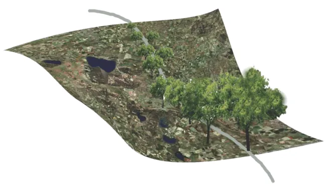
A site is a physical location, a surface or point in the land that can be exactly geographically referenced. But it also can be an act of the imagination making, or something constructed by the past of the time (Hogue 2004). To this occasion, site is also a location for an intervention, project or performance, and can be unfinished in perceptive and interpretative ways (Figure 2). Site will be understood as a geographical reference on the territory defined and with limits but it will be interpreted individually. It means that it was an area represented as structure on a map but it will be not experienced, and on the other hand, it will be constructed as an idea or perception in the experience of the visitors. Exemplify, in words of Martin Hogue: “Site is conceived not as a clearly delineated place, but as a structure for experience in the form of a process (to walk in a straight line) or map (to walk in the landscape the radius of a circle as drawn on a map)” (Hogue 2004).
Figure 2: Location of a site over aerial photo. (Image: Gabriel Sebastián)
17
Space
Space could be considerate as an area or volume that can be measured in height, depth and width. The perception of space is different for everyone as it depends on their culture and learning form past experiences. It is different and varies with cultural groups because abstract notions of space are formed by spatial experience that is defined by the presence of other people (Tuan, 1974).
Thus the personal perception of an individual, for example a geographer with a mathematical abstraction of space, could assimilate experiences of location and the human relationship with the physiographical environment. It would be difficult, however without prior training to absorb and understand the feelings and relationships that produce land art work, as the aesthetic content of the artwork itself and in relation with the environment in which it is situated. Otherwise, an artist will frame views of significant visual value that allows to make a representation with aesthetic value or, otherwise, artistic.
Place
Geographically place is a location, it is a simple and more uncertain definition that can be confounded with site or space. But place is a term that leads a more convinced designation thus it could say that it is a space with significance, that it has a meaning, a substance just perceived for the human being. To be more specific, agreeing with Yi-Fu Tuan (1974) there are three characteristics that give meaning to place:
Spirit, which is experienced in sacred places where a substance without form is perceived in a certain place;
Personality, which involves the human strokes and physical characteristics that make a place unique, i.e. in the Jerte Valley (Figure 2) the cultural cultivations of Prunus avium in terraces make the place unique. Personality has two aspects: Commands awe, when something is sublime and objective, both natural and artificial, directly influencing land in some artworks as Smithson have done with his artwork Spiral Jetty. It evokes nature and monumental art; on the other hand, there are places that evoke affections, where character is imparted by the person who experiences a place, yet in time it acquires a personality that is uniquely its own. Thereby, a place that has history with people takes on certain familiar aspects.
Figure 3: Valle del Jerte, Cáceres, Spain: (Photo: Gabriel Sebastián)
18 In a strong relation human and nature, it is presented the cultural landscape in Aranjuez, Spain. The image (Figure 4) is taken from the center of a big round-about. Since the XVIII century is a square with a big great geometrical expression (Figure 5). There converge twelve streets which were designed as part of the process of landscape planning 300 years ago. Currently, the function is the same and still has the sublime impact of the power of the twelve streets. Thus It is introduce the third character that Tuan defines is A sense of place, when a place takes on a spirit or personality that only human beings have A sense of place is perceived when humans apply their moral and aesthetic discernment to sites and locations. This character getting in the place is called Genius loci. “A place owns its character to the experiences it affords to those who spend time there- to the sights, sounds and indeed smells that constitute its specific ambience. “ (Ingold, 2000).
Landscape
The consideration of the term landscape in this project will be far of the simple visual perception and either the pictorial representation of scenery. Landscape is a complex and dynamic system, where different natural and cultural factors develop and interact in a set. This set is determinate for the global structure resulting of a particular physical and biotical configuration of the land to which mach up a determinate character. This character is consequential of ecological, cultural, sensorial and socio-economical dimensions (Candela D´Abreu, 2004). It is close of the interpretation from European Landscape Convention( Council of Europe, 2010) which establish a holistic view on how one perceives the landscape in the western culture, so "Landscape is defined as an area, as perceived by the people, whose character is the result of the action and interaction of natural and/or human factor” (Europe, 2000a, chap. 1, art. 1). Just like Olwig (2006) explained “Landscape is more than an area, it also expresses the perceptions of an area that people share, value and use”. It can be added that landscape is a palimpsest which presents the mark of the past as a symbol of the ancient culture.
Figure 4: Two streets of the twelve streets in the Cultural landscape of Aranjuez. Unesco 2001. (Gabriel)
Figure 5: location of the twelve streets in the Cultural landscape of Aranjuez. Unesco 2001. (Photo: Gabriel Sebastián)
19
4. GREENWAYS IN LANDSCAPE PLANNING
Introduction
The human depends of the ecosystems. These are the source of biotic and no-biotic resources. The human needs food, energy, water and diverse material to survive thus as place for recreations and to locate all the structures required for the current society.
Humans are able to change the natural system in a short time. The European current landscape is an image of this enormous transformation. The increment of the population in certain areas and the raise of the needs have induced an intensification of the production of the land and the urban expansion. These are induced to lose the traditional patterns, homogeneity of the agricultural and forest production, and an isolation of the protected areas. Thereby, there are more risk to create dysfunction and no equilibrium with difficult reverse due to the lost biodiversity and the fragmentation of the natural areas (Warren, 1998).
In the final of the XX century arose the landscape ecology based in strategies and methods concerning of the natural resources. The preservation of the human life begins for the sustainability in its environment. Thus the International Union for Conservation of Nature and Natural Resources (IUCN, 1980) said that “Sustainable development is the progress of the human life which ensures the needs of the present and for the futures generations. This development has to guarantee the maintenance of the fundamental ecological processes and of the essential systems for the human life, the preservation of the genetic biodiversity and the use of the perpetual form of the species and ecosystems.” The way to guarantee a sustainable use of the necessary ecosystems for the human is through the spatial organization of the landscape (Ahern, 1995).
Greenways appear as product of the landscape ecology (Hellmund & Smith, 1993) and as a strategy in landscape planning for the local and regional development (Ahern, 1995). The needs to link fragile and isolate natural areas, the protection of natural resources against lack of diversity, the control of the irregular and fast changes of the land use, and the seek for a social infrastructure to support recreational functions has induced that greenway is a current and popular movement to global scale (Fabos& Ahern, 1995).
What is a greenway?
“It is a linear open space. It is a corridor composed of natural vegetation...”( Hellmund & Smith, 1993). Taking this short definition as most simple, it can be extended saying that greenway is a linear proportion of land which links two or more isolated part of the landscape (Figure 6). It has the characteristic to be a source, habitat, conduct, barrier, filter and sink of the basic elements of the landscape: water, soil, flora and fauna (Hellmund & Smith, 1993). It is made to support multiples
20 function and the goal is to get the ecological, cultural, social and aesthetic feature. It is planned as a strategic for landscape planning, and designed and managed to be multifunctional, to be integrate in the current landscape, and to be sustainable (Hellmund & Smith, 1993; Ahern, 1995; Fábos, 2010).
It is linear for its spatial configuration which offers a way to transport and move the basic elements of the landscape due to its ecological character (Hellmund & Smith, 1993; Ahern, 1995).
“It is a open space connector linking parks, nature reserves, cultural features or historic sites, with each other and with populated areas” (Little, 1990; Hellmund, 1993, pp.10) Understanding that Open landscape is the land area left not built (Ahern, 1991), but it is also fields not forested, agricultural land, the land areas which the cover canopy is less than the uncover. Greenway is a linear element which goes from a site to other, so it is a linkage. When there are several links which connect different sites, it has established a synergy system, a network. “Greenways are network systems which include linear corridors and large areas of protected land that there are physically and functionally connected” (Ahern, J. 2002). This can be happening to multiple scale levels on the territory being an important spatial characteristic of the greenways.
The multifunction is acquired by the compatibility of different uses. Thus it supports recreational activities and maintenance biodiversity preserving habitats for flora and fauna. It is a way of movement of people and leisure in the nature. With its multifunction want to achieve the compromise of the greenways, to reach the ecological, cultural, social and aesthetic goals (Ahern, 1995)
21 Greenways are a new strategy in landscape planning. It should be a part of a compressive landscape planning. It will protect other areas and to provide support for the society leisure, society movement, society recreation and society education. No doubt it follows a development in a crescent gradient for its nature protection to be sustainable also for the economic resource.
The four characters of the greenways are a landscape strategy option against the stronger changes in the landscape occurred in the last decades. Promote the involvement of the community, the cultural and natural heritage, environmental protection and sustainable development.
Why we should create greenways?
Currently, the importance of the environment is protection and conservation, and the development a health society brings focus in new strategies. Thus, the subject who here is written supports the next goals: “Greenways contribute too many ecological and social goals. They help maintenance biological diversity, protect water resources, conserve soil, support recreation, enhance community and cultural cohesion, and provide species dispersal routes during climate change” (T.T. Forman in Hellmund & Smith, 1993). The necessity come from the aggressive use of the land, it degradation, loss of biodiversity and so on.
Last six decades the European agricultural landscape has undergone the homogenisation of the crop induced to the intensification. It has also induced the reduction of the biodiversity and reduces the attraction for the landscape. One way to stop this is to use greenways introducing connection between isolated areas, dividing fields to facilitate the movement of fauna and bring in variety of species creating biodiversity (Fábos, 2010)
Complex pressure on the South Swedish agricultural landscape from various stakeholders is growing (Peterson, 2010). The need for multifunctional strategies will also increase (Antrop, 2006, and Brandt and Vejre, 2004, in Fábos 2010). Avoiding the expansion of negative factors over the landscape through the introduction of areas protected with high social and ecological value has been the solution against economic value of the land. (Walmsley, 2006)
Lost natural areas for a change of land use bring to the fragmentations of the landscapes. A consequence is to isolate those natural areas. In a social term Hellmund said: “Fragmentation of the landscape affect to the people in their connection with the natural world because it raise an alienation of their sense to decrease people´s sense of the place and enjoyment of the landscape” (Hellmund & Smith, 1993). In an ecological point of view, the troubles are lack habitats, broke the natural spread of the native species, which leads to minimize the diversity. In this case, the isolated areas in small part create a poor suit to maintenance ecological functions. Using greenways as simple lineal corridors would
22 enhance the interchange and the connection among the isolated areas, as long as it has been done with the same biological terms presented in the isolated areas.
Thus Greenways could be planned as natural corridors, recreational places, connect lines and as an important methodology to landscape planning, as a strategy. The strategies are plans and methods to use for the changes of the use of landscape. “The strategies play the role to be instrument against the forces of fragmentation, land degradation, urban expansion and uncontrolled land use change” (Ahern, 2002). According with the four strategies targeted by Jack Ahern, greenway is:
Protective: landscape and its elements are protected by planning policies. This tactic leads to a control against the negative processes that can be affect the landscape;
Defensive: by proposition and implantation of protection areas around sensitive zones; Offensive: used of plans and programs which look for configure a required model of landscape; Opportunistic: extract the potential that a greenway has the possibility to give in a determinate
situation.
All four strategies can be combined depends of the situations and the objectives to achieve.
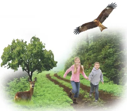
But it is not only the ecological feature and functional strategy that motivates to work with greenways. The natural character of the lineal structure made on nature and with the nature provides the sense of beauty. Greenway is beauty for the simple fact that it is nature. This is a motivation that together with the recreational function, offers a kind of tourism, ecotourism. Greenway is a model of sustainable and responsible tourism that bring people to the nature (Figure 7). (Murphy D. & D., 2010)
23
Brief history of the greenways
The origin of the greenways was found in North America with the sense of the environmental protection around the middle of 19th century. But it could be attributed the first experiences to Frederique Law Olmsted when in 1860s he tried to provide access to city parks by linear open spaces (Csepely-Knorr, L., 2010). The aim was to link parks which supported recreational and aesthetics functions at the same time establish ecological functions. Sometime after, in 1898, Ebenezer Howard showed his ideas in the concept “Garden City” following the same line that Olmsted, when alleys and linear ways connected parks and gardens. Similar examples came from 1640 when it was planted the “alley” of Les Champs-Élysées which connected the Tuileries Garden with the Louvre Palace. “Green belt” is also an urban concept for a park with the shape of the ring around the city which was very spread in the 1970s. Some of these ideas became reality when at the end of 19th the urban planner Arturo Soria designs Ciudad Lineal in Madrid. (Ahern, 2012; Hellmund & Smith, 1993)
Other concept with similar propose emerged to work to large scale, to regional scale, where the target is focused in an ecological point of view. The concept Continuum natural was born and will be explained in subsequent lines.
Also outside of the urban areas the beginning of the concept as greenways appeared in the Appalachian Trail (Ahern, 2002). It was created in 1921 as a hiking trail in a large scale. In 1991 CEC Program (Central European Countries) develops an open network with public benefits trails and natural corridors called “Ecotrails”. But it was in 1994 the route or trail which connects Prague and Vienna that gave rise to the first greenway in Europe. Greenways were presented as a model of sustainable and responsible tourism (Charles, & Mourek, 2010).
Since the 19th, greenways have being extended in USA and Europe, due to the big changes in the use of the landscape and for the stimulation of an ecotourism. The concept of greenways has been widely adopted by landscape planners (Groome, 1990).
It was recently in Sweden, more exactly in Scania (Skåne), where the need of greenway use in landscape planning started. The natural areas and the public access to the countryside together with the low population density may cause the fact to produce late if is compared with the Centro European countries. (Haaland et al.2010 in: Fábos et al. 2010)
24
Theory of “Continuum Naturale” from Francisco Caldeira Cabral
The concept of Continuum natural emerges as a group of ecological theories which must exist in the habitats to maintenance and develop the biological cycles. It was the Professor Francisco Caldeira Cabral (1908-1992), promoter of the studies of the landscape architecture in Portugal, who theorizes the concept (Andresen, 2010). That concept of environment and landscape is “a live set of animals, plants and micro-organism, which dynamic equilibrium is condition of human, who is part of it.” (Caldeira Cabral, F. 2003; Espenica, 1997).Continuum naturale is a methodology applied to the landscape planning. There are proposed ecological ideas to design and maintenance a natural sustainable environment. It must follow four rules (Caldeira Cabral, F. 1980):
Continuity, to ensure the continuity of the “mature ecosystems” (which present biodiversity in a close phase of its climax evolution) because the production from them given can be more. Thus it could maintenance the circulation of these biodiversity of flora and fauna. This network works as a ecologic corridors;
To be an elastic and capable system. The fundamental elements of the landscape can be adapted to the variability situations that there is characteristic of the life;
To have a fringe effect, increasing the interface effect between different landscape elements. It also has more perimeters to increase the energetic flows and to enhance the vital processes of the landscape. It is because the fringes are the area with more diversity in flora and fauna and more intensity of the biological processes,
To optimise compensated parameters of ecological impoverishment areas. Where decrease the surface of the fundamental elements of the landscape have to correspond an optimised of the effect of the remaining area. It means that the presence of the elements could be rising again, like in the past.
However, this concept has been defined under the ecological landscape ideas. With it is required maintenance the fundamental elements of the natural landscape, preserving or constituting its continuity and functionality. This theory, based in ecological landscape principles, is fundamental to greenway planning (Ahern, J. 2002).The rules should be followed in the design of greenways to gain the ecologic character.
25
Values of greenways
A greenway in the landscape would give several vantages to the site, to the land and to the territory. The values of the greenways could be divided in two simple definitions, which are important for the environment and the society. To be a little bit more concrete, the values could split in an ecological, cultural, social and aesthetical.
- The ecological value is representing the natural character that the plants have. Plants are the basic elements of building greenways. Plants are responsible to release oxygen to the atmosphere, to transforming organic material in vegetal material, to catch water, ..., it is a refuge of fauna and provide them food, ..., is an important raw material for the human being, and so on. In just this way, a linear set of several plants will give a lot of benefits to the environment. But beyond that a greenway can be designed with an ecological objective. In some case it is a way where to move animals, or insect. Other is for save land from the erosion or works as firewalls, for example. Greenways are source of life and any case safeguard and foment the biodiversity and, indeed, it has a huge ecological value. (Ahern, 2002; Hellmund &Smith 1993; 2006; Fábos et al. 2010)
- The cultural value is related with the result of the intervention in the landscape. The relationship between the human being and the landscape provides a new use of the land. It is an adaptation against the process lived in the last years, where the traditional uses of the land have been lost due the profitability on the market. New challenges and adaptations to this new era, where the environment and the nature has reached a great importance in the society, has emerge greenways as a new cultural intervention. Consequently, it is possible that later this cultural action would be a cultural and natural heritage, like the vineyards on the island of
Lanzarote in Canary Islands(Figure 8).
- The social value is around the benefits that the society gains with the use of the greenways. But, maybe the mean to create a place where the people walk, run, study and enjoy provides something else. It is a place to meet and to search and to feel the nature. It is a social place where the recreation has been the first enhancer of activities and the way to give to the greenways the consideration as places which evoke affection.
Figure 8: Vineyards in Lanzarote, Spain. (image: Gabriel Sebatián)
26 - The Aesthetical value comes from the natural character of the green structure, as it was commented before. Seen from an overview of the territory, greenways represents a mark in the landscape, a lineal structure that with trees or without which symbolizes a way, a “branch” of a network interconnected a land mark of human´s. Its presence brings back to the romantic pictures of the ninetieth century, feeling a bucolic character. Form another view, inside of a greenway there is another world of sceneries. Just for the broad variety or typologies of greenway there are multiple different sceneries, that there are also characterized for the landscape around them.
Types of greenways
“Linear Open space established along either a natural corridor, such a riverfront, stream valley, or ridgeline, or overland along a railroad right of way converted to recreational use, a canal, a scenic road, or other route”. (Little 1990 in: Hellmund & Smith, 1993)
Even the typology of the greenways can be extremely wide because it depends of a lot of factors. It would commend some aspect and an exceptional simple example that would be interesting for the study case.
A specific location in the world institutes what species of plants should be done the greenway. The site can tell how the plants will develop in its structure.
The wide of the greenway has importance in the effectively for the movement of the fauna, for the development of the plants and for how many recreational activities it can contain. The question is to keep a functional and effective width. No doubt, that the wide is not possible to keep along all of the greenway, it also depend of the orography of the land.
The most common idea of a greenway is a line of trees perfectly visible over the plain agricultural land but a greenway cross forest as an open corridor, or is a open way along the open land. So, as an example of that, in Sweden appears an ephemeral structure of the agricultural field margins called Beträdor. For its ephemeral character, the structure of the greenway can easily be cultivate and appear somewhere else (Figure 9). (Peterson 2010)
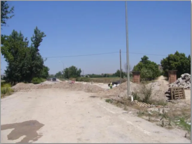
Figure 9: Beträdor on a field in Sjöbo. (Photo: Gabriel Sebastián)
27
Greenway`s functions
The most important characteristic of greenways is the multifunction that it has for the society. From the first industrial revolution and the last processes of change in the use of the land has become a lack of functions due to the productivity and the economy. It has been due of the intensive productions of the agriculture, homogeneous forest and the spreading of the urban area, most of the cases. Before, when the human activity was in equilibrium with the ecological processes of the landscape, several functions were located in a same site as for example the Portuguese’s Montados (Figure 10). Diversity in harmony cheers a sustainable development to the society and to the landscape.
- Ecological function
Protection, preservation and conservation are included in the ecological function of the greenways. Ecological function is referring to all the biological cycles in site. For example the movement of the water and nutrients in the soil needed by plants, or in other levels, birds that use the branches and seeds of the tree to live are also involved in a biological cycle. By its ecological character lead to have an ecological function and the most important for that is maintenance equilibrium between its parts. (Forman and Thorne in Hellmund & Smith, 1993)
As proprieties of this equilibrium, a greenway establishes a linear characteristic that have a vantage and a negative issue. Greenways have great interaction in their borders involving a movement of both animals and plants given diversity. On the other hand, this interaction can exposed to bad influences in very narrow greenways. Hellmund & Smith explained it with six functions (Figure 11) that would clarify and complement of what Caldeira Cabral said about the four rules to design and maintenance a natural sustainable environment. Then the six basic functions as ecological corridor a greenway should have: Habitat: space where different species interact and form a harmonious organic system;
Conduit: space for where the living organism (animal, fungus, micro-organism, plant) can move freely;
Barrier: it can stay as an impenetrable space for other organism; Filter: it allow to transfer only some specific living or dead material; Source: autonomous organism can leave the system;
Sink: new organism can entry in the system.
Figure 10: view over a Montado.(Photo: Gabriel
28
Figure 11: Six basic functions of a corridor. (image: Gabriel Sebastián)
It is supposed to promote the ecological integrity (Forman and Thorne in Hellmund & Smith, 1993) that it is characterized by natural levels of plant productivity, a high level of native biological diversity, natural rates of soil erosion and nutrient loss, clean water and healthy aquatic communities.
These characteristics should be part of every greenway and are important to keep more functions (Ahern 2002):
Protective: safe areas, elements or organism that could be in distress; Conservative: to keep a safe habitat that it is already damage;
There is other important ecological function that could be mention, like the regenerative function. It is due to the dynamic evolution of the system that provides sometimes a reconversion to the climax condition in a habitat that has been damaged.
- Recreational function
It sets all the leisure activities that the human being can enjoy. The greenway provide: hiking trails, bike paths, horseback riding trails, and areas for outside activities.
29 The recreation function has to do with the social character. It is an important investment of the greenway planning, thinking that it is not to many areas for outdoor activities, and the Swedish Right of Public Access is limited (Peterson et al., 2010). Health, leisure and sport has led to increasing the concern for provide new functions to the landscape (Figure 12). Mostly, around the cities this predisposition is higher and is needed to be resolve. The connection city-countryside is the key to open new possibilities, and in that case greenways bring both. In greenways there are interactions between people and nature; it is the way to guide people until the countryside
The tourism attraction that greenways evoke gives a new use and challenges to the countryside (Figure 13). The beauty that can present a promenade on the greenway is a value that the tourism hold, the people looks for serenity, beauty and relaxation. ”Experience in the nature: attractive, athletic recreation, passive viewing and contemplation, intellectual observation and study; help people to gain a sense of appreciation and respect for nature” (Leopold, 1979 in Hellmund & Smith, 1993). Selling the idea of producing recreation and pleasured experience could be improve including cultural and biological objects with interesting attraction along the way (Peterson et al 2010) (Figure 14)
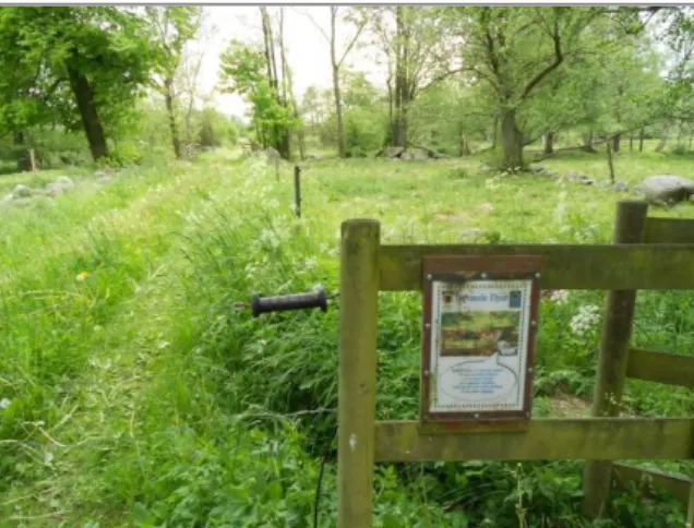
Figure 12: Fences for cattle which allow the access to the public. Sjöbo. (Photo: Gabriel Sebastian)
Figure 13: Tourism and sports activities in the nature. Sjöbo. (Photo: Gabriel Sebastián)
Figure 14: picking berries. West coast of Skåne. (Photo: Gry Arvidsson)
30 To get and keep the values of the greenways the way is the combination of the two main functions: ecological and recreational, the social and the environmental character, because its promote the moral consciousness( -figure 15O. “By doing so, we cannot only protect the integrity of natural system but also help people learn to know and appreciate nature” (Hellmund & Smith, 1993).
Creating a comprehensive greenway network
When the greenways were defined it became an individual structure. Greenways have a structure with different importance depends of the scale of the intervention which is considerate. Thus in a local scale, an individual greenway has ecological, cultural and recreational features, for example, it represents an important role for a population of a village, and have to be described in detail. But a municipality scale, a greenway has lost significance due to its potential capacity to support the ecological and recreational use in a large land. It is not only the lack of capacity for the dimension of the land, the connectivity is reduced. (Walmsley, 2006; Hellmund & Smith, 1993)
A territory present patterns or spatial configurations determinate by the elements of the landscape and the use of the lands establish for humans. (Hellmund & Smith, 1993)
The possibility to create a network increases the vantages that a greenway offers. Network system establishes new contact points multiply and the ratio of the flows (energy, species and nutrients) that in a greenway are produced. A network provides the possibility to created loops, is important to give the possibility to choose different paths for a recreational function. In those terms, the greenways network is a green structure where its benefits and value increase but not only as a sum of the result if not as a synergy system. (Walmsley, 2006)
Thus, it seeks to cover the terms of sociability, leisure, education, culture and aesthetical pleasure as benefits of a multifunctional ecologic network.
Figure 15: Walking through the forest. Maintainance the moral consciousness to the Nature. (Photo: Gabriel Sebastián)
31
Balancing between recreation and conservation: Impacts and planning strategies
The multifunction of the Greenway leads troubles by incompatibilities of use. Some of them there are affective for the others. Some are weak, for example the habitat of a bird, and the others are straight as the path of the hikers. Such the conservation of the habitats that it would be preserves against external sources before to have to mitigate or restore damages caused by negative impacts.
When a greenway is supported of the two main functions, it tends to create conflicts of the use. Therefore, it is identified recreation and conservation in the focus of the biggest troubles. Recreation is a social function and conservation is about the ecological character of greenways. How much negative is the impact of a recreation activity on the nature depends of the following factors (Hellmund & Smith, 1993):
Type of recreation: thus trails which support the pass of the people causes noise and trampling, or places to watch birds in which the people are studying nature quiet and in determinates moments; Where it is: The activity can be located in the boundaries or in the central bone of the greenway. It
could be worse in weak habitats as a wetlands which are in determinates points with a specified type of fauna;
For how long time: Thus it can be considerate the hunting season or a day for a race, but in other case are continuous like a pedestrian path which is used every season;
How large area is affected? Thinking in the noise producing it supposed to be located in a specific point like a shooting arrows place or to be spread inside of the greenway like a orientation activities;
How much is intensity of the action, thus trails close to urban areas are used for more people, every day during the all-day hours, while trails in the countryside are less used.
Sometimes two or more impacts happen at the same time or at the same area. This impact it is not the sum of them, it establish a synergic influence, it is a multiplicity of the impacts.
According with Cole (Cole, D.N. in Hellmund & Smith, 1993), the impacts created for the recreation to the nature can be synthesized in four landscape elements:
Soil: most of the impacts come from the trampling. It causes compaction of soil which generates direct impacts like lack of permeability, and indirect impacts, like difficulties in the growth of the plants and modification in the fauna, flora and water.
Vegetation: negative impacts are produced by people. The behaviour of the users makes damages in plants, like mutilation for cutting braches or marking on the trunks. The areas where have the possibility to be more affected, like the boundaries of the trails. An important impact could create by the introduction of exotic species. Vulnerable habitats could suffer the loss of native species.
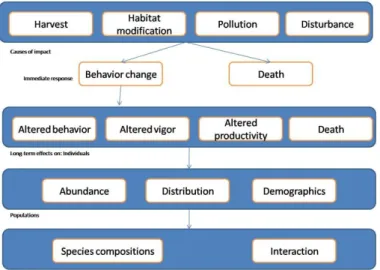
32 Fauna: probably the most affected for recreation activities. Animals change their behaviour and leave the place where they live if they are disturbed. Just for the only presence of humans, birds can be affected changing the nesting place (figure 16). Of course, the most impact of the fauna is done by hunting. In the next (Figure 17) taking for Hellmund (pp. 109, 1993) is presented the impacts of recreational use on animals.
Figure 17: conceptual model of the impacts of recreational use on animals. (Image: Gabriel Sebastián from :Cole, D.N.; Hellmund & Smith, 1993)
Water: Against this element the negative impacts can be considerate as indirect for the impact on the vegetation and soil. Soils without vegetation cover are lost for erosion. But there is a direct impact for pollution. Human produce residues and rubbish, where there is concentration of recreational activities is possible to have contaminated water.
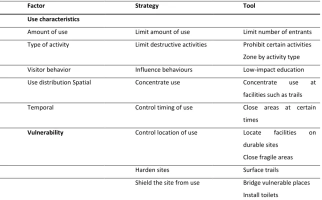
On the way to reduce the negative impacts of the recreation activities on the conservation areas must considerate the five factors described above. Create design strategies to adapt an equilibrated project where recreation activities can be subsisting without causing negative impacts on the nature. Thus it is described basic strategies depend of the characteristics of the use. Prohibit the use of the destructive activities. To locate a zone for the type of use or to close areas those are vulnerable.
Limit the use of the activity. It depends of its intensity, time and area to use. Limit certain times or certain sites.
Concentrate use of the activity to have just in a place the impact.