INTRODUCTION
Spatial and urban development result in various geospatial phenomena. Brownfields are one of the most noteworthy of these phenomena, and they have recently been the focus of various multidisciplinary studies in the transitional countries of Eastern and Southeastern Europe (Đukić et al., 2014), as well as globally (Bijelić, 2014; Hollander et al, 2009). These locations are a significant part of the built-up areas in many settlements. They not only have a negative economic and ecological effect on their surroundings, but also have a negative social, psychological, and aesthetic impact.
There are many definitions of brownfield sites. Generally speaking, there are North American and European approaches to conceptually defining brownfield sites. American and Canadian authors define brownfields as abandoned or underused contaminated sites (Bartsch and Collaton, 1997; Dennison, 1998; Russ, 1999; Yount, 2003; Sigman, 2010), whereas the majority of European authors use more complex definitions of a multidisciplinary character without emphasizing only the potential contamination of these sites (Alker et al., 2000; Grimski and Ferber, 2001; Grimski et al., 2002; Oliver et al., 2005).
Revitalization of brownfields in Serbia – a guide for decision makers and professionals is a typical example of a publication with a complex and multidisciplinary definition; here brownfields are defined as areas and facilities in urbanized zones which have lost their original use or become underused, often presenting, or it is assumed that they present, an ecological hazard, and they have dilapidated manufacturing and other facilities (Danilović et al., 2008). At the global level, brownfields have different causes; that is, their origin varies depending on the country and continent. Taking into account their specific economic features, North American and Western European authors associate brownfields with changes in economic structure arising from the transition from industrial to post-industrial society (a shift from a production-oriented to service-oriented economy). In support of this view, the largest concentration of brownfields is in post-industrial areas, where the boom in industrial production in the last two centuries has been followed by a decline or even shutdown in economic activities, i.e. deindustrialization (Hollander et al 2009; Adams et al., 2010; Van Dyck, 2010; Li, 2011; Ting Tang and Nathanail, 2012). Today’s Western European and North American brownfields owe their origin to the period of continuous economic decline and deindustrialization of the 1970s and 1980s, followed by a period of economic deregulation and liberalization in the 1980s and 1990s (Van
IDENTIFICATION AND ECOLOGICAL ASPECTS
OF LARGE-SCALE BROWNFIELDS
IN THE REPUBLIC OF SRPSKA
Branislav Bijelić
1, Urbis centar Ltd. Banja Luka, Republic of Srpska, Bosnia and HerzegovinaDejan Filipović
, University of Belgrade, Faculty of Geography, Belgrade, SerbiaLarge-scale brownfield sites are the most apparent brownfield category in the Republic of Srpska, and they are the most valuable asset when it comes to explaining this spatial phenomenon. Transition and armed conflict in Bosnia and Herzegovina have caused, among other things, brownfield formation; a decline in industrial employment alongside a reduction in the size of the armed forced have further increased the number and total area of brownfields in Bosnia and Herzegovina and the Republic of Srpska. Their ecological characteristics, as in other transitional countries, are largely responsible for the definition of brownfields, but they are not the most significant barrier to the revitalization of large-scale brownfield sites. The present paper will provide the methodology of large-large-scale brownfield identification as well as an accompanying distribution map of these sites in the Republic of Srpska.
Key words: large-scale brownfields, identification, ecological characteristics, revitalization, the Republic of Srpska.
1 Bulevar vojvode Stepe Stepanovića 101a, 78000 Banja Luka,
Republic of Srpska, Bosnia and Herzegovina [email protected]; [email protected]
Dyck, 2010). The process of brownfield formation itself, in the narrower sense of the meaning, is a vicious circle of decline in which owners are unable to sell contaminated properties and choose to simply abandon them, leaving such locations as places susceptible to various forms of social pathology, and finally resulting in the devaluation of neighboring properties (Bartsch and Collaton, 1997). This attempt to explain the causes of brownfield formation evidently lacks a more detailed and in-depth analysis which is not only characteristic for North American and European authors, but also for authors from Eastern and Southeastern Europe (socialist countries). The emphasis in post-socialist countries is not only on the changes in economic structure, but also on the fact that these countries have experienced a transition from a socialist to a capitalist socio-economic system, each with its own socio-economic specificities. The brownfields of Eastern Europe first appeared in the 1990s immediately after the collapse of communism and the transition from a planned economy to a market economy, accompanied by globalization trends (Frantal et al., 2013; Kunc et al., 2014).
Large-scale brownfields stand out in terms of their relative size within a geospace. Their size varies in respect to their spatial context. This paper identifies large-scale brownfields in the Republic of Srpska and Bosnia and Herzegovina as those with an area covering over 4 ha. The main hypothesis is that the ecological characteristics of large-scale brownfield sites are not the most significant barrier to their revitalization, i.e. restoring their capacities. Although Bosnia and Herzegovina, prior to 1992, was abundant with basic industry (Marić, 1991; MVTEO and UNDP BiH, 2002) and
military facilities (Čekić, 2004), the analysis of large-scale brownfields from the ecological standpoint should lead to a conclusion that the ecological characteristics of these sites do not represent any major obstacle to their reactivation.
AREA OF INTEREST
The area of interest of this paper is large-scale brownfields in the Republic of Srpska, an entity (federal-confederal unit) in Bosnia and Herzegovina.
The Republic of Srpska (RS) covers mainly the northern and eastern part of Bosnia and Herzegovina. Its total area is 24,666 km2 or 48.17 % of the total area of Bosnia
and Herzegovina. This entity is located between 45°16′ and 42°33′ north longitude, and between 16°11′ and 19°37′ east latitude (MPUGE and NUZRS, 2015). There are 64 units of local governance (ULG) in the RS – 57 municipalities and 7 towns (N.B. the town of Istočno Sarajevo is a single local governance unit comprising made up of 6 municipalities). The RS has no regional level of government in its administrative division.
MATERIAL AND METHODS
There are no universal criteria for brownfield identification, which is due to the different perceptions of the nature of brownfield sites themselves. Methodologies for brownfield identification are primarily based on the use of various public registers and databases, which lack accurately defined and objectivized (quantified) criteria. In the process of brownfield identification, a very important role is played by spatial planning documents and the geographic information systems through which numerous spatial registers operate.
Regrettably, legislation at the entity and canton levels in Bosnia and Herzegovina does not address the issue of brownfield sites. Moreover, the majority of existing spatial plans in cantons and entities fail to see the challenges and potential of brownfield sites in terms of their spatial development, which, in the end, results in the lack of proper identification. The changes and amendments to the Spatial Plan of the Republic of Srpska (until 2025) can be seen as a positive exception to this state of affairs.
Because of the diversity of brownfield identification criteria, there is a need to tailor the criteria to various types of such locations. For example, military brownfields require a different set of identification criteria from the most common criteria used for industrial and commercial brownfields. This leads to the conclusion that a specificity principle needs to be applied when creating a proper set of identification criteria. The second principle is that of integrity or homogeneity. This principle assumes that a location needs to be treated as a whole and not partially.
Identification criteria must be based on the key features of these sites; that is, they need to be abandoned and inactive (or underused). The first feature can be determined by the capacity utilization degree of the location, and the second one (for inactive or underused locations) can be established by means of job density. This second indicator is applicable for industrial brownfields, i.e. commercial brownfields, but it is difficult to apply it to military and (municipal) utility brownfields. For military and utility brownfield sites, it is very difficult to determine the exact indicators of inactivity or underuse. The activity level at such locations can only be determined by accessing the location records or through fieldwork (i.e., field inspection).
After the criteria and indicators for brownfield identification in the Republic of Srpska have been established, it is necessary to define certain boundaries that frame the concept of brownfield identification. Based on European (primarily Czech) experience, the degree of the location’s capacity utilization should be below 30%; that is, more than 70% of the location should not be in use (Bergatt Jackson and Votoček, 2010). In terms of job density, the matter is rather complicated. International authors do not even define this indicator, which leaves the matter unaddressed in terms of establishing the necessary quantitative limits. The analysis of strategic spatial planning documents (mainly spatial plans for local communities) in the Republic of Srpska and elsewhere in Bosnia and Herzegovina conducted in the last thirty years indicates that the average job density in industry (industrial zones and industrial plants) prior to 1992 ranges from fifty to sixty employees per hectare, whereas the numbers for the last ten years show fourteen employees per hectare, mostly due to the economic transition. If the limit for the underuse of locations in terms of their job density is set at 10% of the value prior to 1992 (optimal job density by definition), a calculated value of six employees per hectare is found to be the lower limit for brownfields in the Republic of Srpska. To categorize a location as a commercial (industrial) brownfield site, it is essential to have these two indicators below the lower limits, and also to respect the principle of homogeneity.
Municipal (utility) and military brownfields need to be in line with the specificity principle; that is, apart from the exact indicator of location use, they also need to be field investigated in terms of proper registers, inventory access, and remote detection. In the case of military brownfields, the State Property Inventory, created by the Office of the High Representative in Bosnia and Herzegovina in 2009, is relevant in terms of site identification (Office of the High Representative, 2009). This inventory lists the military property once owned by the Federal Secretariat of National Defense (the former Yugoslav Defense Ministry) and the Territorial Defense of Bosnia and Herzegovina. Apart from this inventory, other sources of information on military property (i.e., potential military brownfields) include data obtained from the Bosnia and Herzegovina Ministry of Defense pertaining to non-perspective military locations. These data were acquired from the authorities upon personal request in August 2011. By comparing these two sources of data, it was found that a significant number of sites recorded in the State Property Inventory made by the Office of the High Representative in Bosnia and Herzegovina were not listed in “the inventory list of military locations in the Republic of Srpska, which are neither under operation by the Ministry of Defense nor the armed forces” (MO BiH, 2011).
A study was conducted for this article on December 31, 2013, which resulted in the identification of brownfields in the Republic of Srpska with an area exceeding four hectares (large-scale brownfields). Various sources were used for their identification, but they can all be classified in the following categories:
• Local development strategies;
• Strategic spatial planning documents at the municipality level (local communities);
• The Local Economic Development Portal of the Republic of Srpska Agency for Development of Small and Medium-Sized Enterprises (RARS-MSP, 2008);
• Inventories (the Bosnia and Herzegovina State Property Inventory);
• Graphic sources: satellite images (Google Earth, Bing Maps, Yahoo Maps), aerophotogrammetric (aerial) images, geodetic maps, 1:25,000 topographic maps published by the Military Geographic Institute in Belgrade, 1:50,000 topographic maps published by the Defense Mapping Agency of the United States;
• Interviews conducted with local government (municipality) officials in charge of the departments of economic affairs and/or spatial planning.
RESULTS AND DISCUSSION
In the former Yugoslavia, the common factors of brownfield formation, such as changes in the economic structure and the transition from socialist self-management to a capitalist system, also include two additional significant factors: armed conflict and economic sanctions imposed by the UN against the former Federal Republic of Yugoslavia (Serbia and Montenegro) and the Republic of Srpska during the 1990s. This was particularly evident in Bosnia and Herzegovina (and its entity the Republic of Srpska) and Serbia, whereas Croatia and Macedonia suffered indirect economic effects resulting from the sanctions imposed against the Federal Republic of Yugoslavia.
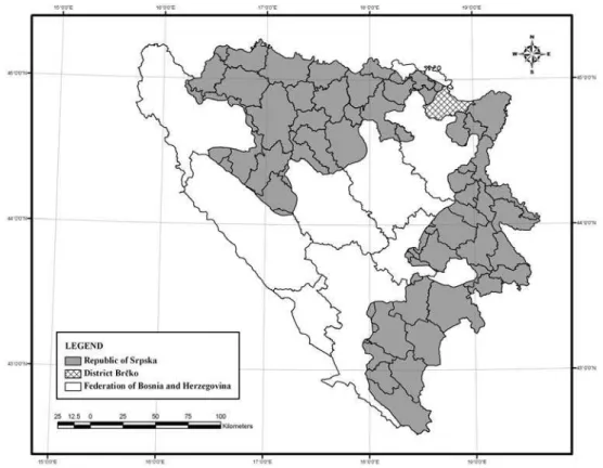
Using criteria from the previous chapter, forty-nine large-scale brownfield sites have been identified in the Republic of Srpska. Their total area is 601.86 ha (0.24 ‰ of the area of the Republic of Srpska). It should be noted that some 90% of these locations were never identified as such by other sources. The largest proportion of these sites has been distinguished in the mesoregion of Istočno Sarajevo (Eastern Sarajevo), i.e. 38.78 % of the total number, or 19 large-scale brownfield sites. Figure 2 shows the distribution map of all of the large-scale brownfields identified in the Republic of Srpska.
There are no relevant ecological data about this category of brownfields in the Republic of Srpska. The ecological documentation needed for an environmental permit at these sites is almost non-existent due to a relatively insignificant number of active companies at large-scale brownfields. However, the sites themselves, even if the toxic emissions are disregarded, present a source of environmental degradation in other ways. Namely, there are a number of production
plants with considerable reserves of toxic substances once used during production processes. Also, it is still possible to see examples of residual pollution as an effect of toxic material emission over previous years, resulting in pollution of the soil, groundwater and surrounding facilities. The soil and groundwater are highlighted here as the most vulnerable categories.
The complexity of brownfield characteristics is best illustrated when the technical (ecological) criteria are outlined in order to prioritize the brownfields for remediation. Such an approach was first developed by the state of Colorado (USA). It includes the following criteria:
• Toxicity of contaminants (human/ecological),
• Site characteristics (waste stability, volume, concentration, and mobility),
• Human exposure,
• Ecological exposure (Colorado Department of Public Health and Environment, 2015).
The first two criteria are internal, whereas human and ecological exposure are the two criteria with external character, since they are related to the surrounding population and environment (endangered or threatened species or managed habitats, and wilderness areas).
The Czech author, Jirži Tylčer, focuses mainly on the internal criteria, and provides a general classification of brownfields in relation to their contamination potential:
• Category 1 – low risk of significant contamination (no limits for future reuse of site),
• Category 2 – medium level risk of significant contamination (the contamination sites are limited
to the soil surface; not extensive remediation; no limitations to future reuse of site),
• Category 3 – high risk of significant contamination (the contamination sites are limited to the soil surface, substantial remediation required; existing limitation to future reuse of site),
• Category 4 – high risk of large-scale contamination (large area remediation required; numerous limitations to future reuse of site) (Tylčer, 2008).
This categorization arises from the type of activity (the main production process) once occurring at the specific site. Similarly, a more simplified classification arranges brownfield sites into: no contamination potential sites, potentially contaminated sites and sites with a high level of potential contamination (Filipović, 2014).
CONCLUSION
Residual contamination is not significantly present at the location of large-scale brownfield sites in the Republic of Srpska, which is supported by their structure in terms of the level of contamination. The distribution of these sites is dominantly characterized by the low and medium risk level of significant contamination; they make up 93.88 % of the total number of large-scale brownfield sites in the Republic of Srpska. This is all due to the nature of the production sites once in place at these locations. The following examples can be seen as exceptions: the paper and cellulose plant in Prijedor, and the asbestos production plant in Petrovo, categorised as brownfields with a high risk of significant contamination, as well as the military facility in Han Pijesak categorised as the only brownfield site with a high level risk of large-scale contamination due to its subsequent contamination with depleted uranium (UNEP, 2003).
The research results clearly indicate that the ecological characteristics of large-scale brownfields in the Republic of Srpska are not the most significant obstacle to their potential revitalization, i.e. their future reuse for the same or a different purpose. The ecological burden of these sites is considerably different from those in Western Europe and North America, where brownfields and contamination sites are often considered to be the same phenomenon. The key
barriers to the reactivation of the large-scale brownfield sites in the Republic of Srpska are, therefore, to be looked for elsewhere – namely, in terms of their spatial, proprietary and legal, economic and socio-psychological traits.
REFERENCES
Adams, D., De Sousa, C., Tiesdell, S. (2010) Brownfield
Development: A Comparison of North American and British Approaches, Urban Studies, 47 (1), pp. 75-104.
Alker, S., Joy, V., Roberts, P., Smith, N. (2000) The Definition of Brownfield, Journal of Environmental Planning and
Management, 43 (1), pp. 49-69.
Bartsch, C., Collaton, E. (1997) Brownfields: Cleaning and reusing of contaminated properties. Westport: Praeger.
Bergatt Jackson, J., Votoček, J. (2010) Metodika inventarizace brownfieldu v urovni ORP. Praha: Institut pro udržitelný rozvoj sídel. [Bergatt Jackson, J., Votoček, J. (2010) Methodology of brownfield inventory at ORP level. Prague: Institut pro
udržitelný rozvoj sídel.]
Bijelić, B. (2014) Large-scale brownfields in the Republic of Srpska, in Đukić, A., Simonović, D., Vujičić, T. (eds.) BrownInfo - Toward a methodological framework for brownfield database
development. Banja Luka: University of Banja Luka, Faculty of
Arhitecture, Civil Engineering and Geodesy, pp. 173-189.
Colorado Department of Public Health and Environment (2015) Site prioritization criteria for HB 00-1306, https://www.
colorado.gov/pacific/sites/default/files/HM_brownfields-Site-Prioritization-Criteria-and-Worksheets.pdf, accessed 2nd
Aug 2015.
Čekić, S. (2004) Agresija na Republiku Bosnu i Hercegovinu - planiranje, pripremanje, izvođenje. Sarajevo: Institut za
istraživanje zločina protiv čovječnosti i međunarodnog
prava. [Čekić, S. (2004) Aggression against the Republic of Bosnia and Herzegovina - planning, preparation, execution. Sarjevo: Institute for research of crimes against humanity and
international law.]
Danilović, K., Stojkov, B., Zeković, S., Gligorijević, Ž., Damjanović,
D. (eds.) (2008) Oživljavanje braunfilda u Srbiji - priručnik za donosioce odluka i profesionalce. Beograd: Palgo centar.
[Danilović, K., Stojkov, B., Zeković, S., Gligorijević, Ž., Damjanović, D. (eds.) (2008) The revival of brownfields in Serbia - a manual for decision-makers and professionals.
Belgrade: Palgo centar.]
Dennison, S. M. (1998) Brownfields Redevelopment: Programs and Strategies for Contaminated Real Estate. Rockville: Government Institutes.
Đukić, A., Simonović, D., Vujičić, T. (eds.) (2014) BrownInfo - Toward a methodological framework for brownfield database
development. Banja Luka: University of Banja Luka, Faculty of
Arhitecture, Civil Engineering and Geodesy.
Filipović, D. (2014) Environmental site assesment as a basis for brownfield revitalisation, in Đukić, A., Simonović, D., Vujičić,
T. (eds.) BrownInfo - Toward a methodological framework for brownfield database development. Banja Luka: University of Banja Luka, Faculty of Arhitecture, Civil Engineering and Geodesy, pp. 73-86.
Frantal, B., Kunc, J., Novakova, E., Klusaček, P., Martinat, S., Osman, R. (2013) Location matters! Exploring brownfields
regeneration in a spatial context (a case study of the South Moravian region, Czech Republic), Moravian geographical
reports, 21 (2), pp. 5-19.
Figure 3. Structure of large-scale brownfields in the Republic of Srpska by level of pollution
Grimski, D., Ferber, U. (2001) Urban Brownfields in Europe,
Land Contamination & Reclamation, 9 (1), pp. 143-148.
Grimski, D., Lowe, J., Smith, S., Ferber, U. (eds.) (2002) Brownfields and Redevelopment of Urban Areas - A report from the Contaminated Land Rehabilitation Network for Environmental Technologies (CLARINET). Umweltbundesamt Austria.
Hollander, J., Kirkwood, N., Gold, J. (2009) Principles of brownfield regeneration. Washington: Island Press.
Kunc, J., Martinat, S., Tonev, P., Frantal, B. (2014) Destiny of urban
brownfields: spatial patterns and perceived consequences of
post-socialistic deindustrialization, Transylvanian Review of Administrative Sciences, 41 (E), pp. 109-128.
Li, X. (2011) Brownfields in China:How Cities Recycle Industrial Land. Massachusetts Institute of Technology.
Marić, Đ. (1991) Industrijalizacija Bosne i Hercegovine – Geografska studija savremenog razvoja. Sarajevo: Geografsko društvo Bosne i Hercegovine.[Marić, Đ. (1991) Industrialization of Bosnia and Herzegovina - Geographical
study of modern development. Sarajevo: Geographical society
of Bosnia and Herzegovina.]
MO BiH (2011) Dopis br. 3511-1/11 /Letter no. 06-50-3511-1/11/. Ministarstvo odbrane Bosne i Hercegovine (MO BiH).
MPUGE, NUZRS (2015) Izmjene i dopune Prostornog plana Republike Srpske do 2025. godine /The changes and amendments to the Spatial Plan of the Republic of Srpska until 2025. Ministarstvo za prostorno uređenje, građevinarstvo i ekologiju (MPUGE), Novi urbanistički zavod Republike Srpske (NUZRS).
MVTEO, UNDP BiH (2002) Procjena održivog razvoja u Bosni i Hercegovini-Izvještaj BiH za Svjetski samit o održivom razvoju (WSSD) /Assessment of sustainable development in Bosnia and Herzegovina-Report of B&H for the World Summit on Sustainable Development (WSSD). Ministarstvo vanjske trgovine i ekonomskih odnosa (MVTEO), Razvojni program Ujedinjenih nacija u Bosni i Hercegovini (UNDP BiH).
Office of the High Representative (2009) State Property
Inventory, http://www.ohr.int/stateproperty/index.htm,
accessed 30th Jul 2015.
Oliver, L., Ferber, U., Grimski, D., Millar, K., Nathanail, P. (2005)
The Scale and Nature of European Brownfields, in Proceedings
of the CABERNET 2005: The International Conference on
Management Urban Land. Nottingham: Land Quality Press, pp.
238–244.
RARS-MSP (2008) Local Economic Development portal. Agency for Small and Medium Enterprises of Republic of Srpska (RARS-MSP), http://www.rars-msp.org/en-US/portal-ler, accessed 2nd Aug 2015.
Russ, T. (1999) Redeveloping Brownfields: Landscape Architects, Site Planners, Developers. New York: McGraw-Hill Professional.
Sigman, H. (2010) Environmental Liability and Redevelopment of Old Industrial Land, Journal of Law & Economics, 53 (2), pp.
289-306.
Ting Tang, Y., Nathanail P. (2012) Sticks and Stones: The Impact
of the Definitions of Brownfield in Policies on Socio-Economic
Sustainability, Sustainability, 4 (5), pp. 840-862.
Tylčer, J. (2008) Rizičnost braunfild lokacija, in Danilović, K., Stojkov, B., Zeković, S., Gligorijević, Ž., Damjanović, D. (eds.)
Oživljavanje braunfilda u Srbiji - priručnik za donosioce odluka i profesionalce. Beograd: Palgo centar, pp. 130-137. [Tylčer, J. (2008) The risk of brownfield sites, in Danilović, K., Stojkov, B., Zeković, S., Gligorijević, Ž., Damjanović, D. (eds.) The revival of brownfields in Serbia - a manual for decision-makers and
professionals. Belgrade: Palgo centar, pp. 130-137.]
UNEP (2003) Depleted Uranium in Bosnia and Herzegovina: Post-Conflict Environmental Assessment. United Nations Environment Programme (UNEP).
Van Dyck, B. (2010) When the third sector builds the city: Brownfield Transformation Projects in Marseille and Montréal. Antwerp: University of Antwerp.
Yount, K. (2003) What are Brownfields? Finding a Conceptual Definition, Environmental Practice, 5 (1), pp. 25-33.