Application of Remote Sensing Techniques for Mapping Shifting
Cultivation
N.Vijaya Kumari
VNR Vignana Jyothi Institute of Engineering and Technology Hyderabad – 500 090
ABSTRACT
Shift ing cultivation is an ancient and primitive method of cultivation, also referred to as ‘slash and burn’ or
‘rotational bush fallow agricultural system’. The practice mainly involves removal of the forests by primitive
slash and burn technique followed by mixed cropping for short period before abandoning the site. Tribals all over India are known to follow the practice of shifting cultivation with some regional variat io ns. The present study has been undertaken to estimate the spatial distribution of podu cultivation in Srika kula m d istrict of Andhra Pradesh by using remote sensing techniques. Results of the present study indicate that an estimated area of 10,491.857 acres of the forest area is under shifting cultivation in Srikaku la m district. Shifting cultivation has caused a great deal of environmental degradation. Re mote sensing techniques with repetitive coverage and synoptic view provide database for assessing environment degrading practices. Mapping of shift ing areas is important not only fro m ecologica l point of v iew but also for management purposes.
Keywords: Shifting cult ivation, re mote sensing, mapping, environ ment,
I.
INTRODUCTION
Shift ing cultivation is a traditional form of agriculture practiced mostly by tribals in the hilly tracts of the region. This agricu ltural system is
termed ‘Shifting cultivation’ indicating move ment
from one plot to another or ‘Slash and burn’
referring to the means of destroying the forest
lands. It is also known as ‘Rotational bush fallow agriculture’ as the system functions in a cyclic
manner. Shift ing cultivation ma inly involves selection and removal of forests by slash and burn techniques followed by mixed cropping, harvesting and fallowing for a short period before abandoning the site(Fig.1)
The rationale of shifting cultivation is simp le (Plate -1). The orig inal forests and the fallowed areas in which trees and other plant species grow provide several benefits (Nair, 1990).During the fallo w period trees replenish the soil organic matter, thereby improving soil structure and prevents soil erosion and e xcessive water runoff (Plate-1). Thus, ideally slash and burn cultivation is ecologically stable under very low density of human population and was operated successfully for subsistence. However, in recent times increased population density led to intensive shifting cultivation with shorter fallows resulting in poor yields and decline in soil fertility (Sharma, 1976).
Shift ing cultivation is practiced with some variations throughout the tropical and subtropical regions of the world. Reports indicate that nearly about 36 million sq.km. of global area is under slash and burn cultivation and is a means of
livelihood for 10 per cent of the world’s population
(Hauck,1973). Sh ift ing cultivation is widespread in the Amazon basin, South west china, Africa, Korea, Vietnam and neighboring counties and is known by various names. Reports indicate Africa as having the largest area under shifting cultivation followed by Latin A merica (Conklin, 1957).
India is the only country where shifting cultivation is confined to hill areas in the Northeast, Southern Orissa and tribal belts of Andhra Pradesh and is commonly known by the local vernacular names. The proble m of shifting cult ivation is acute in Andhra Pradesh, Orissa and North-eastern states whereas it is limited in Madhya Pradesh and Bihar. As per the task force of Min istry of Agriculture nearly 9.95 million hectares of land in India is under shifting cultivation. However, because of its transient nature the exact total area requires periodic monitoring. According to Planning Co mmission (1982) 233 blocks spread over 62 districts in 16 states the jhum is practiced involving 12 per cent of tribal population.
Study are a
In Andhra Pradesh shifting cultivation is e xtensively practiced in the districts of Srika kula m, Vizianagara m, Visakhapatnam, Kha mma m and East and West Godavari and sparsely in Adilabad district. Shift ing cultivation is known as ‘Podu’ in the local vernacular in Srika kula m district and in coastal areas. The present project was undertaken to estimate the areal extent of shifting cultivation in Srika kula m district of Andhra Pradesh, by using re mote sensing techniques.
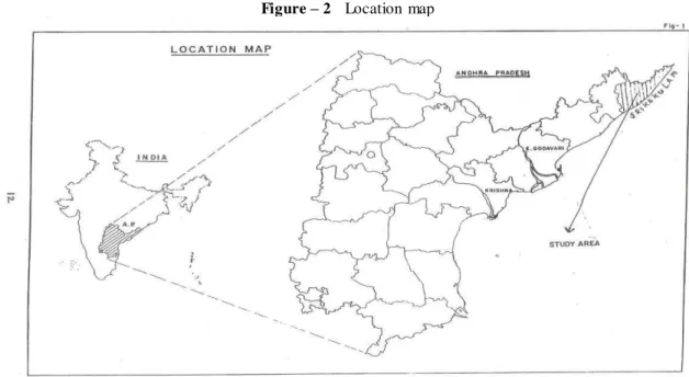
The study area namely Srikaku la m district is part of eastern ghats of Andhra Pradesh. The total area of Srikaku la m d istrict is 5,837 sq.km. and is situated within the geographic co-ordinates of 18-21’ and 19-10’ of northern latitude and 83-5’ and 84-51’ of eastern longitude (Fig.2 - location map). The district is divided into two natural regions namely the hilly reg ion called the agency area in the north-western parts of the district and the plains. The hilly reg ion occupies about 1/3rd of the total area of the district and is mostly under
‘Podu’ cultivation. According to Roy (1990)
shifting cultivation is practiced in the hilly terrain where gentle slope of land, high rainfa ll, mode rate temperature and good soil favor quick gro wth of plants.
II.
METHODOLOGY
The delineation and mapping of podu areas under shifting cultivation was done by visual interpretation technique using IRS-IB LSS II FCC print of path 21 and row 55 covering the study area (Fig. 3). Areas under podu cultivation were delineated on an overlay and fina lly transferred onto the topographical base map prepared at 1:50,000scale (Plate - 2). The final map area was calculated using the grid sheet method.
III.
RESULTS AND DISCUSSION
The total geographical area of Srikaku la m district is 498512 acres with an estimated forest area of 133691 acres. In the present study results indicate that podu is practiced in 10491.57 acres of the forest area (Fig.-4). This constitutes about 7.84 per cent of the total forest area encroached upon by the tribal population. Shift ing cultivation with a short fallow period causes loss of soil fertility and promotes growth of exotic weeds and prevents natural regeneration of the forest. Ultimately, the podu fields are simply abandoned when they are uneconomica l and then new forest regions will be encroached.
The ma in reason for podu cultivation are insufficient e xtent of valley land, less crop produce and need to meet food require ment. This was revealed by the study conducted by Admin istrative Staff College of India (1986) Hyderabad. This was also supported by baseline survey conducted in the districts covered by Andhra Pradesh Development Project (1989).
Srika kula m d istrict comprises of 1.34 lakh tribal population and the predominant triba l groups practicing shifting cultivation in this region are known as Savara, Jatapu, Gadaba and Konda Dora. Podu cultivators are highly skilled at adapting their cropping practices to the environment in which they are working. Estimates reveal that an area of
cultivation in Srikaku la m d istrict. Nea rly 18.51 per cent of the tribal population are engaged in the practice of podu which is the ma in source of live lihood.
Ecol ogical Implic ations
The ecological imp lications of shifting cultivation are disastrous. It is one of the main reasons for deforestation and soil degradation. Natural regeneration of vegetation is inhibited due to the shorter fallo w periods causing irreparable damage to the forest ecosystem. In the past the fallow periods were long about 20-30 years and has been considerably reduced to 5 years. As indicated in Govern ment of India Task force (1983) report on shifting cultivation, the fallow period in Andhra Pradesh is 3 years which was the lowest in the entire country. It has been estimated (EPA, 1990) that about 25 per cent of global warming is attributable to the burning of forests.
The resultant ecological imba lance will definitely have a significant negative impact on the socio-economic conditions of the tribals. It is apparent that this traditional system of cult ivation is unsatisfactory under such conditions and has to be replaced by a more permanent and productive system in order to save the region from an ecological crisis, which if left unchecked will endanger the very existence of the tribal community.
IV.
CONCLUSIONS
Shift ing cultivation also known as slash and burn is a traditional form of agriculture practiced mostly by the tribal people liv ing in the hilly tracts of the forest region. Podu cultivation is of widespread occurrence in the forest zone of Srika kula m district. The ecological imp lications of podu cultivation are disastrous causing deforestation and degradation. The present study demonstrated that IRS data can be successfully utilized for mapping and monitoring areas under shifting cultivation. Re mote sensing is a most useful tool to monitor natural resources and related environmental proble ms leading to suitable manage ment strategies which would enrich the socio-economic conditions of the tribals and also for sustainable development in future.
REFERENCES
[1]. Nair, P.R., Prospects for agro-forestry in the tropics., World technical paper., Washington D.C.1990, 113.
[3]. Hauck, F.W., Sh ift ing cultivation and soil conservation in Africa ., FAO soils bull. 1973, 24, 1-4.
[4]. Conklin,H.C., Hanunoo agriculture, F.A.O. Forestry development, F.A.O. Ro me – 109.1957, paper no. 12.
[5]. Roy Burman, B.K., Anoverview of shift ing cultivation in India. In: Shifting cultivation in north –eastern India. D.N., Ed. Omsons publications, New De lhi., 1990, 1-13. [6]. Environment Protection Act., US-EPA;
WSH.DC. Greenhouse gas emissions from agricultural systems., 1990, vols. 1-2.
Figure – 2 Location map
STEP 1: ANALOG DATA
STEP 2: PRELIMINARY INTERPRETATION
STEP 3: DELIN EATION ON IMAGE OF 1:50000 SCALE STEP 4: FINALISATION OF INTERPRETATION. STEP 5: TRANSFER OF THEMATIC DETAILS STEP 6: MAP FINALIZATION
STEP 7: AREA CALCULATION.
Plate -1
SHIFTING CULTIVATION
CONCEPTUAL MODEL
Plate - 2