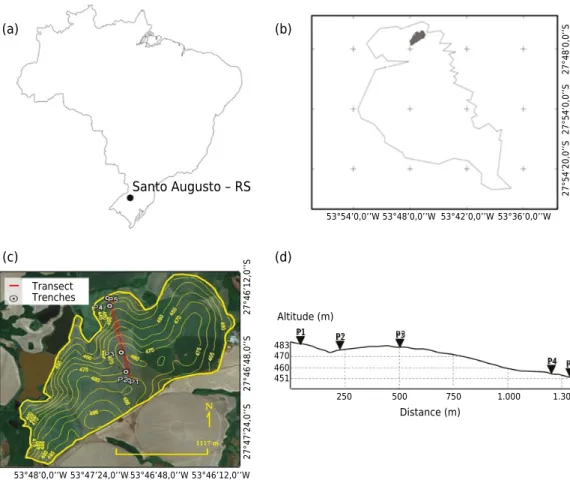
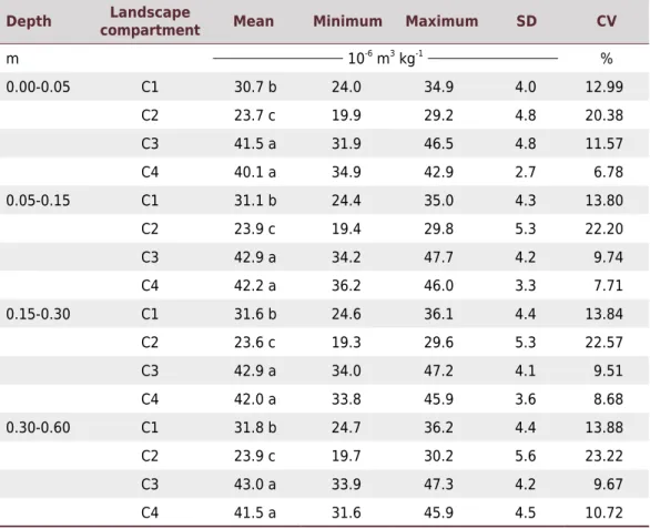
Magnetic Susceptibility of Soil to Differentiate Soil Environments in Southern Brazil
Texto
Imagem


Documentos relacionados
By also applying Software Defined Networking (SDN) and Network Function Virtualization (NFV) techniques through the use of a controller and hosting services as Virtualized
descendente(X,Z) :- genitor(X,Z).. Introdu¸c˜ ao PARTE I PARTE II PARTE III Fatos Consultas Regras Regras recursivas Regras recursivas Exerc´ıcio 7.. Introdu¸c˜ ao PARTE I PARTE
The objective of this study was to predict the levels of organic carbon (OC), clay, and extractable phosphorus (P), from the spectral responses of soil samples in the visible and
Levels of total soil organic carbon, as well as oxidizable fractions and aggregate stability, were analyzed, in addition to the activity and carbon and nitrogen content in the
• Rethinking organization processes related to information handling and an organization communication strategy that should be supported by digital media (Social Network Sites,
The aim of this study was to assess the extent to which intrinsic soil properties (clay and iron oxide contents) explain variable soil properties (sum of bases, potential
The sectors were ordered according to abiotic factors (sand grain diameter, sorting coefficient, and contents of silt-clay, calcium carbonate, and organic matter, salinity, slope
To determine the differences in the clay contents in the treatment areas and avoid interference of the clay content when calculating the C stock, the organic carbon (Corg) data
