University of Barcelona, Pau Gargallo, 4, 08028 Barcelona, Spain.
dUniversity of Lisbon, Rua Sá Nogueira, Pólo Universitário, Alto da Ajuda, Lisbon, 1349-055,
Portugal.
*Corresponding author.
Abstract
Divided by interdisciplinary realms of application, both climate change and urbanism are ulti-mately bound together by cause-and-effect in our ever mutable cities. Although suggested that cities are chan-ging faster than Mankind have been able to adjust out thinking, the yearly dissemination scientific data on climatic change is continually improving the efficiency of urbanism to tackle new looming paradigms. Respec-tively, it is considered that urbanism encounters its greatest opportunities in this uncertain‘third modernity’, whereflexible approaches such as ‘what if?’ scenarios allow urbanism to continuously uphold the ever evolving identity and continuum within eventful horizons. This collaboration between these two interrelating realms of contemporary practice is currently being applied upon the case of Lisbon, where regional and local climate change scenarios are assessed in terms of their potential territorial impacts. This originated the opportunity to evaluate how the city components and functioning within its waterfronts shall be affected by climate change. Resultantly, and embedded within its niche, urbanism presents a new creative laboratory whereflexible and innovative urban adaptation strategies can be developed to counter-act the impending impacts upon Lisbon within the XXI century.URBAN DESIGN International (2014) 19, 77–91. doi:10.1057/udi.2013.15; published online 4 September 2013 Keywords: urbanism; climate change adaptation;flooding; ‘what if?’ scenarios; tipping points; waterfronts The online version of this article is available Open Access
Introduction
It is nowadays established that ‘ten or fifteen years ago, the international community was focused on mitigation, everyone was convinced that this would solve the problem. It was politi-cally incorrect to speak about adaptation. Today, things have changed’ (Santos in Ecosfera, 2011; author’s translation). As such, the adaptation agenda has been experiencing a visible progres-sion in recent years.
On the other hand, implied by this headway, is the particularity of including and incorporating
significant ‘bottom-up’ dynamics. Since the establishment of the third International Panel on Climate Change (IPCC) Assessment Report (IPCC, 2001), data outputs dealing with possible territorial impacts of climate change have been enhanced both locally and regionally. This encourages developing countries to promote studies regard-ing their own regions and countries– for Portu-gal this resulted in PortuPortu-gal’s first SIAM Project Report (Santos et al, 2002). According to Filipe Duarte Santos, and his view regarding the histor-ical record of CO2global emission in 2010,‘if we
which is likely, we will reach a 4°C increase in global average surface air by 2100 (…). It will be a very different world, also for Portugal’ (Santos in Ecosfera, 2011; author’s translation).
Several agendas have already presented themselves before the practice of urbanism. Among these numerous agendas lies the com-prehension of how climate change adaptation has ascended both in importance and con-nectivity with the interdisciplinary that is urbanism. Interlaced with this paradigm lies the question of how adaptation of cities can serenely incorporate uncertainty without trip-ping over surprises as Mankind prepares for future horizons.
Interdisciplinary Practice and Factors of
Uncertainty
The interdisciplinary realms of urbanism and climate change
Within an existing ‘third modernity’, urbanism today faces two correlating paradigms regarding how to face the inevitable impacts of climate change. Thefirst paradigm has strived to mitigate and diminish the greenhouse gas emissions that our modern day cities release into the atmosphere. The second, and more recent paradigm, is now facing the task of establishing adaptation methods to best address the inevitable future impacts on contemporary cities.
It is within the pursuit of effective adaptation methods that urbanism stands before one of its greatest challenges. Climate change is already taking its toll on contemporary cities and coastal lines, but bigger impacts are expected to occur on the med-ium- to long-term scales within the enfolding of the twenty-first century. The balance between urbanism and climate change as a result, raises new considera-tions that concern each of their segregated realms of interdisciplinary application. Yet, these realms are nevertheless bound together by the cause and effect of climate change upon the contemporary city.
Future effects of climate change hence remain uncertain and fall victim to insecurities and hesi-tancies that inhibit scientists to venture upon con-crete future projections. Consequently, this is hindering the urbanists to dwell on these subjects, and even more so in applying them within the vastly interdisciplinary sphere that is Urbanism. There is nevertheless the opportunity to comple-ment the practice of urbanism and climate change
adaptation without the need of exceeding each of their disciplinary realms of practice. On the other hand, this junction between the two spheres requires proactive thinking among the public sec-tor, agencies and investigation centres. It is a vital priority that this synergy of contemplation be rehearsed between those agents. Irrespective of their professional area, be it urban planning, archi-tecture, geography or engineering, there must always be an unyielding commitment to consider their role in preparing for a changing climate.
Urbanism beneath the blanket of uncertainty Understanding what the future reserves under its blanket of uncertainty is a deliberation that has positioned itself strongly upon the pillars of con-temporary urbanism and agendas of global scien-tific investigation. Although the trepidation of scientific investigation burdens the practice of urbanism, new and innovative adaptation measures are conversely becoming more lucid and effective. For urbanism, the information needed to evaluate the impacts of climate change on our landscapes is not irrelevant nor by any means unviable material. It is in reality feasible to use existing information to estimate scenarios on future impacts based on the yearly outputs of scientific knowledge. The amalga-mation of this inforamalga-mation does contain undeniable margins of error, yet with the continuous output of new data the blanket of uncertainty is progressively unveiled.
In summary, the predictability of recurrently published data regarding Sea-Level Rise (SLR), emissions of greenhouse gases and socio-economic tendencies (Figure 1) continues to consolidate and aluminate the relevant tools that urbanism has to use in creating adequate adaptation measures.
As a consequence, Urbanism must be ‘in’, or in other words, must be‘in synchronisation’ with, the continual outputs of new data brought forward by scientific experts (Table 1). These outputs will affect the approaches of urbanism at different scales: first, it shall have impacts at the planning and management level, and second it shall impact the infrastructural level by the creation of contin-gency plans for extreme climatic scenarios.
Reflectively, future adaptation plans that are supported by scientific outputs will only be feasi-ble if we initiate a more proactive thinking, and improve the equilibrium between professional practice and continuous scientific endeavours. This incorporation furthermore requires the rehearsal
of moreflexible processes that exploit the full scope of urbanism and its interdisciplinary practice in a way that accompanies the rapid advances of knowledge.
Anticipating Impacts
The‘what if?’ agendaOn the basis of scientific outputs to date, we can confidently accept that there will be significant climatic impacts upon cities and that they will very likely increase in frequency towards the end of the century. This raises the imperativeness of generat-ing adaptation measures and transposgenerat-ing these actions upon our territory. Although this requires us to work with unpredictable factors, we are able to shift our contemplations around these impedi-ments by approaching them in a new flexible manner. This flexible approach is rooted within ‘what if?’ scenarios that focus on anticipating the possible climatic impacts upon our landscapes,
environments and also socio-economic realms of deliberation.
This approach is an output of the Founda-tion for Science and Technology (FCT) Project
Figure 1:Synthesis of the socio-economic scenarios: A1, A2, B1 and B2 based on the IPCC’s Fourth Evaluation Report (SRES). Source: IPCC (2007a), Santos and Miranda (2006).
Table 1: Summary data of the 4th IPCC evaluation report (2007)
Variation of average temperature
(2090–2099, relatively to 1980–1999) SLR (2090–2099, relativelyto 1980–1999) Scenario Best
estimate Likely interval
Intervals based on models, excluding rapid changes in future defrost dynamics Constant CO2 concentrations (Year 2000) 0.6ºC 0.3–0.9ºC NA Scenario B1 1.8ºC 1.1–2.9ºC 0.18–0.38 m Scenario A1T 2.4ºC 1.4–3.8ºC 0.20–0.45 m Scenario B2 2.4ºC 1.4–3.8ºC 0.20–0.43 m Scenario A1B 2.8ºC 1.7–4.4ºC 0.21–0.48 m Scenario A2 3.4ºC 2.0–5.4ºC 0.23–0.51 m Scenario A1F1 4.0ºC 2.4–6.4ºC 0.25–0.59 m Source: IPCC (2007a).
‘Urbanized Estuaries and Deltas’ that has pro-posed a systematic and pragmatic approach to climatic events in uncertain horizons. The obsta-cles originating from the lack of scientific knowl-edge are overcome by establishing‘possible’ sce-narios based on literature and research of various authors. The generation of these scenarios may contain margins of error, yet they allow an insight into risks that are otherwise difficult to assess. With the aid of continual scientific endeavours, the development of ‘what if?’ scenarios presents the opportunity to aid urbanism into new temporal contexts. The objectives of these scenarios are to disseminate the extent of contemporary urbanism and identify, with the support of scientific out-puts, the impacts of future climatic variability throughout different chronological timeframes.
Requiring constant re-evaluation, ‘what if?’ scenarios can be deconstructed into a two-phased methodological approach. The first phase esti-mates the climatic impacts within an array of different scenarios in order to determine the adequate adaptation measures. For each scenario, and focusing on waterfronts, there should be considerations made upon: (i) the territories that are regularly affected by SLR; (ii) of these terri-tories, those that will be affected by more severe climatic phenomena such as flash floods, and additionally those that are more vulnerable to tidal cycles and undulation; (iii) the establishment of whether these territories are susceptible to geographic and/or pattern modifications due to severe meteorological phenomena such as storms and/or hurricanes; (iv) the impacts that will emerge as a result of altering natural ecosystems within our waterfronts due to global warming; (v) the consequences these occurrences will have on citizens, infrastructure, public/private bodies, and on socio-economic contingencies; and (vi) the role that waterfronts will possibly dwell upon tackling circumstances such as dry patches and heat island occurrences.
Consecutively, the‘what if?’ scenarios will also embark in anticipating potential resolutions and prospective alternatives as a response to these previously made assessments. Loyal to flexible meditation and anticipating risks that are presently uncertain, new orientations should be courteously premeditated by: (i) re-evaluating the predominant features of our city infrastructures; (ii) investigat-ing the practicability of alternative solutions for urban areas that are to be progressively affected by flooding threats; (iii) reassessing any plan that will give new edification rights, be them private or
public, in areas prone to climatic hazards, without at least having guidelines for resilience construc-tion; (iv) discouraging solutions that are immediate responses to short-term contemplations that will invariably substantiate further problems in the future; (v) re-evaluating the strategies of risk man-agement and civil protection in accordance with new available data.
Enclosed in the ‘Urbanized Estuaries and Deltas’ research project the elaboration of the first Portuguese ‘what if?’ simulations were under-taken. The ‘what if?’ scenarios within Lisbon’s waterfronts are focused around the risk of flood-ing, where numerous phenomenon congregate, starting with: (i) rising of sea level; (ii) storm surges;1 (iii) effects of progressive Tagus floods2 (Figure 2); and (iv)‘flash floods’.
Within Lisbon’s coastal area, the use of tipping points were used to identify the vulnerabilities triggered by the risk of flooding. Succeeding an in-depth and analytical site analysis within the city’s waterfront’s, there was an understanding of the impacts that flooding could have upon the areas uses, building typologies and construction (Figures 3, 4 and 5). The values of the tipping points were of 4.00 m, 5.00 m and 4.50 m, where a particular emphasis was made upon the 4.50 m tipping point.
The results demonstrate that if the flooding area of the 5.00 m tipping point is considered to be 100 per cent within the possible flooding range (that is, 4 929 501 m2), then the 4.50 m threatens 86.5 per cent (that is, 4 267 282 m2) of this total flooding range. On the other hand, when compar-ing this with the 4.00 m tippcompar-ing point that threatens 61.5 per cent (that is, 3 036 536 m2) of the total flooding range, it can be noted that because of Lisbon’s topography the slight addition of 0.50 m beyond the 4.00 m tipping point increases the flooding in Lisbon’s waterfronts by 25 per cent.
As the 4.00 m tipping point is already considered a very likely phenomenon within the twenty-first century, the 4.50 m tipping point will be consid-ered as the spectrum of the research. The 4.50 m tipping point is more likely to take place in comparison with the 5.00 m tipping point, yet has a much vaster impact area in contrast to the 4.00 m tipping point.
New temporal horizons for urbanism
The methodological approaches incorporated in the new adaptation agenda directs urbanism to
face the ongoing assignment of accompanying the constant exponential change embedded within our climate, environment and ecosystem. This has implanted a new viewpoint within urbanism, a view that extends the temporal deliberations within previous urbanistic concerns.
Processes that are associated within (re)-generation, (re)-urbanisation and (re)-infrastructural interventions are now interwoven with longer timescale reflections, be them encapsulated within small scale projects, or within larger scale projects with a timeframe of two to three decades. This new perspective will conceivably shift the deliberations beyond the urbanist’s lifespan, and encourage the meditation regarding whether his professional contributions will be favourable for the future. In other words, the professional practice should sti-mulate what Aldo van Eyck describes as continuum whereby‘… the past, present and future must be active in the mind’s interior as a continuum. If they are not, the artefacts we make will be without temporal depth or associative perspective’ (Choay
et al, 1972 [1969], p. 91). In summary, adapting our thinking and professional practice to this conti-nuum raises the invaluable necessity to appreciate that the amount of climatic impacts cities have to face depend on humanities attitudes in the future (Kjellstorm et al, 2011).
This synergy that urbanism today encloses around its field of co-operation with climatic adaptation has henceforth invoked the need to look beyond the short term, beyond the present stature of a project and beyond condemned prac-tices that shall further hinder us. This by no means suggests that there should be a deterministic devaluing of short-term contemplations. Instead, it is suggested that the importance of the life cycle within medium- to long-term considerations are just as vital as the initial stages of implementation. Henceforth we will be able to ask questions and anticipate answers to problems that we are destined to face in the future. The years 2030, 2050, 2080 and 2100 are hence timeframes of work and opportunity.
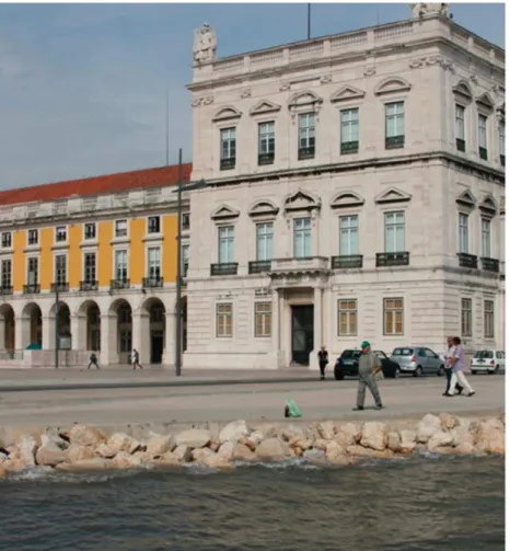
Figure 2:View of Terreiro do Paço during a high tide of 4.26 m.
Afirst-hand look at local risk factors
Although climate change can be measured glob-ally, its impacts present specific characteristics within each particular local territory. Conse-quently, it is possible to observe international examples that are orientated towards waterfronts and that have attuned to relevant ‘risk factors’
brought forward by local impacts of climate change. This analysis of waterfronts encourages the nurturing of questions upon our own national, regional and local scales such as: (i) What are the ‘risk factors’ that climate change will bear on specific territories? (ii) What are the current and future responses these areas will have in reaction to these bearings? (iii) How are our cities to
Figure 3:Map of Lisbon with illustratedflooding tipping points.
Source: FCT Project‘Urbanized Estuaries and Deltas’, FA/UTL and FSHS/UNL, 2011.
Figure 4:Map of illustrated area with building uses affected by the 4.50 m tipping point. Source: FCT Project‘Urbanized Estuaries and Deltas’, FA/UTL and FSHS/UNL, 2011.
sustainably embrace these ‘risk factors’ in med-ium- to long-term timeframes?
These questions lie within the‘Hot Spot’ agenda of the World Bank that expresses the hurried necessity to identify and test each city in terms of its sustainable development, climatic impacts upon the territory and future risk hazards (Prasad et al, 2008, pp. 41, 53).
Waterfronts, coastal areas and estuaries are nevertheless destined to tackle a more specific problem regarding water and its impacts upon these localities. Following this perspective, work-ing with waterfronts requires a more predominant in-depth analysis within this particular factor of risk. Respectively, this originates the necessity to understand: (i) the management of flooding phe-nomena within all possible scenarios by establish-ing today an agenda that addresses problems for tomorrow; (ii) the average rising of sea levels that is constantly cross-referenced with scientific out-puts; (iii) the changes within coastal and estuarine ecosystems, and the respective implications on these landscapes and on the economical protocols they entail; (iv) new reflections regarding the junc-tion between the city and the water in retrospect of arising climatic implications. Similarly, with the previous reflections on Aldo van Eyck’s continuum, ‘risk factors’ also require the analytical viewpoint towards the future, or in order words, the compre-hension, once again, of the city’s life cycle.
For a dynamic and relevant example, we can reflect upon the perspective of ‘living with the water’ (Deltacommissie, 2008) outlined by Holland’s political agenda of 2008. This perspective proposes the most sustainable response in dealing with unpredictability within the medium- to long-term timeframes. It pragmatically sets out to compre-hend both present and future dynamics regarding
ongoing ‘risk factors’ and moreover linking these reflections to extreme scenarios. This process is also further reinforced by the cautiousness and effectiveness in consolidating safety with urban quality, and to furthermore harmonise risk man-agement within the Dutch cityscape and encapsu-lating public realm.
Climatic Adaptation
A methodology for Portuguese adaptation Presenting itself as a new challenge for urbanism, the climatic adaptation agenda provides a number of opportunities for Portugal, and henceforward endorses a prognosis upon the city of Lisbon. In this regard, the identification and synthesising of recent scientific knowledge outcomes are partly accomplished by the‘Circle 2 – Deltas Cooperation in Europe’ (Climate Impact Research & Response Coordination for a Larger Europe). With this information being already well recognised, the focus at this point will be made to the Portuguese National Strategy for Adaptation to Climate Change (ENAAC). Following the resolution of the Council of Ministers in 2010, the delineated document aims at‘providing the country with an instrument that enables the identification of a number of action procedures and of adaptation measures to be adopted (…) furthermore, under the United Nations Organisation, this topic has been acquiring an increasing international inter-est and climate adaptation measures are being one of the fundamental pillars in the global agreement post-2012, which will undoubtedly result in additional obligations for Portugal. (…) scientific consensus is today sufficiently robust,
Figure 5:Bar chart showing the building uses affected by the 4.50 m tipping point within Lisbon’s waterfronts. Source: FCT Project‘Urbanized Estuaries and Deltas’, FA/UTL and FSHS/UNL, 2011.
and that this is a topic where it makes particular sense to evoke initial precautionary measures. This uncertainty should therefore not be an excuse to prolong the awareness of the need for societies to adapt to climate change and to initiate their adaptation activities’ (ENAAC, 2010, p. 1090; author’s translation).
Upon the inaugural launch of this agenda, the initial and invaluable first steps are underway, hence justifying the agenda’s interdisciplinary meeting with Portuguese urbanism as well. As a result, the ENAAC establishes four principal inten-tions, those being to: (i) implementing the funda-mental exercises of climate change adaptation and consolidating corresponding scientific bases and solid application techniques; (ii) reducing vulner-ability by identifying required endeavours, prio-rities and the prerequisite adaptation measures; (iii) increasing participation and awareness regarding the knowledge of climate change and transmitting the necessity of action during the definition and application of the strategy; and lastly (iv) strengthening the cooperation at an international scale, where Portuguese responsibil-ities are assessed in order to cooperate within the arena of global climate change adaptation (ENAAC, 2010).
These principal intentions define the strategic sectors for Portuguese climate change adaptation by considering elements such as spatial planning, water resources, safety of goods, health, energy and industry, biodiversity and agriculture, coastal areas and others. This henceforth establishes a development methodology and also specific appli-cation measures.
Addressing solutions with innovation and creativity
The agenda for climatic adaptation should be seen as a creative laboratory in which urbanism can express new and innovative approaches and prac-tices. In other words, climate change new para-digms have given urbanism the opportunity to explore new possibilities. A phenomenon that instigate the reinforcement of both the old and new interdisciplinary duties that urbanism encom-passes around its own sphere of practice.
The conjuring of interdisciplinary practice is one that takes place in the design of the city by rethinking its network systems, paying particular attention to infrastructure and entrenched natural settings.
Waterfronts should correspondingly be enclosed around this design approach by aiming at accom-plishing resilience and ensuring their capacity to respond to future impacts. This requires the generation of innovative solutions within the realms of urban design, architecture, materiality and building technologies capable of accommo-dating impacts such as, and among others, the rising of sea levels, flooding and also ‘flash floods’. Facing these scenarios, cityscape is pre-sented with the challenge of adapting existing urban fabric to new contexts and the pursuit of new urban morphologies.
With respect to thefirst challenge, one can reflect on a number of conceptual alternatives developed by the British and Dutch to address severe impact scenarios. Their approaches towards these chal-lenges are relevant in that they have adapted their defensive systems in the long term in an incremen-tal and pragmatic way.
The American approach, namely, in New York city, also shows similar resilience methods that have gained ground in preparing urban areas for the occurrence of extreme events. It can be further observed that their public spaces within the more consolidated districtsflourish with multi-functional creative dimensions that are directed at controlling water levels during storm surges. This links with the second challenge, whereby the adaptation measures establish the base to rework the existing frameworks into new settings. Once established, it can be used to reach new approaches contained within a ‘Plan B’, or in other words, a contingency plan, that shall guaranty the continua-tion of the life cycle regarding that specific locality. It is at this point where new innovative outcomes are encountered and disseminated.
New forms of governmental practice
Urbanism within a third modernity (Ascher, 2010 [2001]) and its relationship to the agenda of climatic adaptation also faces questions regard-ing governance and its ‘bottom-up’ approaches. With regard to this relationship in alternating countries, regions or localities, Verschoor (2009, p. 26) adds that‘Adapting to climate change will become part of everyday policy making’.
Policy elaboration that addresses the agenda entails a number of requisites, those being: (i) a leadership that is proportionate to the develop-ment of the agenda in the next few decades, where Merlin (2002, p. 436) suggests there should be a
In retrospect, Robinson and Hamer (2009) state that‘we are failing to move beyond the status quo and traditional lowest common denominator solu-tions’ that characterise ‘the line of least resistance – demonstrating a lack of inspiration, ambition and long-term sustainability’ (p. 26). For these authors, this is a topic that requires pro-active action that is bothflexible and adjustable to medium- and long-term horizons. For the short long-term, the progressive awareness of technicians, politicians and general society is a governmental strategy; one that informs the communities of their role in deciding their future duties in light of climate change. This course is one that Russell (2011, pp. 15, 34) also refers to as ‘climate change in the landscapes of speculation’.
As a result, the ‘what if?’ scenarios have a primary duty: to determine the territorial impacts of climate change scenarios, identifying the vari-ables and, as such, refining the outputs of app-licable scientific knowhow. In addition, if the construction of new infrastructure or large city investments conflicts with ‘risk factors’, the expected life span should already consider possi-ble eventful scenarios in distant horizons such as 2100. This is based around the evaluation of risk identification in order to better identify challenges in different temporal horizons (Alcoforado et al, 2009, p. 58).
Nonetheless, it is important to recognise that the assessment of risk hazards presented by the Portuguese National Program of Lisbon’s Regio-nal Planning Policy (PROT-AML) and its Munici-pal Master Plan (PDM) are only focused towards the present day, and therefore do not consider any climate change scenarios and their consequential territorial impacts. Nevertheless, as guiding princi-ples, Lisbon’s PDM proposes two principal objec-tives that are orientated towards a number of announced adaptation measures,first, in ‘the crea-tion of prevencrea-tion and minimizing measures towards local and regional climatic effects that results in not only natural variability but also in the
ities’ and later to launch a ‘your own way’ strategic adaptation plan (Prasad et al, 2008).
Consolidation of the Urban Waterfront
Urban design and adaptation measures within waterfrontsOn a Friday morning in ravaged New Orleans, Louisiana, Joe Brown learned just howfiercely people value their homes. Along with several dozen other disaster experts, the veteran urban planner had been recruited by Urban Land Institute in Washington D.C., to develop a rebuilding plan for the city, which had been devastated by Hurricane Katrina in August 2005 (…) about a quarter of the city lay in utter ruin and remained at high risk of flooding. Brown displayed diagrams that suggested turning some blocks, for the time being, into open space.
Reaction was swift and harsh. A council member accused Brown of aiming to‘replace these fine neighbourhoods with fishes and animals’ he recalls. A couple of audience members rose up and declared,‘All we want to do is get back our homes’. The planners were startled.‘We got shock and amazement to what, to us, were fairly obvious truths’, Brown says. (Couzin, 2008, Vol. 319, p. 748) Referring to the reconstruction of New Orleans after Hurricane Katrina, the quote of Couzin con-textualises central urban design issues within the agenda of climatic adaptation. The practice of these construction techniques that were resilient to flood-ing hazards were met by a distflood-inguishable impulse within local society, and supported by institutions such as the‘Make it Right Foundation’3. However, beyond the phenomenon particular to this case, Couzin also quotes the experience of Joe Brown in
order to alert the scientific and professional com-munity of various possible disparities. These dis-crepancies can be found between science and its application techniques, and the perceptions of society and common sense. This strengthens the importance of the dissemination of scientific knowledge and the continual understanding of society within the agenda of climatic adaptation.
Conclusively, applying the climate change adaptation agenda can create problematic circum-stances where undertaking‘the line of least resis-tance’ or the ‘lowest common denominator’ are not the most viable approaches, as it impairs the necessity for leadership (Robinson and Hamer, 2009). However, it should be noted that, at any point, the urban design, architecture and‘the art of restricting to and conforming the habitable space’ (Pinto, 2007, p. 21) incur the risk of affirming solutions, and advancing proposals while contem-plating alternative theories.
The reconstruction of New Orleans illustrates another aspect that combines urban design and the agenda of climatic adaptation. In this case, this interdisciplinary practice emerges with particular stringency (Olshansky and Johnson, 2010), deter-mining, in the act of the project, the correlation between urban networks, natural setting frame-works and city infrastructure. Within this harmony of subject matters,‘interdisciplinary practice is as unavoidable as the solutions for problems that arise, and that were originally less evident. Inter-disciplinary approaches, are not only the answers to technical complexity, but above all, to the requirement to achieve coherence between objec-tives on multiple levels (that are many times contradictory), and responding to the incongruities surrounding us’ (Portas, 2006, p. 12; author’s translation). Interdisciplinary approaches conse-quently allow us to stabilise governance as an open-ended framework. As a consequence, this aids the task of designing cities and going beyond the simple layout of the architect or urban planner in his rigorous capacity of creating fruitful spaces. It is hence this blueprint elaborated by various hands that synthesises a wholesome response to the numerous challenges of the project.
In light of waterfront adaptation to climate change, eight interdisciplinary obstacles are pre-sented before contemporary urbanism: (i) con-structing a more succinct liaison between the two subjects; (ii) planning, projecting and managing urban landscapes in scenarios of climatic uncer-tainty; (iii) anticipating impacts through the estab-lishment of investigative and analytical ‘what if?’
scenarios; (iv) prolonging urbanism into new tem-poral horizons; (v) encouraging new bottom-up perspectives upon local risk factors in light of climatic changes; (vi) recovering previous yet rele-vant teachings concerning city planning and design; (vii) the tender of innovative and creative concepts within adaptation strategies; and lastly (viii) perus-ing novel forms offlexible governability.
On the basis of these challenges, two in particu-lar respect the practice of urban design: recovering new teachings and developing solutions with the utilisation of innovation and creativity. This way, the design of the city faces two distinctive chal-lenges. First, it is important to incrementally pre-pare the existing cityscape for estimated hazards in function of temporal horizons and scenarios for climatic adaptation. Second is the opportunity for new and resilient forms of urban occupation that are adapted to cope with the transformation of current risk factors. As has been done so far, this document will concentrate on waterfronts being a partial, yet relevant, representative of this urban phenomenon.
The adaptation of a consolidated city towards climatic changes
Focusing on waterfronts, the project ‘Urbanised Estuaries and Deltas’ encloses the focus on the transposition of climatic impacts upon our terri-tories where waterfronts are analysed within the enclosure of urban contexts. It is in this under-going stage where the‘comprehension of facts’ are delineated, later allowing the ‘identification of vulnerabilities’ (Figure 6) and ‘alternative adapta-tion strategies’ to be analysed (Addressing alter-native adaptation strategies are the following published items by the research project: Costa et al (2012) and Coelho et al (2012)) and respectively incorporated.
Directing our attention further on Lisbon’s waterfronts, the convergence of various phenom-enon have resulted in the risk offlooding being the ‘critical factor’ in light of climate change (Figure 3). This convergence is established by seven predeter-mined issues, those being: (i) rising of sea level (Table 2); (ii) storm surges; (iii) effects of progres-sive Tagusfloods; (iv) ‘flash floods’ events within Portuguese coastal lines; (v) tidal cycle effects; (vi) undulation; and lastly (vii) topographic correc-tion of nacorrec-tional cartography.
Having in mind the various scenarios of climatic change (and the variation of estimates regarding
average SLR), the combination of the two to seven referenced issues have been methodologically approached through the identification of tipping points (Marchland, 2010). The use of this metho-dology within the undergoing research project has allowed the elaboration of the comprehensive ‘what if’ scenarios as discussed in Chapter 2. As such and by working with tipping points, urban-ism will no longer be hindered by contradicting information regarding SLR and other variables when considering the continuum of Lisbon’s water-fronts. It is argued that this approach shall result in the stabilisation of goals regarding specific impacts, and moreover allowing the identification of vulnerabilities and quantification of looming future damages.
These anticipative considerations permit more concise and effective adaptation measures to be considered and identified, regardless of them being two or three decades before or after they are expected. In addition, in its later stages, it is anticipated that the application of this methodol-ogy can also be applied in tsunami simulations in order to calculate future climatic impacts upon the coastal city of Lisbon.
This approach harmoniously interlaces with the Dutch approach of‘working with nature’, a policy
that delineates a very clear and pragmatic orienta-tion towards the design of their cities. This policy enforces the adaptation to new contexts and, in turn, decreases the dependency on infrastructure that can prove to be inefficient and inept at a certain point in time (Meyer et al, 2010, p. 36). Accordingly, it is an approach that shall sig-nificantly increase Portugal’s progression in adjourning to both its national and international commitment to climate change adaptation.
New forms of urban occupation in waterfronts Liberating from the constraint of protecting or mini-mising impacts in the existent city, investigations that scrutinise new forms of urban occupation unlock diverse potentialities, such as the application of resilience concepts. In new waterfronts,‘working with nature’ consists in conceiving the city, the architecture or new forms of technological construc-tion in order to prepare and continue to work on flood scenarios of diverse origin.
Adaptive systems hence punctuate the motto, and elucidate two different conceptual approaches. In the first approach, resilience partakes in the integration of a‘Plan B’ so that it can be applied in
Figure 6:Identification of possible flooding vulnerabilities through tipping points in Lisbon’s waterfronts. Source: FCT Project‘Urbanized Estuaries and Deltas’, FA/UTL and FSHS/UNL, 2011.
aflooding scenario in order to diminish potential city damage. Anticipating water hazards and/or climatic change scenarios, the various urban dimensions (such as accessibility, water supply/ sanitation, construction and public spaces) are cooperatively addressed to prepare a determined urban area that tackles dynamic risk factors imposed by bordering water. Being a practical example of this conceptual approximation, the 255 ha ‘HafenCity’ regeneration project in Ham-burg’s harbour area can be used as a relevant and current precedent. Situated outside the city dam perimeter, and acknowledging that it is not sus-tainable to continually remove areas from River Elba for urban occupation, this occupation permits the occurrence of regular urban flooding. It also
tackles the challenge of avoiding possible city damage and simultaneously maintains normal urban functionality. Consequently, and between other project options, alternative accessibility sys-tems are applied, and the construction solutions are developed for groundfloors to resist flooding events.
The second conceptual approach incorporates the development of new forms of occupation that are immune toflooding scenarios. As an historical example, one can reflect upon the biblical arche-type of Noah’s Arch or the ancient practices of the Uros tribe (Nordenson et al, 2010, p. 132; Olthuis and Keuning, 2010, pp. 179–180).
The conception offloating structures is an excel-lent resilient solution to flooding, one that
Table 2: Factors of calculation regardingflooding upon Lisbon’s waterfronts in the 2100 horizon Scenarios for 2100 Rise in
sea level
Correction of cartography
Rising of tides Undulation Flood elevation Storm surge IPCC (2007b) scenario A1 Rahmstorf (2007) scenario B1 Taborda et al (2010) scenario B1 +0.60 m +0.16 m Antunes (2011) +1.92 m (62 events in 2011) 2.12 m (21 events in 2011) +2.22 m (4 events in 2011) APL (2011) +0.20 m (frequent elevation) +0.35 m (extreme events) Santos et al (2006) +0.15 m (progressiveflooding of Tagus river) +0.45 m (‘flash flood’ on urbanised coasts) Ramos and Reis (2001). +0.40 m (1 event in 5 years) +0.50 m (1 event in 25 years) +0.58 m (1 event in 100 years) Andrade et al (2006) Rahmstorf (2007) scenario A1 Taborda et al (2010) scenario A1 CRC (2010) recommended +1.00 m Vellinga et al (2009) Defra (2006) recommended scenario worst scenario +1.20 m Deltacommissie (2008) worst scenario +1.30 m Vellinga et al (2009)
California Climate Action Team (2010) A1f1 CRC (2010) worst scenario Taborda et al (2010)
+1.40 m
Defra (2006) worst scenario NYCPCC (2009) worst scenario +1.60 m Hansen (2007) Pfeffer et al (2008) extreme scenario EA (2009) extreme scenario UK Climate Projections (2012) extreme scenario +2.00 m
multi-cooperative autonomy. Some authors argue that Man shall progressively occupy the aquatic domain in search for more occupational space, nourishment and energy (Wang et al, 2008, p. 18). A variant of this second conceptual approximation are floating super-structures; however, this con-ception is limited to utopian projects.
Moreover and just like all the forms of urban occupation, utopian conceptuality alsofinds it niche. It is therefore argued that the combination of float-ing structures with resiliency principals that exploit and investigate all of the potentialities in neighbour-ing water is a present and relevant ambition.
Conclusion
Climate change adaptation is not a‘vague concept’ (Bourdin, 2010); contrariwise, it is the concrete bond within specific localities that substantiates its preciseness and importance. The territorial impacts associated with global warming are today exponentially increasing upon urban frameworks, city infrastructure, public spaces and city equip-ment. This thus reinforces the imperativeness to link climate change with the practice and execution of urbanism upon contemporary cities.
Supported by existing scientific knowledge, a new adaptation agenda has emerged, one that shall not diverge or wander from its established objectives. Owing to the dissemination of consoli-dated scientific data in recent years, urbanism is now able to evaluate possible consequences of climatic impacts in both local and regional scales. Undoubt-edly, this newly established agenda will gain impor-tance when impacts progressively increase their bearings upon cities and landscapes. This implies that the progression of the agenda for climate change adaptation shall proportionately shadow the antici-pated exponential increase of climate change within and beyond the twenty-first century.
Enclosed in the Lisbon case, the initial‘what if?’ simulations of 4.00 m, 4.50 m and 5.00 m tipping
climate change within present-day Portugal and its enveloping coastal cities. More specifically, and reflecting back upon the eight challenges in corre-lating the spheres of urbanism and climate change within waterfronts, the project ‘Urbanized Estu-aries and Deltas’ inaugurates for Lisbon a: (i) more concise understanding of how urbanism can incor-porate climatic issues within its own realm of practice; (ii) better comprehension of how urban and spatial planning can challenge factors of cli-matic unpredictability; (iii) more lucid anticipation of future impacts by establishing ‘what if’ scenar-ios; (iv) expansion into new temporal hori-zons and potentials for Portuguese urbanism; (v) more articulate and coherent look upon local risk factors in light of climatic changes; (vi) recover-ing of lessons regardrecover-ing the composition and design of city’s layout; (vii) proposal of solutions that encourage innovation and creativity; and lastly (viii) review of existing and propositions towards new forms of Portuguese governability.
Enclosed within this study, and based as the fulcrum of the methodology, the use of the 4.50 m tipping point has already launched the project into the ‘comprehension of facts’, ‘identification of vulnerabilities’ and has opened up appreciations towards‘alternative adaptation strategies’ for Por-tugal. As such, this methodology shall hence pro-pagate the propulsion of Portuguese urbanism into new horizons of application. This approach will also concede the appreciation of new innovative and creative adaptation measures that shall con-tour the hindrances of climatic uncertainty.
Climate change adaptation should not be an explosive sprint, rather a progressive marathon that regards each case as an individual step towards the finish lines of 2050, 2080 and 2100. Although there may be other impending agendas, climate change adaptation has already defined horizons for an interdisciplinary practice that is conscious of the estimated impacts of climate change. Inevitably, however, only the future can tell when cities, such as Lisbon, will embark on this
progressive journey in order to avoid the impos-ingly acute bearings that the future will rigorously disclose upon urban landscapes.
Acknowledgements
The authors would like to acknowledge the research project ‘Urbanised Estuaries and Deltas. In search for a comprehensive planning and governance. The Lisbon case.’ (PTDC/AUR-URB/100309/2008) funded by the Portuguese Foundation for Science and Technology and the European Social Found, 3rd Community Support Framework.
Notes
1 In Cascais, there is a tidal gauge that registered a 0.43 m storm surge between 2000 and 2010 (Santos and Cruz, 2010). Previously, the estimated values were of 0.40 m, 0.44 m, 0.50 m, 0.54 m and 0.58 m for return periods of 5, 10, 25, 50 and 100 years (Santos and Miranda, 2006). Empirical data from 1978 and 1981 registered the occurrence of 0.42 m and 0.52 m of storm surge (ARH-Tejo, 2009a). Thus, for riverside occupation guidelines, ARH-Tejo follows the value of 0.50 m as a reference for a return period of 100 years (ibid.). 2 For the purpose of accounting of progressiveflooding of the
Tagus River, the value of 0.15 m is established by the LNEC for the Trancão River and adopted as a reference by the ARH-Tejo (2009b).
3 Founded by Brad Pitt in 2007 (http://makeitright.org/ about/).
References
Alcoforado, M.J., Andrade, H., Oliveira, S., Festas, M.J. and Rosa, F. (2009) Alterações Climáticas e Desenvolvimento Urbano. DGOTDU.
Andrade, C., Pires, H.O., Silva, P., Taborda, R. and Freitas, C. (2006) Zonas Costeiras. In: F.D. Santos and P. Miranda (eds.) Alterações Climáticas em Portugal. Cenários, Impactos e Medidas de Adaptação. Projecto SIAM II. Lisboa: Gradiva, pp. 169–208.
Antunes, C. (2011) Variação actual do NMM em Cascais. VII Conferência Nacional de Cartografia e Geodesia. Porto, Portugal.
APL. (2011) Tabela de marés. Marinha, Portugal, Instituto Hidrográfico.
ARH-Tejo. (2009a) GOT-00005-OFI-2009 Informação Técnica da Administração da Região Hidrográfica do Tejo. Lisboa, Portugal: ARH-Tejo.
ARH-Tejo. (2009b) GOT-00093-OFI-2009 Informação Técnica da Administração da Região Hidrográfica do Tejo. Lisboa, Portugal: ARH-Tejo.
Ascher, F. (2010 [2001]) Novos princípios do urbanismo/Novos compromissos urbanos. Lisboa, Portugal: Livros Horizonte. Bourdin, A. (2010) O Urbanismo depois da Crise. Lisbon, Portugal:
Livros Horizonte.
Choay, F. et al (1972 [1969]) Le sens da la ville. Paris, France: Éditions du Seuil.
Climate Action Team. (2010) Climate Action Team Biennial Report, California Environmental Protection Agency, p. 126. CML. (2011) Plano Director Municipal de Lisboa– Relatório da Proposta
de Plano. Lisboa, Portugal: Câmara Municipal de Lisboa. Coelho, C.D. and Costa, J.P. et al (2012) Thinking Lisbon for
2100 - ‘What if?’ essays on the climate change adaptation agenda (IN PRESS). New Urban Configurations. Delft – The Netherlands: EAAE / ISUF International Conference. Costa, J.P. and Silva, M.M. et al (2012) A adaptação às alterações
climáticas, os processos ecológicos e o desenho da infra-estrutura de gestão das inundações urbanas. Palcos da Arquitectura. Lisbon: Academia de Escolas de Arquitetura e Urbanismo de Língua-Portuguesa.
Couzin, J. (2008) Living in the danger zone. Science, AAAS 319: 748.
CRC. (2010) North Carolina Sea-Level Rise Assessment Report. N.C. Coastal Resources Commission's Science Panel on Coastal Hazards, p. 15.
Defra. (2006) Flood and Coastal Defence Appraisal Guidance– FCDPAG3 Economic Appraisal – Supplementary Note to Operating Authorities– Climate Change Impacts DEFRA, p. 9. Deltacommissie. (2008) Working together with water– A living
land builds for its future. Wilfried Ten Brinke, p. 138. EA. (2009) TE2100 Plan Consultation Document– Managing Flood
Risk through London and the Thames Estuary. London: Environ-ment Agency, p. 216.
Ecosfera. (2011) NASA alerta que subida do nível dos oceanos pode acontecer mais depressa. Lisboa, Portugal: Público, http://www.deltacommissie.com/.
ENAAC. (2010) Estratégia Nacional de Adaptação às Alterações Climáticas. Resolução do Conselho de Ministros n.º 24/2010, de 1 de Abril.
Hansen, J.E. (2007) Scientific reticence and sea level rise. IOP Publishing– Environmental Reserch Letter 2(024002): 6. Hansen, J.E. and Sato, M. (2012) Paleoclimate implications for
human-made climate change. In: A. Berger, F. Mesinger and D. Šijački (eds.) Climate Change: Inferences from Paleoclimate and Regional Aspects. New York: NASA Goddard Institute for Space Studies and Columbia University Earth Institute, pp. 21–48.
IPCC. (2001) Climate Change 2001: Impacts, adaptation and vulnerability, http://www.ipcc.ch/publications_and_data/ publications_and_data_reports.htm, accessed 7 August 2013. IPCC. (2007a) Climate Change 2007: Impacts, Adaptation and Vulnerability. In: M. Parry, O. Canziani, J. Palutikof, P.v.d. Linden and C. Hanson (eds.) Cambridge University Press.
IPCC. (2007b) Global climate projections. In: The Physical Science Basis. Contribution of Working Group 1 to the Fourth Assessment Report of the Intergovernmental Panel on Climate Change. Cambridge, UK and New York: Cambridge University Press.
Kjellstorm, E., Nikulin, G., Hansson, U., Strandberg, G. and Ullerstig, A. (2011) 21st century changes in the European climate: Uncertainties derived from an ensemble of regional climate model simulations. Tellus 63(A): 24–40.
Merlin, P. (2002) Láménagement du territoire. Paris, France: Presses Universitaires de France.
Meyer, H., Bobbink, I. and Nijhuis, S. (2010) Delta Urbanism: The Netherlands. Chicago, IL: Planners Press.
Nordenson, G., Seavitt, C. and Yarinsky, A. (2010) On the Water: Palisade Bay. Ostfildern, Germany: Hatje Cantz Verlag.
Pinto, J.C. (2007) O Espaço-Limite. Produção e Recepção em Arquitectura. Lisbon, Portugal: ACD Editors.
Portas, N. (2006) Uma Tese Triangular: O Urbano, a Inter-disciplinaridade e a Ètica. In: P. Brandão (ed.) A cidade entre desenhos. Profissões do desenho, ética e interdisciplinaridade. Lisbon: Livros Horizonte.
Portas, N., Domingues, Á. and Cabral, J. (2003) Políticas Urbana: Tendências, Estratégias e Oportunidades. Lisbon, Portugal: Fundação Calouste Gulbenkian.
Prasad, N., Ranghieri, F., Shah, F., Trohanis, Z., Kessler, E. and Sinha, R. (2008) Climate Resilient Cities– A Primer on Reducing Vulnerabilities to Disasters. Washington DC: The World Bank. Rahmstorf, S. (2007) A semi-empirical approach to projecting
future sea-level rise. Science 315: 368–370.
Ramos, C. and Reis, E. (2001) As cheias no sul de Portugal em diferentes tipos de bacias hidrográficas. Finisterra 36: 61–82. Robinson, D. and Hamer, B. (2009) Facing Up to Rising Sea-Levels:
Retreat? Defend? Attack? The Future of Our Coastal and Estuar-ine Cities. Great Britain, UK: RIBA– Royal Institute of British Architects/Building Futures, Institution of Civil Engineers. Russell, J. (2011) The Agile City, Building Well-Being and Wealth in
an Era of Climate Change. Washington DC: Island Press.
Taborda, R. et al (2010) Plano Estratégico de Cascais face às Alterações Climáticas – Sector Zonas Costeiras, PECAC, Cascais, p. 48.
UK Climate Projections. (2012) 11 de Março de 2012).‘Online Marine & coastal projections 3.2 High++ scenario.’ Retrieved 7 de Dezembro de 2012, 2012, http://ukclimateprojections .defra.gov.uk/22822.
Vellinga, P. et al (2009) Exploring High-end Climate Change Scenarios for Flood Protection of the Netherlands. Netherlands: The Bilt.
Verschoor, M. (2009) Climate hot spot investigation, stake-holders demand regional research data. In: Change Magazine. (Ministery of Climate and Energy, Copenhagen, Denmark) 5, pp. 24–29.
Wang, C.-M., Watanabe, E. and Utsuonomiya, T. (2008) Very Large Floating Structures. New York: Taylor & Francis.
This work is licensed under a Creative Commons Attribution 3.0 Unported License. To view a copy of this license, visit http:// creativecommons.org/licenses/by/3.0/