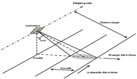
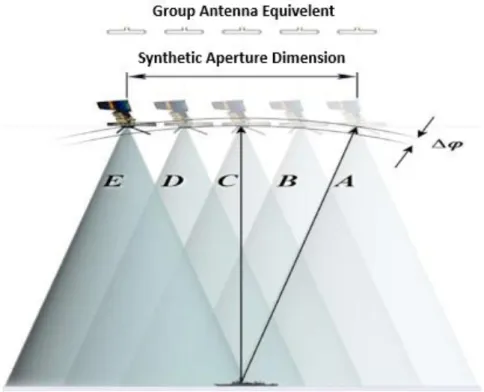
SAR Image Processing
Texto
Imagem


Documentos relacionados
In recent years compact and light weight FMCW radar systems in the millimetre and also lower terahertz domain become appli- cable for mobile mapping scenarios.. Operational airborne
Conventional methods for motion compensation either fail for wide beam antennas, since for contributions of wide angles the phase reconstruction is incorrect, or is not applicable
Neste módulo introdutório, o professor formador promoverá a reflexão em torno dos problemas gerais sobre o ensino-aprendizagem do PL2; o contexto específico do PL2 em
We also review and synthesize the sources of marine plastic litter including economic drivers, human activities, and pathways, quantify the pressures of marine plastic litter on
Ressalta que qualquer fator que predisponha à estagnação do leite no interior das mamas, como, por exemplo: a produção excessiva de leite, o esvaziamento incompleto
Pequenos produtores não têm o acesso a máquinas e equipamentos para modernizar seu olival, tendo na colheita manual a sua força de trabalho, e da mesma forma em relação
In this study, we investigated the feasibility of using the C-band European Remote Sensing Satellite (ERS-1) synthetic aperture radar (SAR) data to estimate surface soil roughness in
No nosso caso é Innovation and Excitement for Everyone, inovação e entusiasmo para todos, que no fundo é um fio condutor, é algo que une aquilo que são as várias
