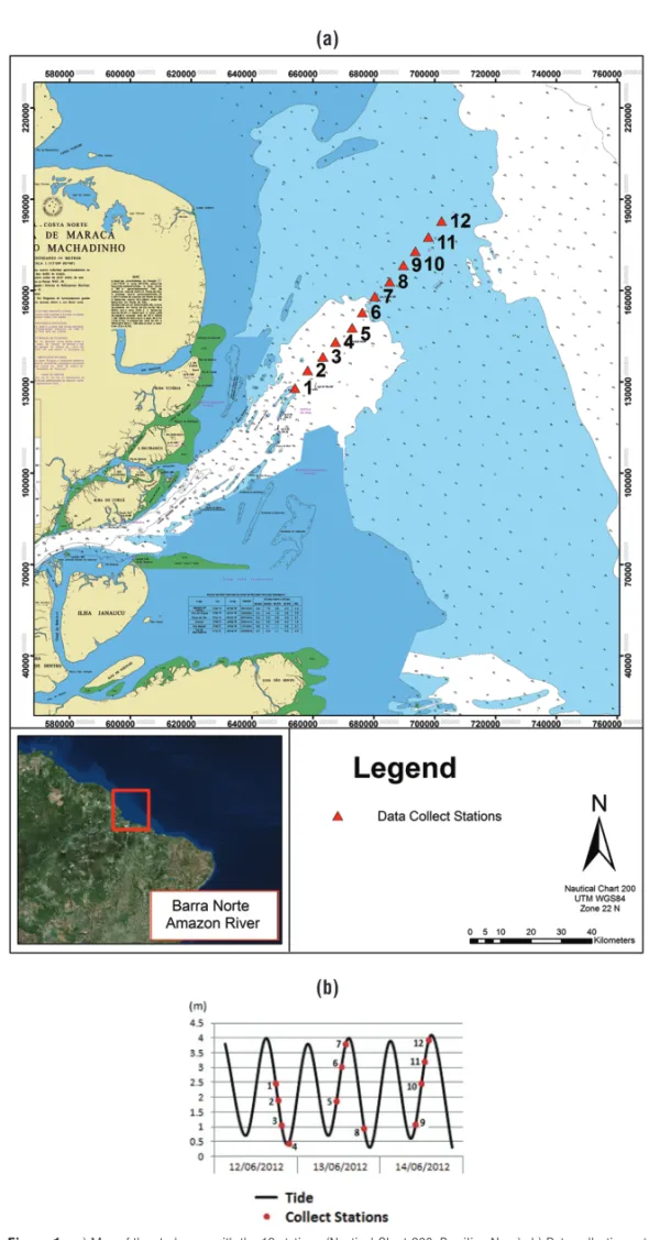
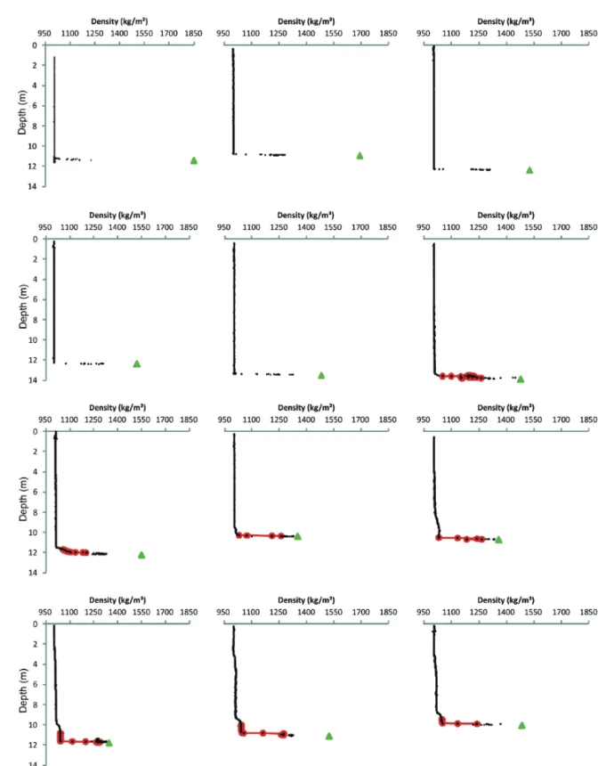
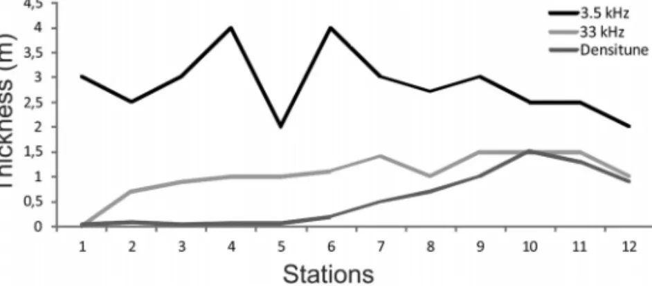
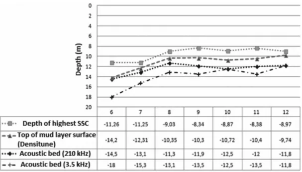
ACOUSTIC RESPONSE OF AMAZON SHELF MUDDY SEDIMENTS
Texto
Imagem


Documentos relacionados
FIGURA 5 - FLUTUAÇÃO POPULACIONAL DE Hypothenemus eruditus, Sampsonius dampfi e Xyleborus affinis (SCOLYTINAE, CURCULIONIDAE) COLETADOS COM ARMADILHAS ETANÓLICAS (25%)
The probability of attending school four our group of interest in this region increased by 6.5 percentage points after the expansion of the Bolsa Família program in 2007 and
Como contribuições específicas desta tese, podemos citar: • Definição de um método, com respectivo algoritmo evolutivo, para detecção de outliers em streams de dados;
Para quem olhe para a medicina dentária dos dias de hoje como uma medicina de reabilitação, tem no sistema CEREC um grande e eficaz aliado, com enormes vantagens
Mechanical property (hardness) and tribological properties (wear and coefficient of friction) were investigated to deduce the optimum manufacturing parameters and
The bursts of the swallowing acoustic signal were identified and their duration and the interval between them were later analyzed using a specific software, which allowed
7 after analyzing ultrasound reflection signal, estimated the acoustic impedance of bovine cortical bone and correlated it with indicators of bone mechanical
From this perspective, it can be observed that the Chinese investments announced since 2010 are from oil companies, such as China National Petroleum Corporation (CNPC);
