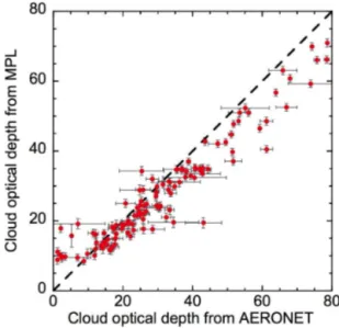
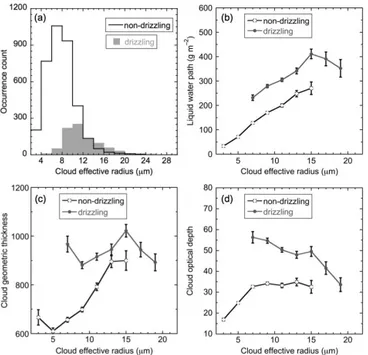
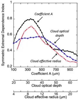
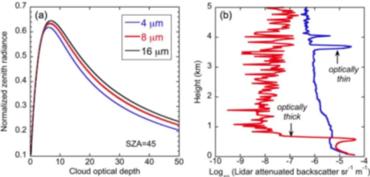
The interdependence of continental warm cloud properties derived from unexploited solar background signals in ground-based lidar measurements
Texto
Imagem
Documentos relacionados
In that paper, several cloud fields with the same stochastic properties as real clouds are generated assuming variable cloud tops, vertical profile of water droplet, mixed phase,
Absolute error (in km) in the cloud top height retrieval with SNGome as function of cloud top height and optical thickness... 1, but as a function of solar zenith angle in
Once ground image point clouds have been generated, each corresponding airborne LiDAR point cloud of the target building is found and extracted by using GPS and imaging
Weekly cycles have been analysed in surface observations of sulfur dioxide and sul- fate concentrations, satellite observations of aerosol optical depth, cloud properties (cloud
The satellite cloud parameters cloud top height (CTH) and liq- uid water path (LWP) are compared with ground-based CTH obtained from a cloud mask created using lidar and radar data
The cloud optical thickness and the droplet e ff ective radius are retrieved from spectral radiance data in nadir and and from hyperspectral radiances in a 40 ◦ field of view..
If cirrus clouds lead to a warming or cooling thus depends on their macrophysical properties such as the optical thickness of the cloud which is determined by microphysical
These figures confirm that a single parameter value provides accurate descriptions of the droplet spectra in the most common range of moment values, but significantly deviates at
