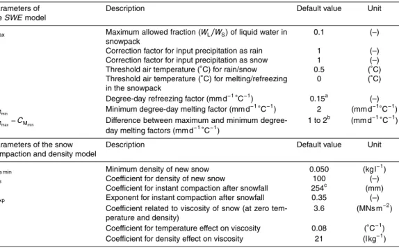
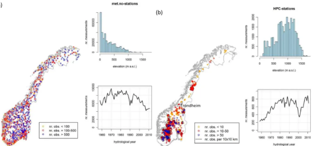
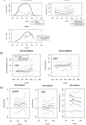
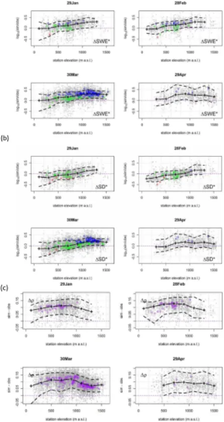
Simulating snow maps for Norway: description and statistical evaluation of the seNorge snow model
Texto
Imagem

Documentos relacionados
The probability of attending school four our group of interest in this region increased by 6.5 percentage points after the expansion of the Bolsa Família program in 2007 and
The results of simulations based on such model are compared to those of the new model (Model 2), which, in addition to the explanatory variables of the previous model, includes
de traços, cores e formas, cria identidade visual para empresas, produtos e serviços, conforme Guimalhães (2003). 14) explica que: “[...] branding é o termo em inglês para
The thermodynamic snow model SNTHERM and the microwave emission model for layered snowpacks (MEMLS) were used to identify the contribution of regional patterns in atmospheric
Intermittent catheterisation with hydrophilic-coated catheters (SpeediCath) reduces the risk of clinical urinary tract infection in spinal cord injured patients: a
Tidal analysis of 29-days time series of elevations and currents for each grid point generated corange and cophase lines as well as the correspondent axes of the current ellipses
Os temas analisados demonstram a existência do uso recorrente da estratégia desta diplomacia como instrumento de poder e faz com que seja um conceito cada vez mais presente
A própria palavra “virtual” possui certa mobilidade de significado para a autora: na tabela, espaço sonoro real (2.1, real sound-space) relaciona-se com instrumentos
