* Corresponding author:
E-mail: [email protected]
Received: March 21, 2016
Approved: June 22, 2016
How to cite: Zenero MDO, Silva LFS, Castilho SCP, Vidal A, Grimaldi M, Cooper M. Characterization and
Classification of Soils under
Forest and Pasture in an Agroextractivist Project in Eastern Amazonia. Rev Bras Cienc Solo. 2016;40:e0160165.
Copyright: This is an open-access article distributed under the
terms of the Creative Commons
Attribution License, which permits unrestricted use, distribution, and reproduction in any medium, provided that the original author and source are credited.
Characterization and Classification
of Soils under Forest and Pasture
in an Agroextractivist Project in
Eastern Amazonia
Mariana Delgado Oliveira Zenero(1)
, Laura Fernanda Simões da Silva(1)
, Selene Cristina de Pierri Castilho(2), Alix Vidal(3), Michel Grimaldi(4) and Miguel Cooper(5)*
(1)
Universidade de São Paulo, Escola Superior de Agricultura “Luiz de Queiroz” Departamento de Ciência do Solo, Programa de Pós-graduação em Ciência do Solo, Piracicaba, São Paulo, Brasil.
(2)
Universidade Estadual de Mato Grosso do Sul, Unidade de Mundo Novo, Mundo Novo, Mato Grosso do Sul, Brasil. (3)
Université Pierre-and-Marie-Curie (UMR Metis), Paris, France.
(4) Institute of Research for Development (IRD), IRD France-Nord Research Center, Bondy Cedex, France. (5)
Universidade de São Paulo, Escola Superior de Agricultura “Luiz de Queiroz”, Departamento de Ciência do Solo, Piracicaba, SP, Brasil.
ABSTRACT: Knowledge of soils in the Amazon rainforest is becoming increasingly essential due to dynamics adopted by farmers that substitute forest for pastures, together with growing pressure from diverse segments of society towards adoption of sustainable production systems. The objective of this study was to characterize the soils along two toposequences, one under forest (F) and the other under pasture (P), and to verify how the change in land use influences soil attributes, evaluating their inclusion in the Brazilian Soil Classification System (SiBCS). The soils were sampled in pits located at the summit, backslope and footslope positions for morphological, chemical, physical, and clay mineralogy analysis. The results show that the soils are chemically poor and predominately kaolinitic. Sandy and loamy sand soils are in the surface horizons, with an increase in clay content with depth. The highest values of bulk density and lowest values of macroporosity were observed in the Bt horizons due to the change from a granular structure in the surface to an angular and subangular blocky structure in these horizons. The morphological properties observed in the field are strongly influenced by the annual soil water dynamics, the parent material, and the landscape, representing diagnostic characteristics that influenced classification of the soils, such as aquic with episaturation (epirredóxico), saprolitic, and gravelly. These diagnostic characteristics in the Argissolo Amarelo (Hapludults) are important morphological properties that have not been highlighted by the current edition of the SiBCS.
Keywords: Argissolos, Ultisols, southeast of Pará, soil classification, saprolitic character, aquic with episaturation (epirredóxico) character.
INTRODUCTION
Rural colonization in Amazonia resulted in intense deforestation and, consequently, in an increase in soil degradation. In the Amazon biome, the use of pastures has been indicated as the major factor promoting extensive deforestation and causing serious losses to landscape dynamics (Ferraz et al., 2005; Grimaldi et al., 2014; Marichal et al., 2014).
Among the impacts caused by conversion of forests to cropland, we can cite changes in soil hydro-physical properties, such as reduction in total porosity and soil macroporosity, which affect the water infiltration rate and increase runoff, resulting in increased soil erosion (Zimmermann et al., 2010). The main factor in the change of vegetative cover from forest to pasture is modification of soil hydro-physical dynamics, as cited by Kairis et al. (2015). Braz et al. (2013) evaluated the chemical and physical changes caused to a Latossolo Vermelho Distrófico (Typic Hapludox) due to conversion from forest to pasture. The authors concluded that physical properties such as bulk density, porosity, and gravimetric moisture were different in forest soils compared to pasture soils, showing that land use change has important impacts on the soil.
The focus of other studies has been on changes caused by land use conversion on chemical properties (Mcgrath et al., 2001; Braz et al., 2013), soil C stocks and dynamics (Carvalho et al., 2010; Araújo et al., 2011; van Straaten et al., 2015), changes in the quantity and quality of shoot biomass (Fearnside and Barbosa, 1998; Lohbeck et al., 2015), emission of greenhouse gases through burning of forests and/or pastures (Fearnside, 2002; Fujisaki et al., 2015), soil biological activity (Silva et al., 2012; Rodrigues et al., 2013; Cram et al., 2015), reduction in ecosystem services (Grimaldi et al., 2014), and negative impacts on the invertebrate communities (Marichal et al., 2014).
In addition to contributing to evolution of knowledge regarding soil functioning in Amazonia, these studies assist in improving soil classification systems. The Brazilian Soil Classification System (SiBCS) has joined the properties of Brazilian soils and the research evolves information with the goal of encompassing all soils in the territory. The SiBCS (Santos et al., 2013c) includes different soil characteristics and properties that can be identified in the field or that can be inferred from soil science knowledge or correlated disciplines. This system is open, which means it allows new inclusions as new diagnostic characteristics emerge and are inserted in a specific soil class.
Given the dynamics adopted by farmers in substituting forest for pastures, together with increasing pressure of diverse segments of society in favor of adoption of sustainable production systems in Amazonia, is important to know the distribution of regional soil classes and understand their functioning so that alternative land use systems adapted to local conditions can be proposed for conservation purposes. Thus, the hypothesis of this work is that the substitution of native forest by pasture cause changes in the soil morphological, chemical and physical properties; and, consequently, in its functioning. The objective of this study is to characterize the soils and their relationship to position in the landscape along two toposequences, one under forest and the other under pasture, to understand the influence of land use changes on soil properties. We also seek to evaluate these properties to subsidize improved taxonomic framing of these soils in lower hierarchical levels of the Brazilian Soil Classification System.
MATERIALS AND METHODS
Depression of the southern Pará morphostructural unit, with planation surfaces, folded strips, metasedimentary cover, and dissection of hills due to erosion processes reactivated during the Holocene Epoch (Sampaio et al., 2004; Copserviços, 2009). According to Carneiro (2010), the settlement project is on the Bacajá geological domain, composed of rehydrated granulites of tonalitic and granulitic compostion, containing pyroxenes that give rise to soils rich in quartz, and small amounts of potassic feldspars affected by metamorphism with fragmented crystals, resulting in soils with fine textures (Vasquez and Rosa-Costa, 2008). The climate, according to the Köppen classification system, is Am, a very humid equatorial climate with annual rainfall of 2,000 mm and mean annual temperature of 26 °C (Inmet, 2015). Natural vegetation of the area is classified as Submontane Dense Ombrophilous Forest (Sampaio et al., 2004).
Two toposequences representative of the soils of the settlement project were studied. They were located in a watershed along the line of the highest slope, one across from the other. One of the toposequences was covered by primary forest (F) and the other by pasture (P), with a mean slope of 20 % for the forest toposequence and 14 % for the one under pasture. Part of the area under forest, approximately 20 ha, was converted to pasture using the traditional slash and burn system and posterior seeding of Brachiaria brizantha in 1996. During the first 10 years, the area was undergrazed (four to eigth head of cattle), and every 3 years the area was burned for pasture renovation and new seeding. Fire was last used in 2006; since then it remained fallow, with sporadic use of the pasture by neighboring cattle raisers.
At the footslope of both toposequences, a small creek separates both land uses. In the rainy season, this small watercourse undergoes fluctuations, increasing its flow rate, due to an increase in rainfall and also to the probable rise in the water table.
Three pits of approximately 1.65 m in depth were opened at the summit, backslope, and footslope of each of the toposequences, for soil characterization. Soil morphological
Figure 1. Localization of the Agroextractivist Praialta Piranheira settlement project in the
municipality of Nova Ipixuna, Pará, location of Maçaranduba II and the study site. N
S
1:150.000
W E
Fonte: LANDSAT 7/IBGE Projeção: UTM Universal Transversa de Mercator
DATUM SAD 69
km
1 0.5 0 1
676000 680000 684000 688000 692000 696000
9455000
9450000 9450000
9460000
9465000
9470000
9475000
676000 680000 684000 688000 692000 696000
9455000
9460000
9465000
9470000
descriptions were made according to Santos et al. (2013a), and the bi-dimensional geometrical distribution of the soil horizons followed the structural analysis methodology proposed by Boulet et al. (1982). The bi-dimensional distribution of the horizons between the pits was detailed by taking undisturbed samples and disturbed samples using an auger in all soil horizons. The latter samples were air dried and sieved in a 2 mm mesh for chemical, physical, and mineralogical analyses.
Determinations of Al, Ca, Mg, K, available P, potential acidity, organic matter, and pH in water followed the methods proposed by Claessen (1997); sum of bases (SB), cation exchange capacity (T), base saturation (V), and aluminum saturation (m) were also calculated. The clay fraction minerals were separated according to Mehra and Jackson (1960) and identified by X ray diffractometry at 25 °C.
Particle size distribution was determined according to Gee and Or (2002). Gravel was separated and quantified manually; it was described and classified according to Santos et al. (2013c). Bulk density (Bd) was evaluated using the volumetric cylinder method, with sample sizes of 0.05 m height and 0.05 m diameter (Grossman and Reinsch, 2002). Particle density (Pd) was determined using the helium gas picnometer method (Flint and Flint, 2002). Total porosity (TP) and macro- and microporosity were determined using the tension table method (Claessen, 1997). The TP was determined by the saturated water content, microporosity by drainage with application of 6 kPa suction, and macroporosity by the difference between total porosity and microporosity. The soils were classified according to criteria established in the Brazilian Soil Classification System (Santos et al., 2013c) and Soil Taxonomy (Soil Survey Staff, 2014) (Table 1).
RESULTS AND DISCUSSION
Structural analysis was performed to understand soil distribution in the landscape in both toposequences and the vertical and horizontal differences among horizons. Local relief exhibits slopes that range from 3 to 20 %, and areas with low hills and flat summits. Figure 2 shows the distribution of the horizons along the toposequences under pasture and forest.
The A horizon has dark color (dark yellowish-brown to black), sandy texture, and predominantly granular structure. In the forest, the A horizon was shallower at the summit and backslope compared to the footslope of the toposequence, since the slope facilitates transport of part of the organic material downslope, as well as accumulation of plant residues in the lower parts of the landscape, transported by torrential rains, thus not permitting the development of deeper A horizons (Sanches et al., 2009). Under pasture, the formation of a deeper A horizon is caused by the presence of brachiaria and its root system morphology, which, after 7 years of fallow, contributes to development of a relatively deeper A horizon. This does not imply that the organic matter contents are higher in the surface horizons of the pasture compared to the forest surface horizons, because it is well known that although tropical forests have low fertility, the plants and biota have adapted mechanisms for acquisition of biomass and nutrient retention (Celentano et al., 2011).
Table 1. Morphological properties of the six profiles studied
Horizon Depth Moist color Clay Textural class(2)
Structure(3)
Gravel(4)
Matrix Mottles(1)
m g kg-1
%
F1 Summit: Argissolo Amarelo Distrófico saprolítico, textura argilosa cascalhenta (Typic Hapludults) A 0.00-0.06 10YR 4/4 10YR 5/6; po, pe, dif 150 Loamy sand gr, me, mo, fo
AB 0.06-0.17 10YR 5/6 - 330 Faa very gravelly bs, gr, p, me, mo, fo 65 Bt1 0.17-0.44 10YR 5/8 5YR 5/8; co, g, dis 400 Sandy clay bs, gr, p, mo
Bt2 0.44-0.62 10YR 5/8 5YR 5/8; co, g, dis 500 Clay bs, gr, p, me, mo 5YR 6/8; co, g, pro
BC 0.62-0.99 7.5YR 5/6 10YR 6/8; ab, g, pro 600 Clay gravelly bs, p, me, fo 40 Cr 0.99-1.63+ 5YR 5/8 5YR 6/8; ab, g, pro 480 Clay bs, p, mo, fo
10YR 7/8; ab, m, pro 2.5Y 7/8; ab, p, pro 10YR 6/8; ab, m, pro
F2 Backslope: Argissolo Amarelo Distrófico saprolítico, textura argilosa cascalhenta (Typic Hapludults) A 0.00-0.06 10YR 5/6 - 130 Loamy sand gr, p, me, fo
AB 0.06-0.26 10YR 5/8 - 280 Faa very gravelly bs, p, me, mo 70 Bt1 0.26-0.45 10YR 6/8 7.5YR 5/6; po, pe, dif 380 Sandy clay loam bs, gr, p, mo
Bt2 0.45-0.63 10YR 5/8 7.5YR 5/6; po, pe, dif 580 Clay bs, gr, p, me, fo
BC 0.63-0.90 2.5YR 5/6 2.5Y 6/8; ab, g, dis 450 Clay gravelly bs, me, mo 35 Cr 0.90-1.65+ 2.5YR 5/8 2.5YR 6/8; ab, m, pro 430 Clay with gravels bs, me, g, fo 15
2.5YR 8/3; ab, g, pro 2.5YR 4/4; ab, g, pro 10YR 6/8; ab, g, pro 2.5Y 6/8; co, m, pro
F3 Footslope: Argissolo Amarelo Distrófico saprolítico, textura argilosa cascalhenta (Typic Hapludults) A 0.00-0.12 10YR 3/3 10YR 5/6; po, pe, dif 150 Loamy sand gr, p, me, mo, fo
AB 0.12-0.24 10YR 6/6 - 250 Faa very gravelly bs, p, me, mo 80 Bt1 0.24-0.43 7.5YR 6/8 - 300 Sandy clay loam bs, p, me, fo
Bt2 0.43-0.58 7.5YR 6/6 5YR 5/8; po, pe, dif 400 Sandy clay bs, me, mo
Bt3 0.58-0.88 5YR 5/8 10YR 6/8; co, g, pro 380 Aa with gravel bs, p, mo 20 2.5Y 6/8; po, pe, pro
BC*Fr
0.88-1.27 5YR 5/8 10YR 7/8; co, g, pro 250 Faa with gravel bs, p, me, mo, fo 20 Cr 1.27-1.60+ 2.5YR 5/8 2.5YR 4/6; po, p, pro 230 Sandy clay loam bs, g, fo
10YR 7/8; ab, gr, dis 2.5Y 8/4; po, p, pro 7.5YR 5/6; ab, gr, dis
P1 Summit: Argissolo Amarelo Distrófico saprolítico, textura argilosa cascalhenta (Typic Hapludults) A 0.00-0.05 10YR 3/3 - 100 Loamy sand gr, p, mo
AB 0.05-0.13 2.5Y 4/4 5YR 4/6; po, p, dif 170 Far very gravelly bs, gr, me, mo 80
2.5Y 5/6; po, p, dif
Bt1 0.13-0.67 10YR 6/8 10YR 3/3; po, p, dif 370 Sandy clay bs, pr, p, fr, mo
2.5Y 4/4; po, p, dif
Bt2 0.67-0.93 7.5YR 6/8 - 500 Clay with gravel bs, pr, p, mo 30 BC 0.93-1.21 7.5YR 6/8 5YR 5/8; ab, g, pro 570 Clay gravelly bs, pr, p, me, mo 50 Cr 1.21-1.80+ 5YR 5/8 10YR 6/8; ab, m, pro 500 Clay ba, p, me, fo
2.5Y 7/8; ab, m, pro
P2 Backslope: Argissolo Amarelo Distrófico saprolítico, textura argilosa cascalhenta (Typic Hapludults) A 0.00-0.09 10YR 3/2 - 200 Loamy sand gr, p, me, mo
BA 0.09-0.18 10YR 5/8 7.5YR 5/8; po, p, dif 300 Faa very gravelly ba, gr, p, fo 75
5Y 4/2; po, p, dif
The C horizon is made up of alteration or saprolitic material, with an increase in the coarse sand fraction and without much gravel. The material is a continuous mass that breaks up into angular and subangular blocks.
At the footslope of the pasture toposequence and below the A horizon, a non-continuous horizon appears, in this case named Re (redoxic). This horizon features evidences of redox processes and mottles of greyish colors, related to restricted drainage, conditioned by proximity to the water table and its position in the landscape. In the forest, also in the lower part of the toposequence, below the Bt horizon, a moist horizon appears, with yellowish colors and low clay content; it has high abundance of coarse sand and considerable influence of the water table, with the presence of parent material fragments larger than those found in other horizons of both toposequences, with stones and boulders. In this case, the horizon was designated as Fr (fragments).
On both toposequences, the A and AB horizons have granular and crumb structures with a moderate grade, favored by the presence of organic matter and biological activity. Due to the contribution of this type of structure under forest and pasture, macroporosity was important down to the depth of 0.25 m (Santos et al., 2010) (Tables 1 and 3). In the subsurface horizons, beginning in the Bt horizon, the structure grade varied from moderate to strong, the structure type alternated from medium subangular blocks to medium and large angular blocks, and an increase in clay content was observed. These properties found in the subsurface Bt horizons led to a reduction in soil hydraulic conductivity, leading to formation of a perched water table, which is evidenced by the presence of hydromorphic features such as mottles (Embrapa, 2006; Juhász et al., 2006). The blocky structure of the subsurface horizons can occur as a consequence of the action of alternate wetting and drying cycles (Santos et al., 2010). (1) Mottles: po: few; co: common; ab: abundant; pe: small; m: medium; g: large; dif: diffuse; dis: distinct; pro: proeminent; F: forest; P: pasture. (2)
Faa: sandy clay loam; Aa: sandy clay; Far: loamy sand. (3)
bs: subangular block; ba: angular block; gr: granular; pr: prismatic; p: small; me: medium;
g: large; fr: weak; mo: moderate; fo: strong. (4)
Nodules and mineral concretion: mostly quartz and petroplinthite. *Fr: fragments. **Re
: redox horizon.
Continuation...
Bt 0.18-0.44 7.5YR 6/8 10R 4/8; po, p, dif 400 Clay loam ba, p, me, mo
BC 0.44-0.85 7.5YR 6/8 10R 5/6; co, p, dis 420 Clay gravelly ba, pr, p, me, mo, fo 45 10R 5/8; co, p, dis
10R 4/4; co, m, pro 10YR 7/8; co, m, dis
Cr 0.85-1.60+ 10R 3/4 10R 4/6; co, g, dis 270 Clay loam ba, pr, p, me, mo, fo 10R 4/8; co, m, pro
10R 6/8; co, p, dis 10R 7/6; po, p, dis 7.5YR 6/8; co, m, pro
2.5YR 6/8; po, p, dis 2.5YR 7/8; po, p, dis
P3 Footslope: Argissolo Amarelo Distrófico epirredóxico argilosa, textura argilosa cascalhenta (Typic Hapludults) A 0.00-0.09 10YR 2/1 - 70 Loamy sand gr, p, fr, mo AB**Re
0.09-0.15 10YR 6/8 2.5Y 8/8; co, p, pro 120 Far very gravelly bs, p, me, mo 80 7.5YR 7/8; po, p, dis
10YR 3/1; co, p, dis 10YR 5/6; co, p, dis
BA 0.15-0.37 2.5Y 7/6 10YR 6/8; co, p, dif 250 Sandy clay loam bs, p, me, mo 30 Bt1 0.37-0.76 2.5Y 7/6 5YR 5/6; po, p, dis 350 Sandy clay ba, me, mo
7.5 YR 6/6; co, m, dif
Bt2 0.76-1.10 5YR 5/8 2.5YR 5/8; co, m, dif 480 Clay gravelly ba, me, fo 40
10YR 7/8; co, m, dif
The sequence of the soil horizons in profile F1, situated at the summit of the toposequence under forest, was A-AB-Bt1-Bt2-BC-C. This soil was characterized as deep, with an increase in clay content with depth. In addition, hue 10YR was observed in the surface horizons and an increase in chrome in the deeper horizons. Profile F2, situated on the backslope, featured a horizon sequence similar to the previous profile, A-AB-Bt1-Bt2-BC-C. This profile has a 7.5YR hue in the deeper horizons, with brownish colors dominating from the depth of 0.5 m, and in the BC and C horizons, reddish and yellowish colors dominate (hue 2.5YR). In profile F3, at the footslope, the sequence of horizons was A-AB-Bt1-Bt2-Bt3-BC-C, featuring higher mottling when compared to the other profiles. Hues varied between brownish and red yellow (10YR, 7.5YR, and 5YR).
The color of the soils was influenced by water dynamics, probably due to the fluctuation of the water table in the lower parts of the landscape and to the great volumes of rain that influence the entire profile, especially the surface horizons. In a similar study, Campos et al. (2012) also found that soil color varied from red, in the summit positions, to yellow in the backslope, and red yellow in the footslope and low summits. These authors agree that color variation is conditioned by the water flux downhill, via runoff and subsurface lateral flux, and, therefore, influenced by position in the landscape, as well as by its strong relationship with parent material.
In profile P1, at the summit under pasture, the sequence of horizons was A-AB-Bt1-Bt2-BC-C. In this profile, the dark brown color (10YR) was observed in the surface and subsurface
Figure 2. Structural analysis of the toposequence. P: profile under pasture; F: profile under forest; Tr: auger hole.
Tr1 P2 Tr2 Tr5 Tr4 P3 Tr6 F1 F2 Tr10 Tr11 Tr8 Tr3 Tr7 P1 Distance (m) PASTURE FOREST 5 10 15 20 25 A AB BA Bt1 Bt2 Bt3 BC Cr Fr Re Tr9 1.80 0.90 0.00 0.45 1.35 Depth (m) 1.80 0.90 0.00 0.45 1.35 Depth (m) 5 0 0 10 15 20 25
Relative altitude (m
) Relative altitude (m
)
F3
Surface horizon with organic matter. Yellowish brown (10YR 5/6) and black (10YR 2/1), granular sandy.
Subsurface horizon, with redoximorphic features (Re), close to the creek. Coarse sand and presence of quartz.
Subsurface horizon. Yellowish brown (10YR 5/6) to brownish yellow, loam clay sand, with gravel (quartz) and coarse sand.
Horizon with increase in clay. Predominance of colors strong brown (7.5YR 5/6) and reddish yellow. Few red mottles. Horizon with abundance of gravel (quartz and petroplinthite). Angular and subangular blocks with variegated colors: Brown, red and yellow. Large amount of mottles.
Horizon with parent material in alteration, firm and dry, less clayey texture and great amount of coarse sand. few and frequent gravel (petroplinthite).
Horizon with parent material in alteration, with rock fragments (Fr). Loamy sand, with variegation of grayish colors related to drainage restrictions.
horizons. From the surface to 0.10 m depth, olive brown and yellowish red (2.5Y and 5YR) colors appear in the form of mottles. From 0.67 m, the reddish yellow (7.5YR) and yellowish red (5YR) colors predominated. In profile 2, situated on the backslope, the sequence of horizons was A-BA-Bt-BC-C, with a grayish brown color (10YR) in the surface transitioning to yellow red in the subsurface, until the predominance of red (10R) in the C horizon. In this profile, the absence of the AB horizon could be due to the position this profile occupies in the landscape. The presence of mottles increases in the Bt horizon. In profile P3, situated at the footslope, the sequence of horizons is A-AB-BA-Bt1-Bt2-BC, with predominance of dark colors (10YR 2/1) in the surface layers. Yellow (2.5Y) and red (2.5YR and 10R) mottles are observed from 0.15 m down to the BC horizon (1.33 m). Both in forest and in pasture, even with the presence of mottling that conferred various colors to these soils, hues 7.5YR or yellower were dominant down to the depth of 1 m of the B horizon (including the BA horizon). Thus, according to the SiBCS (Santos et al., 2013c), the soils of both toposequences fall under the suborder Amarelos.
The redox characteristic appeared in zones closer to the soil surface, in small scale, and can be related to temporary saturation of the surface horizons, probably due to the formation of a perched water table at the top of the Bt horizon, as explained above. The presence of this feature in deeper layers of the soil can be explained by the fluctuation of the water table and the influence of the rainfall period throughout the profile (Figure 2). High soil moisture contents in the soil profile for long periods of the year favor redox processes, which contribute to the solubilization and precipitation of Fe, as was evidenced by the redoximorphic features in the form of mottles, plinthite, and petroplinthite observed in the soils studied (Benedetti et al., 2011; Campos et al., 2012; Garcia et al., 2013; Santos et al., 2013b).
The results of chemical analysis show low values of pH, high exchangeable Al contents, and limited availability of nutrients in these soils (Table 2). In all profiles, for both land uses, the pH in water ranged from 3.9 to 5.0. The lowest values were found in the backslope of the forest (F2), while the highest values were found in the summit profile of the pasture (P1), with a maximum value of 5.5 in the soil surface. Based on these pH values, the profiles under forest can be classified as extremely to strongly acid (Santos et al., 2013c), whereas, under pasture, the soils are less acid, probably due to soil management, as the use of fire for forest removal is very common in this region, and the ashes deposited on the soil elevate the value of pH, which can remain high for decades, as shown by Mcgrath et al. (2001), Quesada et al. (2010), and Araújo et al. (2011).
The potential and exchangeable acidity in both land uses exhibited moderate and high values in all profiles and depths, as observed by Freitas et al. (2013), for Amazonian soils under forest, pasture, and other land uses. Under forest, the potential acidity values ranged from 1.2 to 2.6 cmolc kg
-1
; under pasture, from 1.7 to 2.1 cmolc kg -1
; and in the footslope profile, the values were lower and ranged from 1.1 to 1.8 cmolc kg
-1.
The values of exchangeable acidity were more constant under forest with moderate levels (ranging from 0.5 to 0.9 cmolc kg
-1) than under pasture, where values considered
high were observed, mainly in the diagnostic horizons of the P1 and P2 profiles. P3 also had low values of Al3+ compared to the rest of the profiles. The values of aluminum saturation (m) found under forest were moderate to very high; lower values were found in the pasture, mainly in the surface horizons of the three profiles. In the deeper horizons of the pasture, the values increased to high and very high (Lopes e Guidolin, 1989).
pH in water and 1 mol L-1 KCl; H+Al: potential acidity; MO: organic matter; SB: sum of bases; V: base saturation; m: aluminum saturation.
Table 2. Chemical properties of the six profiles studied
Horizon Depth pH Al3+
H+Al K+
Ca2+
Mg2+
SB MO P V m
H2O KCl
m cmolc kg
-1
dag kg-1 mg dm-3 % F1 Summit: Argissolo Amarelo Distrófico saprolítico, textura argilosa cascalhenta (Typic Hapludults)
A 0.00-0.06 3.9 3.6 0.88 4.36 0.17 3.12 5.81 10.65 32.51 8.59 19.63 45.21 AB 0.06-0.17 3.9 3.9 0.91 2.88 0.13 0.04 1.48 2.85 11.54 2.23 8.99 76.21 Bt1 0.17-0.44 4.4 4.0 0.88 2.38 0.08 0.00 1.60 2.41 10.96 1.32 9.21 78.50 Bt2 0.44-0.62 4.7 4.1 0.64 2.18 0.08 0.00 3.37 4.16 12.13 1.14 16.03 60.62 BC 0.62-0.99 5.0 4.2 0.69 2.26 0.07 2.00 4.18 6.93 4.87 1.05 23.46 49.93 Cr 0.99-1.63+ 4.7 4.1 0.81 1.98 0.11 0.11 2.95 4.15 3.62 0.95 17.34 66.11
F2 Backslope: Argissolo Amarelo Distrófico saprolítico, textura argilosa cascalhenta (Typic Hapludults)
A 0.00-0.06 3.9 3.8 0.60 2.46 0.09 1.15 1.22 3.26 13.02 5.50 11.71 64.79 AB 0.06-0.26 4.1 3.9 0.86 2.24 0.04 0.28 0.73 1.37 9.53 2.41 5.77 86.23 Bt1 0.26-0.45 4.3 4.0 0.84 2.16 0.04 0.37 1.24 1.97 8.97 1.50 8.37 81.01 Bt2 0.45-0.63 4.7 4.1 0.82 2.24 0.02 0.04 2.78 3.04 6.37 1.14 11.96 72.88 BC 0.63-0.90 4.8 4.1 0.91 1.96 0.01 0.03 2.00 2.15 6.68 1.23 9.88 80.94 Cr 0.90-1.65+ 4.8 4.1 1.19 2.16 0.01 0.00 1.19 1.31 1.43 1.14 5.74 90.10
F3 Footslope: Argissolo Amarelo Distrófico saprolítico, textura argilosa cascalhenta (Typic Hapludults)
A 0.00-0.12 3.9 3.7 0.88 2.68 0.14 1.74 2.17 5.30 17.28 9.95 16.52 56.94 AB 0.12-0.24 4.2 4.0 0.91 2.32 0.12 0.44 2.09 3.71 12.21 4.68 13.79 65.30 Bt1 0.24-0.43 4.4 4.0 0.70 1.72 0.10 0.28 3.69 4.99 9.40 2.23 22.49 56.22 Bt2 0.43-0.58 4.6 4.1 0.70 1.90 0.10 0.26 3.23 4.47 7.67 1.68 19.03 60.41 Bt3 0.58-0.88 4.8 4.3 0.64 1.40 0.09 0.14 1.59 2.69 5.10 1.23 16.11 68.34 BC* 0.88-1.27 5.0 4.3 0.68 0.98 0.10 0.00 0.63 1.61 4.23 1.23 14.08 73.66 Cr 1.27-1.60+ 4.9 4.2 0.58 1.20 0.07 0.00 0.35 1.00 3.29 0.95 7.73 86.80
P1 Summit: Argissolo Amarelo Distrófico saprolítico, textura argilosa cascalhenta (Typic Hapludults)
A 0.00-0.05 5.5 4.6 0.15 1.78 0.25 8.07 6.47 17.07 25.40 16.86 48.96 8.12 AB 0.05-0.13 4.9 4.3 0.22 2.92 0.35 5.09 4.14 12.71 18.30 4.50 30.33 14.81 Bt1 0.13-0.67 4.2 3.9 1.35 3.04 0.08 0.87 0.36 2.07 9.73 2.50 6.37 86.68 Bt2 0.67-0.93 4.2 3.9 1.10 3.24 0.10 0.44 0.16 1.64 8.05 2.41 4.80 87.10 BC 0.93-1.21 4.6 4.1 1.15 2.24 0.07 0.37 0.16 1.18 7.29 1.32 5.01 90.73 Cr 1.21-1.80+ 4.7 4.1 0.44 2.26 0.12 0.15 0.37 1.71 5.05 1.95 7.05 87.39
P2 Backslope: Argissolo Amarelo Distrófico saprolítico, textura argilosa cascalhenta (Typic Hapludults)
A 0.00-0.09 4.6 4.6 0.73 2.18 0.08 4.98 1.95 7.71 17.33 5.23 26.12 36.32 BA 0.09-0.18 4.5 4.3 1.12 2.28 0.04 4.00 0.93 5.37 14.40 2.14 19.07 57.6 Bt 0.18-0.44 4.4 3.9 1.28 2.70 0.02 2.21 1.01 3.45 11.31 4.32 11.32 76.53 BC 0.44-0.85 4.8 3.9 1.18 2.36 0.02 1.54 1.11 2.87 8.05 2.14 10.84 81.69 Cr 0.85-1.60+ 4.6 4.1 0.35 1.98 0.03 0.39 0.58 1.27 2.19 0.95 6.04 90.34
The available P in both land uses had higher values in the surface horizons, decreasing along the profile due to the low mobility of soil P and to the low contribution of ash deposition due to burning, in the case of pasture (Freitas et al., 2013). T, SB, and V values were also considered low in both toposequences (Table 2). These properties were higher in the first 0.2 m of the soil. In general, organic matter contents were concentrated in the surface horizons in both land uses, decreasing with depth. These contents ranged from 32.51 to 1.43 g kg-1
under forest and from 25.40 to 1.63 g kg-1
under pasture. The higher content of organic C in the surface horizons is related to the higher material input and cycling in this site. In tropical environments, due to high temperatures and mineralization rates of organic matter, the stability of this material is low. Generally, the organic matter contents are lower than 30 g kg-1 in the surface horizons in most of the Amazon soils (Quesada et al., 2010; Garcia et al., 2013).
The six profiles had V lower than 50 % (Table 2), with low pH in all soil horizons. This characterizes the soils as dystrophic, an important characteristic that defines the third SiBCS categorical level of the soils studied (Santos et al., 2013c).
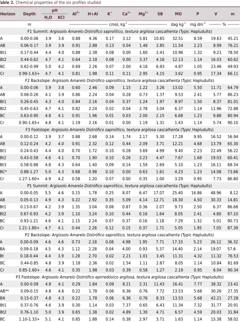
The mineralogical composition of the clay fraction did not show great variation of minerals along the toposequences. Analysis revealed the dominance of kaolinite, as well as small quantities of gibsite, illite, and quartz (Figure 3). This result corroborates studies that evidence kaolinite as the main mineral of the clay fraction of Amazonian soils (Corrêa et al., 2008; Benedetti et al., 2011).
The particle size distribution of the soil horizons up to 0.20 m had clay contents from 120 to 300 g kg-1 in all profiles and were characterized as loamy sand and loamy clay sand (Santos et al., 2013c). From 0.6 m, profiles F1, F2, P1, P2, and P3 are clayey, with clay contents superior to 460 g kg-1, featuring an abrupt textural change. This change
Figure 3. Clay fraction diffractograms of the toposequence studied. Examples of some profiles and depths analyzed. (A: F1 0.06-0.17 m, B: F2 0.45-0.63 m, C: P3 0.15-0.37 m). Ct: Kaolinite; Il: Illite; Gb: Gibbsite; Qz: Quartz.
Ct
Ct
Ct
Il + Gb
Ct
Ct
Ct Ct
Qz
Qz Il + Gb Il
Qz Il + Gb Il
°2θCuα °2θCuα
°2θCua
0 10 20 30 40 0 10 20 30 40
0 10 20 30 40
(a) (b)
occurs in forest between the A and AB horizons, while under pasture, between the AB and B horizons (including Bt1 and BA). Horizon C, in profiles F3 and P2, contains less clay (250 g kg-1, 270 g kg-1) (Table 1). Soils of both land uses developed a textural B horizon, with higher clay contents than the A and C horizons, and an increase in the clay content, with a B/A textural ratio above 1.80, made up of low activity clays and low base saturation, which classifies them as Argissolos in the Brazilian Soil Classification System (Santos et al., 2013c) or Ultisols in Soil Taxonomy (Soil Survey Staff, 2014).
From the depth of 1.00 m, the horizons have gravel size fragments, with characteristics similar to the C horizon material, and changes in soil texture. These properties contribute to classification of five profiles in this study in the 4th categorical level (subgroups) as saprolitic. The criteria established by Santos et al. (2013c) assume that the saprolitic character occurs in soils with Cr (soft) in the first 1.0 m from the soil surface and without lithic contact in the first 1.5 m from the soil surface. Nevertheless, this diagnostic characteristic only exists for Argissolos Vermelhos Eutróficos and Eutroférricos (Typic Rhodudalfs); thus, we suggest that it should also be applied to the suborder of the Argissolos Amarelos Distróficos (Typic Hapludults).
Gravel appears with more frequency from the depth of 0.4 m, where generally the more clayey horizons of the toposequences begin. Horizon Bt of P3 had the most gravel. Gravels are formed as residues of the parent material, from quartz and largely petroplinthite, but not in sufficient quantities to satisfy the requirements of the plinthic character, according to Santos et al. (2013c). This aided in identification of the 5th categorical level of classification of these soils as poorly gravelly and gravelly (Santos et al., 2013c). The poorly gravelly and gravelly classes are likewise not included in the Argissolos Amarelos (Ultisols); thus, we also suggest inclusion of this diagnostic characteristics in the 5th categorical level for these soils.
The Bd values for the surface horizons ranged from 1.26 to 1.58 Mg m-3 in the toposequence under forest, while for pasture the values ranged from 1.27 to 1.63 Mg m-3 (Table 3). At the surface, the incidence of low specific weight organic matter contributed to reduce soil bulk density, as well as increase macroporosity and facilitate formation of a granular and crumby structure (Bilibio et al., 2010), promoting better aeration and other gas exchanges, as well as water flow.
The soil horizons with an increase in clay content, Bt, had variations in Bd from 1.41 to 1.53 Mg m-3 under forest, and from 1.47 to 1.69 Mg m-3 under pasture. The Bd of the deepest horizon, C, made up of alteration materials, ranged from 1.40 to 1.44 Mg m-3 under forest, while under pasture it ranged from 1.42 to 1.68 Mg m-3. The higher values of Bd in the surface horizons of the pasture primarily occurred due to the presence of higher contents of sand, which naturally has Pd than clay (Dias Junior and Estanislau, 1999). Secondly, the change in land use, from forest to pasture, together with the wetting and drying cycles, probably contributed to such values (Araújo et al., 2004; Figueiredo et al., 2009). In general, the highest values of Bd of the toposequences occurred in the Bt horizons. This is correlated with the structural change that occurs between the granular structure in the surface horizons and the angular and subangular blocky structure of the subsurface horizons, as well as the soil textural change from sandy, with higher macroporosity, to clayey, with higher microporosity. Gravel, present mainly in depth, also influences these values of Bd, and these gravels are found in the horizons with the highest clay contents due to drainage restriction (Figueiredo et al., 2009), the occurrence of petroplinthite, and altered parent material.
Table 3. Soil particle density (Pd) and bulk density (Bd), macro- and microporosity, and total porosity (TP) of the six profiles studied
Horizon Depth Pd Bd Macro Micro TP
m Mg m-3
m3
m-3
F1 Summit: Argissolo Amarelo Distrófico saprolítico, textura argilosa cascalhenta (Typic Hapludults)
A 0.00-0.06 2.58 1.26 0.32 0.19 0.51 AB 0.06-0.17 2.60 1.58 0.14 0.12 0.26 Bt1 0.17-0.44 2.61 1.54 0.21 0.28 0.49 Bt2 0.44-0.62 2.60 1.52 0.15 0.23 0.39 BC 0.62-0.99 2.61 1.47 0.11 0.37 0.48 Cr 0.99-1.63+ 2.64 1.41 0.11 0.17 0.28
F2 Backslope: Argissolo Amarelo Distrófico saprolítico, textura argilosa cascalhenta (Typic Hapludults) A 0.00-0.06 2.60 1.47 0.26 0.19 0.45 AB 0.06-0.26 2.61 1.52 0.15 0.27 0.42 Bt1 0.26-0.45 2.61 1.50 0.18 0.22 0.40 Bt2 0.45-0.63 2.61 1.41 0.18 0.32 0.50 BC 0.63-0.90 2.62 1.43 0.10 0.15 0.25 Cr 0.90-1.65+ 2.62 1.40 0.10 0.17 0.27
F3 Footslope: Argissolo Amarelo Distrófico saprolítico, textura argilosa cascalhenta (Typic Hapludults) A 0.00-0.12 2.60 1.28 0.23 0.23 0.46 AB 0.12-0.24 2.61 1.52 0.19 0.12 0.31 Bt1 0.24-0.43 2.61 1.39 0.15 0.09 0.24 Bt2 0.43-0.58 2.61 1.43 0.13 0.14 0.27 Bt3 0.58-0.88 2.62 1.37 0.11 0.18 0.29 BC 0.88-1.27 2.61 1.40 0.07 0.22 0.29 Cr 1.27-1.60+ 2.63 1.44 0.07 0.25 0.32
P1 Summit: Argissolo Amarelo Distrófico saprolítico, textura argilosa cascalhenta (Typic Hapludults)
A 0.00-0.05 2.58 1.27 0.24 0.28 0.52 AB 0.05-0.13 2.60 1.63 0.27 0.15 0.42 Bt1 0.13-0.67 2.60 1.52 0.31 0.12 0.43 Bt2 0.67-0.93 2.61 1.41 0.36 0.12 0.48 BC 0.93-1.21 2.61 1.46 0.20 0.11 0.31 Cr 1.21-1.80+ 2.61 1.46 0.20 0.11 0.31
P2 Backslope: Argissolo Amarelo Distrófico saprolítico, textura argilosa cascalhenta (Typic Hapludults) A 0.00-0.09 2.60 1.52 0.16 0.29 0.45 BA 0.09-0.18 2.61 1.59 0.15 0.30 0.45 Bt 0.18-0.44 2.61 1.53 0.15 0.32 0.47 BC 0.44-0.85 2.64 1.58 0.12 0.18 0.30 Cr 0.85-1.60+ 2.65 1.68 0.08 0.13 0.21
under forest and profiles P1, P2, and P3 under pasture had values below the minimum necessary (0.10 m3 m-3) to ensure good aeration and oxygen diffusion for the root system (Xu et al., 1992).
The decrease in soil porosity with depth was also observed by Desjardins et al. (2004). According to these authors, this decrease may be due to textural and structural modifications along the profile. In the soils of this study, the increase in clay with depth corroborates such observations. Soil bulk density, which increases in depth, and the angular and subangular blocks found in the subsurface horizons contribute to the lower number of pores in the clayey horizons; whereas in the surface horizons with sandier textures, small and medium granular structure, and lower soil bulk density, the porosity was higher (Table 1 and 3).
The soil microporosity results observed in the forest and pasture toposequences had lower minimum and maximum values in the surface horizons from 0.17 to 0.27 m3 m-3. These values increased in depth in the clayey Bt horizons from 0.19 to 0.37 m3 m-3, and in the alteration horizons (C), with values from 0.23 to 0.37 m3 m-3 (Table 3).
In the specific case of P3, the high Bd and presence of micropores in the Bt1, Bt2, and C horizons probably contributed to the expressive modification in soil water dynamics, favoring the process of retention, which, together with fluctuation in the water table, favors the emergence of redox features (mottles and plinthite), which leads to the variation in colors described above. Based on these observations and on the discussions raised in this study, we suggest the inclusion, also in the 4th categorical level, of the aquic with episaturation (epirredóxico) character in the Argissolos Amarelos (Typic Hapludults). Currently, this characteristic is only admitted in the Argissolos Vermelhos (Typic Rhodudalf) (Santos et al., 2013c). In the previous editions of the SiBCS (Embrapa, 1999; 2006) the epiaquic character was admitted in the 4th categorical level. The current edition (Santos et al., 2013c) includes the epiaquic character in the redox character, expanding its limits to situations with the presence of redoximorphic features, both in surface and subsurface horizons. In this sense, based on the SiBCS (Santos et al., 2013c) and on field and laboratory observations, the profiles were classified as: Argissolo Amarelo Distrófico saprolítico, textura cascalhenta (PAd) for F1, F2, F3, P1, and P2; and Argissolo Amarelo Distrófico epirredóxico, textura cascalhenta (PAd) for P3. The suggestions for inclusion of new classes in the 4th categorical level are relevant and should serve as a stimulus for new studies for development of the Argissolo Amarelo (Hapludults) class.
CONCLUSIONS
Soil response under pasture underwent modifications due to changes in the vegetative cover. The higher values of pH, bulk density, and microporosity and greater presence of plinthite and mottles show a possible direct relationship to change in land use.
The chemical and mineralogical properties characterize the soils studied as poor and predominantely kaolinitic. Morphologically, the differences found in the profiles are related to the characteristics of the Argissolos (Ultisols): lower clay content and granular structure in the surface horizons, with higher macroporosity and, consequently, lower bulk density; and higher clay content and blocky structure in the subsurface horizons, with higher microporosity.
ACKNOWLEDGMENTS
Our thanks to the farmers of the Praialta Piranheira Settlement Project for their availability and attention, especially to José Claudio Ribeiro da Silva and Maria do Espírito Santo da Silva (in memoriam); to FAPESP for financing this project (Project No.2012/14767-9); to the Universidade Federal do Sul e Sudeste do Pará (UNIFESSPA) and Institut de Recherche pour le Développement (IRD) for supporting and assistance to this research; to the Conselho Nacional de Desenvolvimento Científico e Tecnológico (CNPq) for concession of the scholarship and fellowship to the authors; and to the Fundação Agrisus for financial support for field trips.
REFERENCES
Araújo EA, Lani JL, Amaral EF, Guerra A. Uso da terra e propriedade físicas e químicas de Argissolo Amarelo distrófico na Amazônia Ocidental. Rev Bras Cienc Solo. 2004;28:307-15.
doi:10.1590/S0100-06832004000200009
Araújo EA, Ker JC, Mendonça ES, Silva IR, Oliveira EK. Impacto da conversão floresta - pastagem nos estoques e na dinâmica do carbono e substâncias húmicas do solo no bioma Amazônico. Acta Amaz. 2011;41:103-14. doi:10.1590/S0044-59672011000100012
Benedetti UG, Vale Júnior JF, Schaefer CEGR, Melo VF, Uchôa SCP. Gênese, química e
mineralogia de solos derivados de sedimentos pliopleistocênicos e de rochas vulcânicas
básicas em Roraima, Norte Amazônico. Rev Bras Cienc Solo. 2011;35:299-312.
doi:10.1590/S0100-06832011000200002
Bilibio WD, Corrêa GF, Borges EN. Atributos físicos e químicos de um
Latossolo, sob diferentes sistemas de cultivo. Cienc Agrotec. 2010;34:817-22.
doi:10.1590/S1413-70542010000400004
Boulet R, Chauvel A, Humbel FX, Lucas Y. Analyse structurale et cartographie en pédologie.
1 – prise en compte de l’organisation bidimensionelle de la couverture pédologique: mes études de toposéquences et leurs principaux apports a la connaissance des sols. Cah ORSTOM Série Pédol. 1982;19:309-21.
Braz AMS, Fernandes AR, Alleoni LRF. Soil attributes after the conversion from forest to pasture
in Amazon. Land Degrad Dev. 2013;24:33-8. doi:10.1002/ldr.1100
Campos MCC, Ribeiro MR, Souza Júnior VS, Ribeiro Filho MR, Almeida MC. Topossequência
de solos na transição campos naturais-floresta na região de Humaitá, Amazonas. Acta Amaz.
2012;42:387-98. doi:10.1590/S0044-59672012000300011
Carneiro CC. Modelagem espacial de dados aerogeofísicos e interpretação de imagens SAR aplicados ao mapeamento geológico e metalogenético da região central do Domínio Bacajá, Estado do Pará [tese]. Campinas: Universidade Estadual de Campinas; 2010.
Carvalho PCF, Anghinoni I, Moraes A, Souza ED, Sulc RM, Lang CR, Flores JPC, Lopes LMT, Silva JLS, Conte O, Wesp CL, Levien R, Fontaneli RS, Bayer C. Managing grazing animals to achieve nutrient cycling and soil improvement in no-till integrated systems. Nutr Cycl Agroecosyst. 2010;88:259-73. doi:10.1007/s10705-010-9360-x
Celentano D, Zahawi RA, Finegan B, Ostertag R, Cole RJ, Holl KD. Literfall dynamics under different tropical forest restoration strategies in Costa Rica. Biotropica. 2011;43:279-87.
doi:10.1111/j.1744-7429.2010.00688.x
Claessen MEC, organizador. Manual de métodos de análise de solo. 2a ed. Rio de Janeiro:
Centro Nacional de Pesquisa de Solos; 1997.
Cooperativa de Prestação de Serviços - Copserviços. Plano de recuperação do Projeto de
Assentamento Agroextrativista Praialta Piranheira. Marabá: 2009.
Corrêa MM, Ker JC, Barrón V, Torrent J, Fontes MPF, Curi N. Propriedades cristalográficas de caulinitas de solos do ambiente tabuleiros costeiros, Amazônia e Recôncavo Baiano. Rev Bras
Cram S, Sommer I, Fernández P, Galicia L, Ríos C, Barois I. Soil natural capital modification through land use and cover change in a tropical forest landscape: implications for management.
J Trop For Sci. 2015;27:189-201.
Desjardins T, Barros E, Sarrazin M, Girardin C, Mariotti A. Effects of forest conversion to
pasture on soil carbon content and dynamics in Brazilian Amazonia. Agric Ecosyst Environ. 2004;103:365-73. doi: 10.1016/j.agee.2003.12.008
Dias Junior MS, Estanislau WT. Grau de compactação e retenção de água de Latossolos submetidos a diferentes sistemas de manejo. Rev Bras Cienc Solo. 1999;23:45-51.
doi:10.1590/S0100-06831999000100006
Empresa Brasileira de Pesquisa Agropecuária - Embrapa. Centro Nacional de Pesquisa de Solos. Sistema Brasileiro de Classificação de Solos. Rio de Janeiro: 1999.
Empresa Brasileira de Pesquisa Agropecuária - Embrapa. Centro Nacional de Pesquisa de Solos. Sistema brasileiro de classificação de solos. 2a ed. Rio de Janeiro: 2006.
Fearnside PM, Barbosa RI. Soil carbon changes from conversion of forest to pasture in Brazilian
Amazonia. For Ecol Manage. 1998;108:147-66. doi:10.1016/S0378-1127(98)00222-9
Fearnside PM. Fogo e emissão de gases de efeito estufa dos ecossistemas florestais da Amazônia brasileira. Estudos Avanç. 2002;16:99-123.
Ferraz SFB, Vettorazzi CA, Theobald DM, Ballester MVR. Landscape dynamics of Amazonian deforestation between 1984 and 2002 in central Rondônia, Brazil: assessment and future scenarios. For Ecol Manage. 2005;204:69-85. doi:10.1016/j.foreco.2004.07.073.
Figueiredo CC, Santos GG, Pereira S, Nascimento JL, Alves Júnior J. Propriedades físico-hídricas em Latossolo do Cerrado sob diferentes sistemas de manejo. Rev Bras Eng Agric Amb.
2009;13:146-51. doi:10.1590/S1415-43662009000200006
Flint AL, Flint LE. Particle density. In: Dane JH, Topp GC, editors. Methods of soil analysis: Physical methods. Madison: Soil Science Society of America; 2002. p.229-40.
Freitas IC, Santos FCV, Custódio Filho RO, Correchel V, Silva RB. Agroecossistemas de
produção familiar da Amazônia e seus impactos nos atributos do solo. Rev Bras Eng Agric Amb.
2013;17:1310-7. doi:10.1590/S1415-43662013001200009
Fujisaki K, Perrin AS, Desjardins T, Bernoux M, Balbino LC, Brossard M. From forest to cropland and pasture systems: a critical review of soil organic carbon stocks changes in Amazonia.
Global Change Biol. 2015;21:2773-86. doi:10.1111/gcb.12906
Garcia CHP, Lima HN, Silva FWR, Neves Junior AF, Teixeira WG, Macedo RM, Tavares SG.
Chemical properties and mineralogy of soils with plinthite and petroplinthite in Iranduba (AM),
Brazil. Rev Bras Cienc Solo. 2013;37:936-46. doi:10.1590/S0100-06832013000400011
Gee G, Or D. Particle-size analysis. In: Dane JH, Topp C, editors. Methods of soil analysis: Physical methods. Madison: Soil Science Society of America; 2002. p.255-93.
Grimaldi M, Oszwald J, Dolédec S, Hurtado MPMIS, Xavier SA, Assis WS, Castañeda E,
Desjardins T, Dubs F, Guevara E, Gond V, Lima TTS, Marichal R, Michelotti F, Mitja D, Noronha NC, Oliveira MND, Ramirez B, Rodriguez G, Sarrazin M, Silva Junior ML, Costa LGS,
Souza SL, Veiga I, Velasquez E, Lavelle P. Ecosystem services of regulation and support in Amazonian pioneer fronts: searching for landscape drivers. Landscape Ecol. 2014;29:311-28.
doi:10.1007/s10980-013-9981-y
Grossman RB, Reinsch TG. Bulk density and linear extensibility. In: Dick WA, editor. Methods of soil analysis: Physical methods. Madison: Soil Science Society of America; 2002. p.201-28.
Instituto Nacional de Meteorologia - Inmet. Estação Meteorológica de Observação de
Superfície Automática. Ministério da Agricultura, Pecuária e Abastecimento, Brasília, DF: 2015 [acesso em: 21 Jul 2015]. Disponível em: http://www.inmet.gov.br/projetos/rede/
pesquisa/inicio.php.
Juhász CEP, Cursi PR, Cooper M, Oliveira TC, Rodrigues RR. Soil water dynamics in a
Kairis O, Karavitis C, Salvati L, Kounalaki A, Kosmas K. Exploring the impact of overgrazing on soil erosion and land degradation in a dry Mediterranean agro-forest landscape (Crete, Greece).
Arid Land Res Manage. 2015;29:360-74. doi:10.1080/15324982.2014.968691.360
Lohbeck M, Poorter L, Martínez-Ramos M, Bongers F. Biomass is the main driver of changes in ecosystem process rates during tropical forest succession. Ecology. 2015;96:1242-52.
doi:10.1890/14-0472.1
Lopes AS, Guidolin JA. Interpretação de análise de solo: conceito e aplicações. São Paulo:
ANDA; 1989.
Marichal R, Grimaldi M, Feijoo AM, Oszwald J, Praxedes C, Cobo DHR, Hurtado MP, Desjardins T, Silva Junior ML, Costa LGS, Miranda I, Oliveira MND, Brown GG, Tselouiko S, Martins MB, Decaëns T, Velasquez E, Lavelle P. Soil macroinvertebrate communities and
ecosystem services in deforested landscapes of Amazonia. Appl Soil Ecol. 2014;83:177-85.
doi:10.1016/j.apsoil.2014.05.006
Mcgrath DA, Smith CK, Gholz HL, Oliveira FA. Effects of land-use change on soil nutrient
dynamics in Amazonia. Ecosystems. 2001;4:625-45. doi:10.1007/s10021-001-0033-0
Mehra OP, Jackson ML. Iron oxide removal from soils and clays by a dithionite-citrate system buffered with sodium bicarbonate. In: Swinford A, editor. Clays and clay minerals: Proceedings of the 7th National Conference on Clays and Clay Minerals. New York: Pergamon;
1960. p.317-27.
Quesada CA, Lloyd J, Schwarz M, Patiño S, Baker TR, Czimczik C, Fyllas NM, Martinelli L, Nardoto
GB, Schmerler J, Santos AJB, Hodnett MG, Herrera R, Luizão FJ, Arneth A, Lloyd G, Dezzeo N, Hilke I, Kuhlmann, Raessler M, Brand WA, Geilmann H, Moraes Filho JO, Carvalho FP, Araujo Filho RN, Chaves JE, Cruz Junior OF, Pimentel TP, Paiva R. Variations in chemical and physical
properties of Amazon forest soils in relation to their genesis. Biogeoscience. 2010;7:1515-41.
doi:10.5194/bg-7-1515-2010
Rodrigues JLM, Pellizari VH, Mueller R, Baek K, Jesus ED, Paula FS, Mirza B, Hamaoui GSJ,
Tsai SM, Feigl B, Tiedje JM, Bohannan BJM, Nüsslein K. Conversion of the Amazon rainforest to agriculture results in biotic homogenization of soil bacterial communities. Proc Nat Acad Sci Unit
Stat Am. 2013;110:988-93. doi: 10.1073/pnas.122060811
Sampaio SMN, Venturieri A, Silva BNR, Silva LGT, Homma AKO, Carvalho RA. Dinâmica da cobertura vegetal e uso da terra no Sudeste Paraense: o caso do Projeto de Assentamento São
Francisco. Belém: Embrapa Amazônia Oriental; 2004.
Sanches L, Valentini CMA, Biudes MS, Nogueira JS. Dinâmica sazonal da produção e
decomposição de serapilheira em floresta tropical de transição. Rev Bras Eng Agric Amb.
2009;13:183-9. doi:10.1590/S1415-43662009000200012
Santos AC, Pereira MG, Anjos LHC, Bernini TA, Cooper M, Nummer AR, Francelino
MR. Gênese e classificação de solos numa topossequência no ambiente de mar de
morros do médio Vale do Paraíba do Sul, RJ. Rev Bras Cienc Solo. 2010;34:1297-314. doi:10.1590/S0100-06832010000400027
Santos RD, Lemos RC, Santos HG, Ker JC, Anjos LHC, Shimizu SH. Manual de descrição e coleta de solo no campo. 6a ed. Viçosa, MG: Sociedade Brasileira de Ciência do Solo; 2013a.
Santos FAS, Mariano RSR, Pierangeli MAP, Souza CA, Bampi AC. Atributos químicos
e físicos de solos das margens do Rio Paraguai. Rev Amb Água. 2013b;8:239-49.
doi:10.4136/ambi-agua.1009
Santos HG, Jacomine PKT, Anjos LHC, Oliveira VA, Lumbreras JF, Coelho MR, Almeida JA,
Cunha TJF, Oliveira JB. Sistema brasileiro de classificação de solos. 3a ed. Brasília,
DF: Embrapa; 2013c.
Schroth G, Seixas R, Silva LF, Teixeira WG, Zech W. Nutrient concentrations and acidity in
ferralitic soil under perennial cropping, fallow and primary forest in Central Amazonia. Eur J Soil
Sci. 2000;51:219-31. doi:10.1046/j.1365-2389.2000.00303.x
Silva DKA, Freitas NO, Sousa RG, Silva FSB, Araújo ASF, Maia LC. Soil microbial biomass and
activity under natural and regenerated forests and conventional sugarcane plantations in Brazil.
Soil Survey Staff. Keys to soil taxonomy. 12th ed. Washington, DC: USDA-Natural Resources
Conservation Service; 2014.
van Straaten O, Corre MD, Wolf K, Tchienkoua M, Cuellar E, Matthews R, Veldkamp E.
Conversion of lowland tropical forests to tree cash-crop plantations loses up to half of stored soil
organic carbon. P Natl Acad Sci. 2015;112:9956-60. doi:10.1073/pnas.1504628112
Vasquez ML, Rosa-Costa LT. Geologia e recursos minerais do Estado do Pará: Sistema de Informações Geográficas - SIG: texto explicativo dos mapas geológico e tectônico e de recursos minerais do Estado do Pará. Belém: CPRM; 2008.
Xu X, Nieber JL, Gupta SC. Compaction effects on the gas diffusion coefficients in soils. Soil Sci
Soc Am J. 1992;56:1743-50. doi:10.2136/sssaj1992.03615995005600060014x Zimmermann B, Papritz A, Elsenbeer H. Asymmetric response to disturbance and
recovery: Changes of soil permeability under forest-pasture-forest transitions. Geoderma.