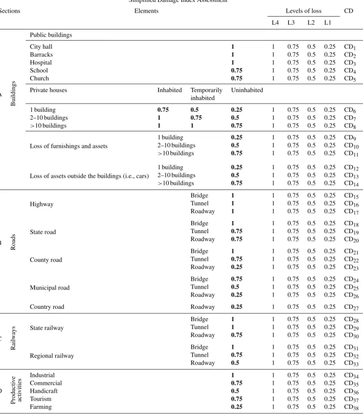
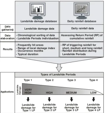
A methodological approach to characterise Landslide Periods based on historical series of rainfall and landslide damage
Texto
Imagem

Documentos relacionados
Na hepatite B, as enzimas hepáticas têm valores menores tanto para quem toma quanto para os que não tomam café comparados ao vírus C, porém os dados foram estatisticamente
The probability of attending school four our group of interest in this region increased by 6.5 percentage points after the expansion of the Bolsa Família program in 2007 and
No campo, os efeitos da seca e da privatiza- ção dos recursos recaíram principalmente sobre agricultores familiares, que mobilizaram as comunidades rurais organizadas e as agências
O consultor deverá informar o cliente, no momento do briefing inicial, de quais as empresas onde não pode efetuar pesquisa do candidato (regra do off-limits). Ou seja, perceber
didático e resolva as listas de exercícios (disponíveis no Classroom) referentes às obras de Carlos Drummond de Andrade, João Guimarães Rosa, Machado de Assis,
H„ autores que preferem excluir dos estudos de prevalˆncia lesŽes associadas a dentes restaurados para evitar confus‚o de diagn€stico com lesŽes de
Ousasse apontar algumas hipóteses para a solução desse problema público a partir do exposto dos autores usados como base para fundamentação teórica, da análise dos dados
