THE ROLE OF THE RELIEF IN THE DEVELOPMENT OF HUMAN SETTLEMENTS IN HUŞI DEPRESSION
ELENA CHIRILĂ - ACATRINEI1
ABSTRACT. – The Role of the Relief in the Development of Human Settlements in Huşi Depression. (uman settlements are closely related to the regional
physical-geographical framework determined by the geological, geomorphological, hydrological and climatic features that condition the location and evolution of the settlements system. Among the morphometric parameters that characterize local conditions, slopes and altitudes play an important role in the spatial extent of settlements. Slope determines the access, the extension of built space and the drainage inside the area of settlements. An excessively flat land is not able to drain rainwater. The optimum gradient is - , a value that generally characterizes terraces, plateaus and sculptural interfluves or accumulation glacises. Slopes over raise problems in the construction of buildings and access roads, especially on territories with an excessive fragmentation. The altitudinal gradient is also important in the spatial development of settlements, as it implies a significant contrast between the localities situated in the eastern lower part of Depression and those located on the higher western and northern sides. To analyze the spatial evolution of human settlements in the (uşi Depression in relation to slope and altitude were used various editions of cartographic materials covering a period of about years - , the years and being conventionally selected as reference.
Keywords: Huşi Depression, relief, slope, altitude, settlements.
1. INTRODUCTION
The specific natural conditions of (uşi Depression, together with certain social-economic and historical aspects that characterized this region during the recent period, provided a favorable environment for the development of human communities, so that most of the currently existing settlements are documented even from the th- th centuries. Over the time, the succession of several political regimes led to profound legislative changes that had important effects on land utilization and the expansion of settlements. The spatial evolution of the settlements in (uşi Depression experienced the most important transformations during the last century, many of the villages now doubling their surface.
Studies regarding the relief of (uşi Depression can be found in a small number of papers with local coverage, the majority addressing larger areas such as the Moldavian Ţlateau. Gugiuman , a, b, conducted a series of studies which
specifically address the problem of slope processes in (uşi Depression and Bârlad Basin. Among the geomorphological studies with larger extension, which also include the study area, may be mentioned those of (ârjoabă , and (ârjoabă & Ţoghirc . One of the most important studies is the monograph of Vaslui County of Gugiuman et al. . Other studies that focused on larger areas, but also make references to (uşi Depression, are those of Ţaraschiv and Obreja , in a series of papers that deal with the problem of valleys and terraces, and that of Rădoane et al. regarding sediment budgets and gully erosion in the Bârlad basin.
)mportant contributions to the study of settlements and population of Moldova and implicitly the Depression of (uşi have also been brought by geographical studies regarding the development patterns of the built-in urban settlements or the identification of urban influence areas and urban hierarchies Ungureanu, , theoretical concerns regarding rural and urban settlements Şandru, or the hierarchy of rural settlements Nimigeanu, ; Chiriac, . Other studies are those of Băican that presents the evolution of the Moldavian territory using maps and census materials from the thcentury, or those of Ungureanu , , who captures the evolution of the Romanian population since . Muntele addressed the issue of reconstructing the population dimension at different moments in the Moldavian history. Among the latest studies are the synthesis of human geography regarding the population, labor and human settlements in transition from Moldova Ungureanu et al., and that of urcănaşu about the evolution and current status of the Moldavian settlement system.
2. STUDY AREA
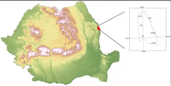
The Depression of (uşi is a distinct geographic unit, located in the south-eastern part of the Central Moldavian Ţlateau, in the subunit of Bârlad Ţlateau fig. . The Depression is situated on the river Ţrut, being delineated on the north by Ţietrăriei Cuesta, developed on the right side of Moşna River, which continues eastward with Cîlcea (ill. To the west it is limited by the summit of Lohan (ill, south of Drăslăvăţ Cuesta, continued eastwards with the right side of the Voloşeni brook up to Ţrut River, which forms the eastern boundary of the basin, between Cîlcea (ill north and Săratu village south .
Between these limits the depression has an area of approximately km and it includes the town of (uşi and other villages belonging to several communal territories: Arsura, Duda-Epureni, Stănileşti and Drânceni.
As a controlling factor in the formation and evolution of the landscape, the geology of the depression is of main importance due to the reduced resistance to erosion of the predominantly loamy deposits. These allowed for a fast denudation of the area, leaving as dominant some structural plateaus developed on oolithic limestone. The monocline position of the geological deposits prompted the formation of some subsequent asymmetric valleys.
The mean annual temperature is . C. The monthly minimum average is in January - . C and the maximum average in July . C . Mean annual rainfall is low mm and has a torrential regime especially in summer, which is also reflected in the river flow regime.
The overall aspect of the relief of (uşi Depression is of an amphitheater opening to the SE. The western part of the depression is higher, the hills here frequently exceeding the altitude of m. The central part of the basin presents a hilly relief, which decrease in altitude towards Ţrut River. On the right side of the valley there are some fairly well preserved terrace levels.
3. MATERIALS AND METHODS
)n the analysis of the distribution of settlements in relation to altitude and slope we have used cartographic materials covering two time periods: - for which topographic master plans scale : were used and - for which orthophotos and recent topographical plans scaled : were used . Tables and diagrams obtained from this analysis have used conventionally the year for the first time span and for the second.
Slopes and altitudes were determined automatically through a process based on the SRTM Shuttle Radar Topographic Mission digital elevation model, resampled to a pixel size of m. Slopes were classified into six classes, and elevations into seven classes. Subsequently, using the Zonal Histogram module implemented in ArcG)S . ,
the spatial development of settlements on the depression slope and elevation classes was analyzed for a period covering approximately - years.
4. RESULTS AND DISCUSSION
of - are specific for the heavily degraded slopes, especially those of the cuesta type, landslide escarpments and gully banks. Compared to the distribution of slope classes throughout the depression, it appears that current settlements are developed mainly on the declivity classes of - and - , which have the largest share table .
The comparative analysis of the distribution of the built-up areas within the (uşi Depression according to slope classes is shown in table for and table
for .
Table 1. Settlement distribution according to the slope
Location Surface (ha) Slope (degrees)
Minimum Maximum Medium
Ghermăneşti . . . .
Arsura . . . .
Râseşti . . . .
Drânceni . . . .
Albiţa . . . .
M. Kogălniceanu . . . .
Fundătura . . . .
Ţâhneşti . . . .
Duda . . . .
Epureni . . . .
Valea Grecului . . . .
Chersăcosu . . . .
(UŞ) . . . .
Stănileşti . . . .
Ţogăneşti . . . .
Table 2. The distribution of the built area (ha) on slope classes (0) in 1950
Slope (0) HUŞI Arsura Duda Epureni Stănileşti Drânceni
- . . . . .
- . . . .
- . . . .
- . . . .
- . . . . .
> .
Table 3. The distribution of the built area (ha) on slope classes (0) in 2010
Slope (0) HUŞI Arsura Duda Epureni Stănileşti Drânceni
- . . . .
- . . . .
- . . . .
- . . . .
- . . . .
> . . .
623.88 85.5 157.95 101.16 160.47 33.66
)n the case of (uşi City it is noted that the largest expansion of built-up areas from to the present took place on terrains with slopes between and , of importance also being the slopes between and .
The localities Duda, Epureni and Arsura, being located under Lohan Cuesta, at the source area of some valleys, had an extension conditioned by this type of relief, so that the built-up areas have advanced on terrains with a greater slope, generally in the range of - .
Drânceni village, located on the - m terrace of Ţrut, expanded its territory especially along that terrace to the NW and SE, on slopes of - .
Locatedat the contact between the right side of the Ţrut valley and its plain, Stănileşti extended in both directions, both on the floodplain about ha and on the slopes about ha on gentle slopes of - and about ha on steep slopes of - .
The location of Râseşti underwent a resembling spatial evolution to that of Drânceni due to its location on similar relief conditions terrace . Ţogăneşti expanded predominantly on the right side of the Ţrut valley, avoiding the floodplain affected by moisture excess.
The villages Valea Grecului and Chersăcosu, being more recent they do not appear on the topographical plans prior to the year were not included in this analysis.
Fig. 2. The evolution of the built-up areas on slope classes - .
The second morphometric parameter analyzed in this paper in relation to the spatial development of settlements is altitude. Muntele assigns the altitudinal gradient an important role in the structuring of settlements. )n the author’s opinion, the altitudinal gradient is manifested with different intensities from one region to another in historical Moldova. )n the space between Ţrut and Siret rivers, the altitudinal gradient manifests in two-way, from some favored areas such as contact depressions to the open steppe fields or the higher wooded areas. )n the virtue of historical inertia and although not that obvious, these contrasts remain until today.
Analyzing the location of the main settlements in the depression (uşi, Ghermăneşti, Duda, Arsura in relation to their position on altitudinal classes, it was found that larger settlements (uşi, Ghermanesti occupy in a percentage of over % altitudes of - m. For comparison, Duda developed in a higher percentage % in the range of - m, while Arsura is located % in the - m altitude class.
)n the case of (uşi, a significant weight is held by the altitude class of - m, which corresponds to the old center of the locality, in this altitudinal span being located the old residential and commercial - industrial city. The proportion of the altitude classes reflects the polynuclear structure of the town, with an old center with acompact appearance and a spatial evolution through the incorporation of neighboring villages. Currently, the built-up area of (uşi expanded inclusively in the vineyard area around, to higher altitudes of - m where there are numerous scattered houses.
Table shows the distribution of build-up area on altitudinal classes in , while table presents the situation of . Figure shows evolutionary aspects for (uşi and the commune seats within the depression.
Table 4.
The distribution of the built area (ha) on altitudinal classes (m) in 1950
Altit. (m) HUSI Arsura Duda Epureni Drânceni Stănileşti
- . .
- . .
- . . .
- . . . .
- . .
- . .
-355.05 30.42 89.01 63.9 13.77 32.76
Table 5. The distribution of the built area (ha) on altitudinal classes (m) in 2010.
Altit. (m) HUSI Arsura Duda Epureni Drânceni Stănileşti
- . .
- . . .
- . . .
- . . . .
- . .
- . .
-623.88 85.5 157.95 101.16 33.66 160.47
slope of Ţrut valley and in a lesser extent in the upper third of it. Ghermăneşti village has expanded eastward at lower altitudes, on the interfluvial ridges bordering the valley of Luncani and descending slightly to the valley of Ţrut.
Fig. 3.The distribution of the built area ha on altitudinal classes - .
)t is noted that in the case of (uşi the built-up area expanded mainly in the - m spacing corresponding to the old center of the locality, but significantly advanced to the highest ground, in the vineyard, at altitudes of m and even m. Epureni and Duda extended more horizontally in the altitude of - m spacing, the highly fragmented landscape forbidding the expansion of these settlements in altitude.
5. CONCLUSIONS
The diachronic approach on the development of human communities in the Depression of (uşi reveals the spatial development of settlements and how the land was used during the thcentury. )t appears that in the case of (uşi and other localities situated on the western side of the depression, within hollow type slip basins located at the heads of valleys, the extension of the built-up areas, although conditioned by this rather improper relief, took place on higher slopes - and at a higher altitudes compared to the original situation. )n the case of (uşi, the location has expanded mainly in the - m spacing corresponding to the old hearth of the city, but significantly advanced in the higher area, in the vineyard, at an altitude of m and even m.
The villages located in the central part of the depression or those on the terraces and on the Ţrut valley are characterized by land expansion conditions with an optimal gradient - , specific to terraces, sculptural interfluves or accumulation glacises.
The overall conclusion is that through its specific characteristics, the relief is a key factor, sometimes limiting for the location of human settlements. The geomorphological specificity of the (uşi Depression consists of an alternation of land propitious for settlements development, such as interfluvial plateaus and ridges or terraces and high levees, with less favorable ones of the cuestas affected by slope processes or excessively humid floodplains, conditions that could not prevent the continuous human presence in this geographical subunit.
R E F E R E NC E S
. Băican, V. , Geografia Moldovei reflectată în documentele cartografice din secolul al XVIII-lea, Editura Academiei Române, Bucureşti.
. Chiriac, D. , Aşezări rurale din Moldova. Studiu de geografie economică, Editura Universităţii „Alexandru )oan Cuza , )aşi.
. Gugiuman, ). , inutul Elan-Horincea, BERRG, Bucureşti.
. Gugiuman, ). a , inutul Elan-Horincea pe harta lui Cantemir, Buletinul Societăţii Române Regale de Geografie, Bucureşti.
. Gugiuman, ). b , Observa ii asupra modului de grupare a popula iei în depresiunea Elan-Horincea, Buletinul Societăţii Române Regale de Geografie, Bucureşti.
. Gugiuman, ). , Valea Lohanului, RGR, Bucureşti - Cluj. . Gugiuman, ). , Depresiunea Huşi, Ed. Ştiinţifică Bucureşti.
. Gugiuman, )., Cîrcotă, V., Băican, V. , Jude ul Vaslui, Editura Academiei Române, Bucureşti. . (îrjoabă, )., , Contribu ii la studiul teraselor din Colinele Tutovei, ASUC)-GG, V))).
. (îrjoabă, )., , Procese geomorfologice care contribuie la degradarea terenurilor din Colinele Tutovei, ASUC), s. GG, t. X).
. (ârjoabă, )., Ţoghirc, Ţ. , Considera ii geografice cu privire la sistematizarea aşezărilor rurale din Moldova, Natura, Bucureşti.
. Muntele, ). , Popula ia Moldovei în ultimele două secole, Editura Corson, )aşi.
. Obreja, Al. , Câteva date geomorfologice asupra văii Bîrladului, Analele Şt. ale Univ. „Al. ). Cuza , tom )V, s. ))., Fasc. , )aşi.
. Obreja, Al. , Analiza granulometrică a nisipurilor de pe cursul Bîrladului inferior şi semnifica ia lor geografică, Analele Şt. ale Univ. „Al. ). Cuza , s. ))., Ştiinţe Naturale, b. Geol. B Geogr., tom. X)V, )aşi.
. Ţaraschiv, D. , În legătură cu orientarea văii Bîrladului, Natura, Geografie - Geologie, nr. , Bucureşti.
. Rădoane, M., Rădoane, N., )chim, )., Surdeanu, V. , Efectul amenajărilor de lacuri mici asupra efluen ei aluviunilor în bazinul râului Bîrlad, Lucrările celui de-al )))-lea simpozion
Ţrovenienţa şi efluenţa aluviunilor , Ţiatra Neamţ.
. Şandru, ). , România. Geografie economică, Editura didactică şi pedagogică, Bucureşti. . urcănaşu, G. , Evolu ia şi starea actuală a sistemului de aşezări din Moldova, Casa
Editorială Demiurg, )aşi.
. Ungureanu, Al. , Observa ii asupra deplasărilor de popula ie din Moldova, Analele ştiinţifice ale Universităţii „Al. ). Cuza din )aşi.
. Ungureanu, Al. , O sursă valoroasă de documente istorico-geografice pentru Moldova de la începutul secolului XIX, Analele ştiinţifice ale Universităţii „Al. ). Cuza din )aşi.
. Ungureanu, Al. , Oraşele din Moldova: studiu de geografie economică, Editura Academiei Republicii Socialiste România, .