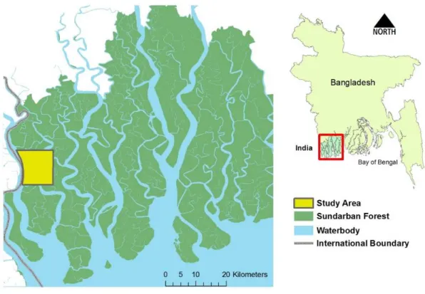
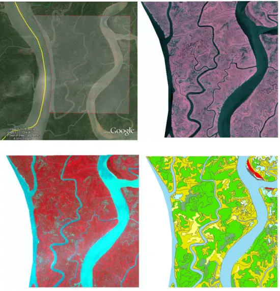
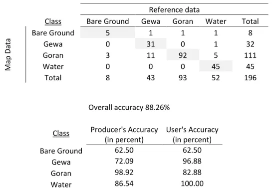
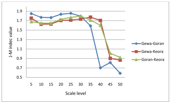
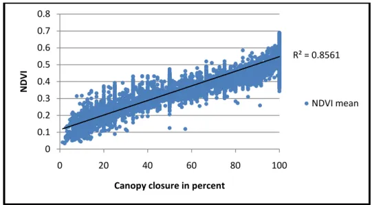
MULTI-SCALE VEGETATION CLASSIFICATION USING EARTH OBSERVATION DATA OF THE SUNDARBAN MANGROVE FOREST, BANGLADESH
Texto
Imagem
Documentos relacionados
L’idée de consacrer une séance à la mise en scène et à la mise en exposition de la chasse dans les cultures extra-européennes est née d’un double constat : d’une part, les
A obra de Catherine Opie interessa-me porque: primeiro, a distinção clara que a artista faz entre autorretrato e autorrepresentação; segundo, o seu modo de
Outra hipótese defende que os relacionamentos abusivos (incluindo outras formas de violência que não apenas a física) limitam com- pletamente a possibilidade das mulheres negociarem
Automatic detection and classification of damaged buildings, using high resolution satellite imagery and vector data. In: The International Archives of the Photogrammetry,
The comparison of classification in artificial and fuzzy neural networks technique has been conducted to separate classes of forest from non-forest using SPOT satellite
This study aimed to conduct a survey of the edaphic fauna in a forest fragment of transition from ombrophilous forest to mixed seasonal deciduous forest in the municipality
The mangrove region of Cananéia (Lat. from la nd the geochemical properties of the Iagoon water are more or less changed secondarily. During each observation
The architecture of forest fire emergency system, should ensure the access to the data (geographical data from sensors, vegetation information, topographical
