Soybean crop area estimation by ModisEvi data
Texto
Imagem

Documentos relacionados
Baseado numa proposta anterior, foi desenvolvido o Índice de Politização Ministerial (IPM) para mensurar sistematicamente as nomeações ministeriais, incluindo
Among the commonly used methods, the non-destructive indirect one can be an alternative for estimating leaf area based on the regression relationship, using dimensions of the
The objective of this study was to investigate changes in water and oxygen supply and soybean yield caused by soil management in lowland soils.. A soybean crop was grown under
When the agricultural area is sown with 60 % corn and 40 % soybean in the first crop and the entire area with wheat in the second crop, the risk of a negative return is 6 %..
However, even if this policy does not change the problem of land concentration, its importance is undoubtable, since the legal recognition of these areas is a debt that the
Nos últimos anos a tecnologia de construção evoluiu bastante, mas, segundo Carlos Lisboa na apresentação intitulada “Net-Zero energy performance em edifícios de serviços”
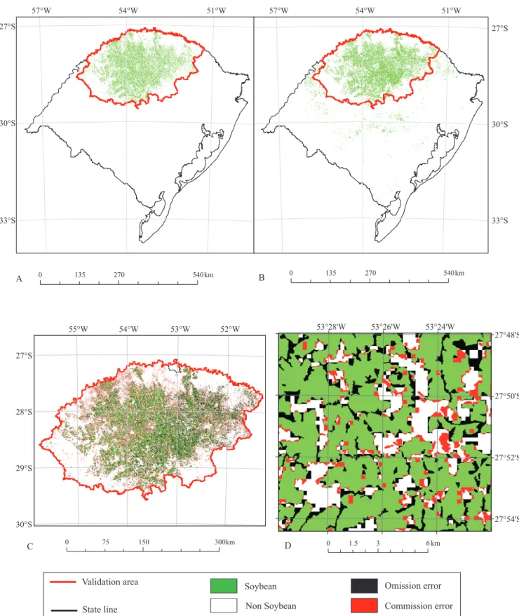
Soybean ( Glycine max ) yield distribution mask from the coupled model (CM) estimation in the 2011 crop year in: A, the municipality of Sinop and adjacent municipalities; and B,
The crossing of the flood area generated by the HAND model with the area classified as irrigated rice crop (based on the spatiotemporal attribute in Modis images) generated a
