BCG - Boletim de Ciências Geodésicas - On-Line version, ISSN 1982-2170 http://dx.doi.org/10.1590/S1982-21702016000300033
Bol. Ciênc. Geod., sec. Artigos, Curitiba, v. 23, no3, p.573, jul-set, 2016.
http://creativecommons.org/licenses/by/4.0/
No Artigo PPP COM INTEGRAÇÃO DE DADOS GPS/GLONASS: FUNDAMENTOS
ENVOLVIDOS E ANÁLISE DE ACURÁCIA, com número de DOI
10.1590/S1982-21702016000200012, publicado no periódico Boletim de Ciências Geodéscias, Vol 22 n° 2:
217-231, na página 224, onde se lia:
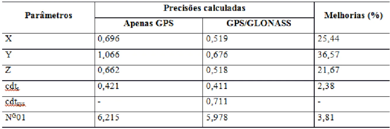
Tabela 1: Estimativa das precisões (em metros) e melhorias percentuais
Leia-se: